ملف:Kameničská vrchovina - vrchol U oběšeného (Na panenkách), CZ160922.jpg
حجم هذه المعاينة: 800 × 462 بكسل. البعدان الآخران: 2٬560 × 1٬477 بكسل | 4٬571 × 2٬637 بكسل.
الملف الأصلي (4٬571 × 2٬637 بكسل حجم الملف: 3٫19 ميجابايت، نوع MIME: image/jpeg)
وصف قصير
| ⧼wm-license-information-description⧽ |
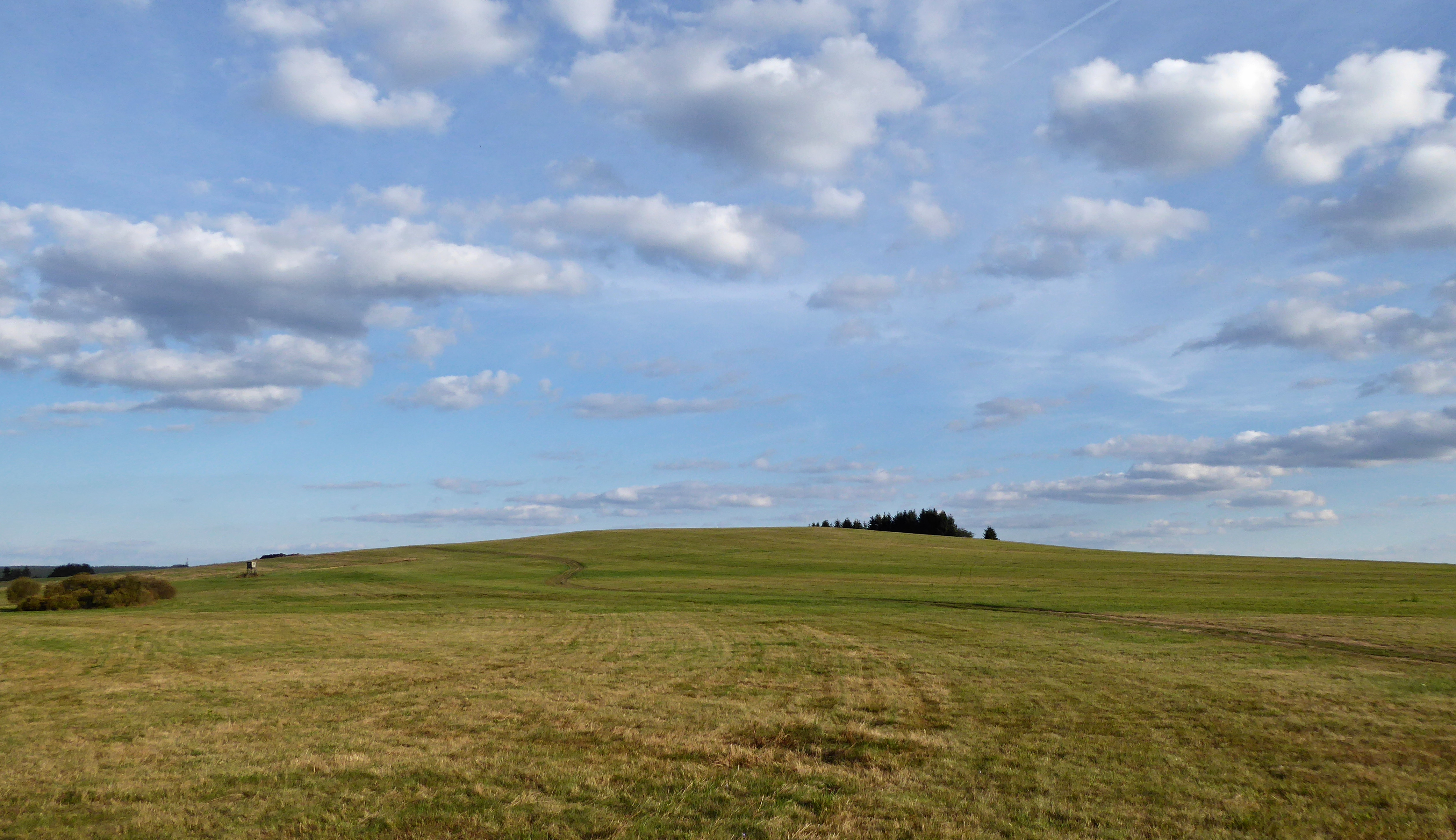
English: "U oběšeného" is the geographical name (oronym) of the hill and its peak with an altitude of 737.4 m on the cadastral area "Svratouch" in the Chrudim District, belong to the Pardubice Region in the Czech Republic. Within the regional divided of the georelief of the Czech Republic the highest peak of the Iron Mountains lies in the south-eastern part of the mountain range with name "Sečská" Highlands, in the geomorphological district "Kameničská" Highlands. Photo-location: Czechia, Pardubice Region, the village of "Svratouch".
Source of information:
(بالتشيكية) |
| ⧼wm-license-information-date⧽ | 2016, {{time}} – invalid date format 18 (help) |
| ⧼wm-license-information-source⧽ | ⧼Wm-license-own-work⧽ |
| ⧼wm-license-information-author⧽ | Josef Kreuz (PEPan) |
49°44′08″N 16°00′57″E / 49.735681°N 16.01574°E
,_CZ160922.jpg¶ms=49.735681_N_16.01574_E_heading:135)
Zeměpisný název:
Písemná podoba zeměpisného názvu U oběšeného je standardizované jméno geografického objektu publikované ve státním mapovém díle a databázích Českého úřadu zeměměřičského a katastrálního.
ترخيص
|
تاريخ الملف
اضغط على زمن/تاريخ لرؤية الملف كما بدا في هذا الزمن.
| زمن/تاريخ | صورة مصغرة | الأبعاد | مستخدم | تعليق | |
|---|---|---|---|---|---|
| حالي | ★ مراجعة معتمدة 06:48، 17 أكتوبر 2023 | | 4٬571 × 2٬637 (3٫19 ميجابايت) | Pastakhov (نقاش | مساهمات) | Upload https://upload.wikimedia.org/wikipedia/commons/9/98/Kameni%C4%8Dsk%C3%A1_vrchovina_-_vrchol_U_ob%C4%9B%C5%A1en%C3%A9ho_%28Na_panenk%C3%A1ch%29%2C_CZ160922.jpg |
لا يمكنك استبدال هذا الملف.
وصلات
لا يوجد صفحات تصل لهذه الصورة.
,_CZ160922.jpg&oldid=3158552)