ملف:Ireland medieval location map-es.svg

حجم معاينة PNG لذلك الملف ذي الامتداد SVG: 481 × 599 بكسل. البعد الآخر: 1٬643 × 2٬048 بكسل.
الملف الأصلي (ملف SVG، أبعاده 1٬450 × 1٬807 بكسل، حجم الملف: 667 كيلوبايت)
وصف قصير
| ⧼wm-license-information-description⧽ |
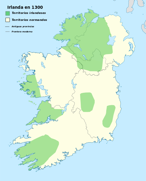
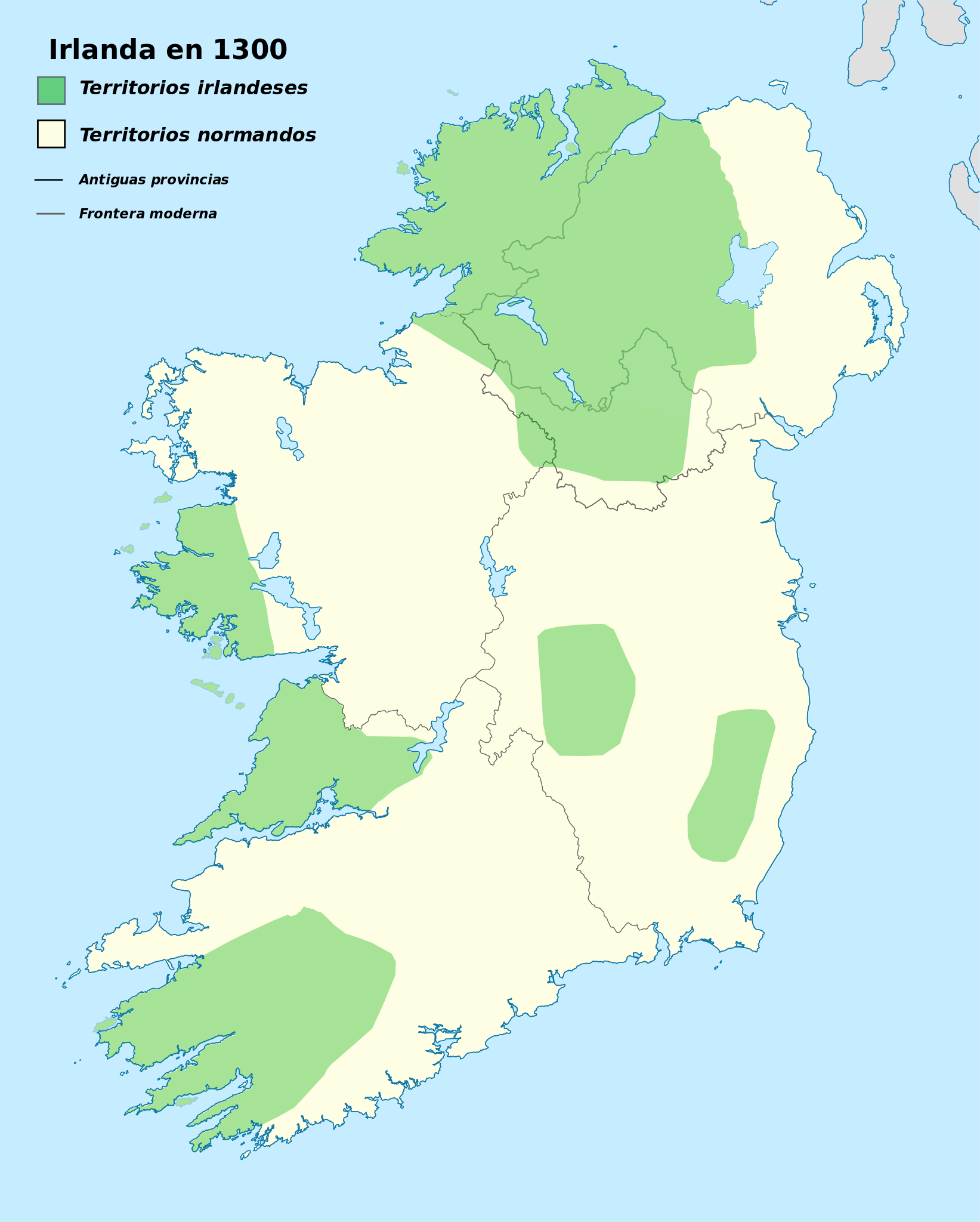
English: Historical map of Ireland, year 1300 for geolocation purpose. Lands held by native Irish and by Normans related to Norman invasion of Ireland started a century ago
|
| ⧼wm-license-information-date⧽ | 2016 |
| ⧼wm-license-information-source⧽ | قالب:F |
| ⧼wm-license-information-author⧽ |
|
ترخيص
|
تاريخ الملف
اضغط على زمن/تاريخ لرؤية الملف كما بدا في هذا الزمن.
| زمن/تاريخ | صورة مصغرة | الأبعاد | مستخدم | تعليق | |
|---|---|---|---|---|---|
| حالي | ★ مراجعة معتمدة 21:55، 24 ديسمبر 2023 | | 1٬450 × 1٬807 (667 كيلوبايت) | Pastakhov (نقاش | مساهمات) | Upload https://upload.wikimedia.org/wikipedia/commons/b/b5/Ireland_medieval_location_map-es.svg |
لا يمكنك استبدال هذا الملف.
وصلات
لا يوجد صفحات تصل لهذه الصورة.