ملف:India Kerala Kasaragod district.svg

حجم معاينة PNG لذلك الملف ذي الامتداد SVG: 411 × 599 بكسل. البعد الآخر: 1٬405 × 2٬048 بكسل.
الملف الأصلي (ملف SVG، أبعاده 874 × 1٬274 بكسل، حجم الملف: 539 كيلوبايت)
| ⧼wm-license-information-description⧽ |
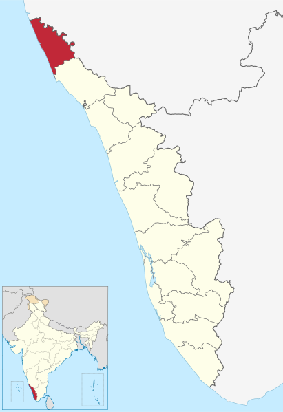
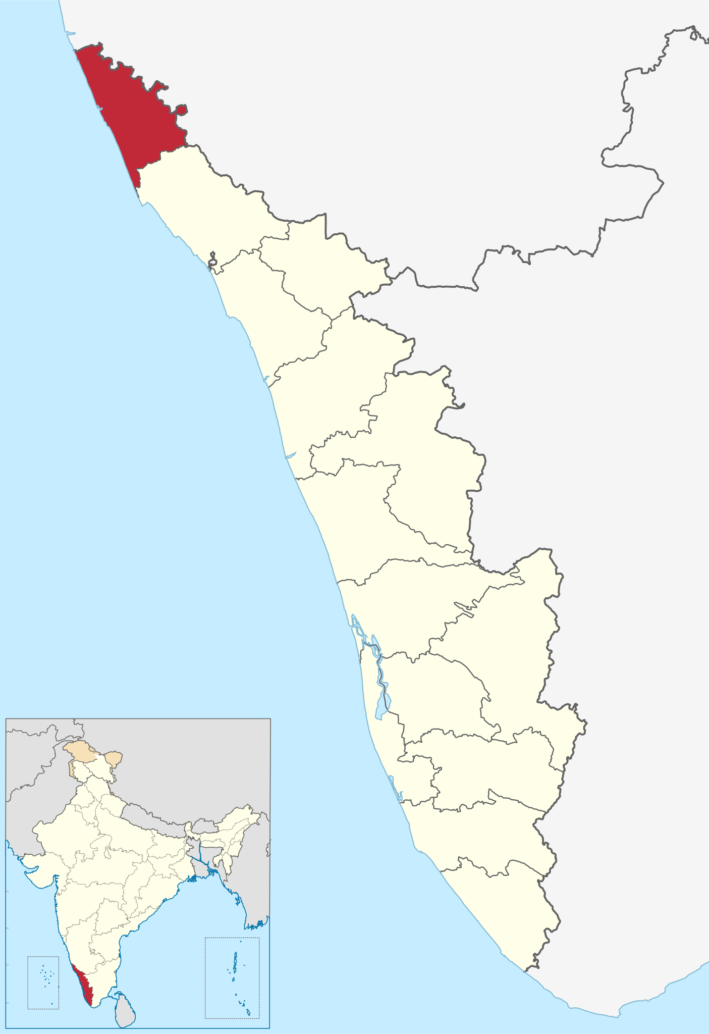
Location of Kasaragod district in Kerala |
| ⧼wm-license-information-date⧽ | 2011-03-11 14:09 (UTC) |
| ⧼wm-license-information-source⧽ | |
| ⧼wm-license-information-author⧽ |
|
|
قالب:Original upload log
This image is a derivative work of the following images:
- File:India_Kerala_location_map.svg licensed with Cc-by-sa-3.0
- 2011-03-11T09:30:07Z NordNordWest 827x1205 (135528 Bytes) =={{int:filedesc}}== {{Information |Description= {{de|Positionskarte von [[:de:Kerala|Kerala]], [[:de:Indien|Indien]]}} Quadratische Plattkarte, N-S-Streckung 102 %. Geographische Begrenzung der Karte: * N: 13.0° N * S: 8.0�
تاريخ الملف
اضغط على زمن/تاريخ لرؤية الملف كما بدا في هذا الزمن.
| زمن/تاريخ | صورة مصغرة | الأبعاد | مستخدم | تعليق | |
|---|---|---|---|---|---|
| حالي | ★ مراجعة معتمدة 10:43، 14 ديسمبر 2023 | | 874 × 1٬274 (539 كيلوبايت) | Pastakhov (نقاش | مساهمات) | Upload https://upload.wikimedia.org/wikipedia/commons/b/b2/India_Kerala_Kasaragod_district.svg |
لا يمكنك استبدال هذا الملف.
وصلات
لا يوجد صفحات تصل لهذه الصورة.