ملف:Icelandic ocean.svg

حجم معاينة PNG لذلك الملف ذي الامتداد SVG: 800 × 592 بكسل. البعد الآخر: 2٬560 × 1٬896 بكسل.
الملف الأصلي (ملف SVG، أبعاده 1٬276 × 945 بكسل، حجم الملف: 1٫61 ميجابايت)
وصف قصير
| ⧼wm-license-information-description⧽ |
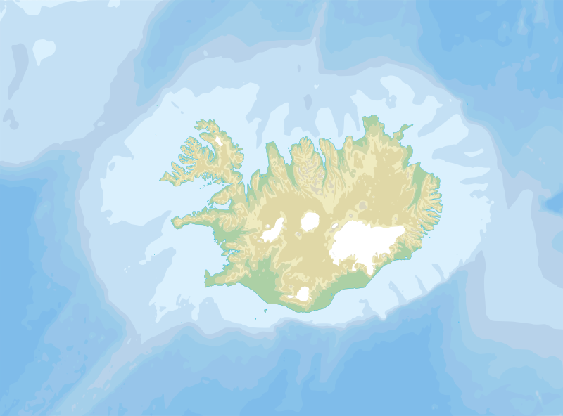
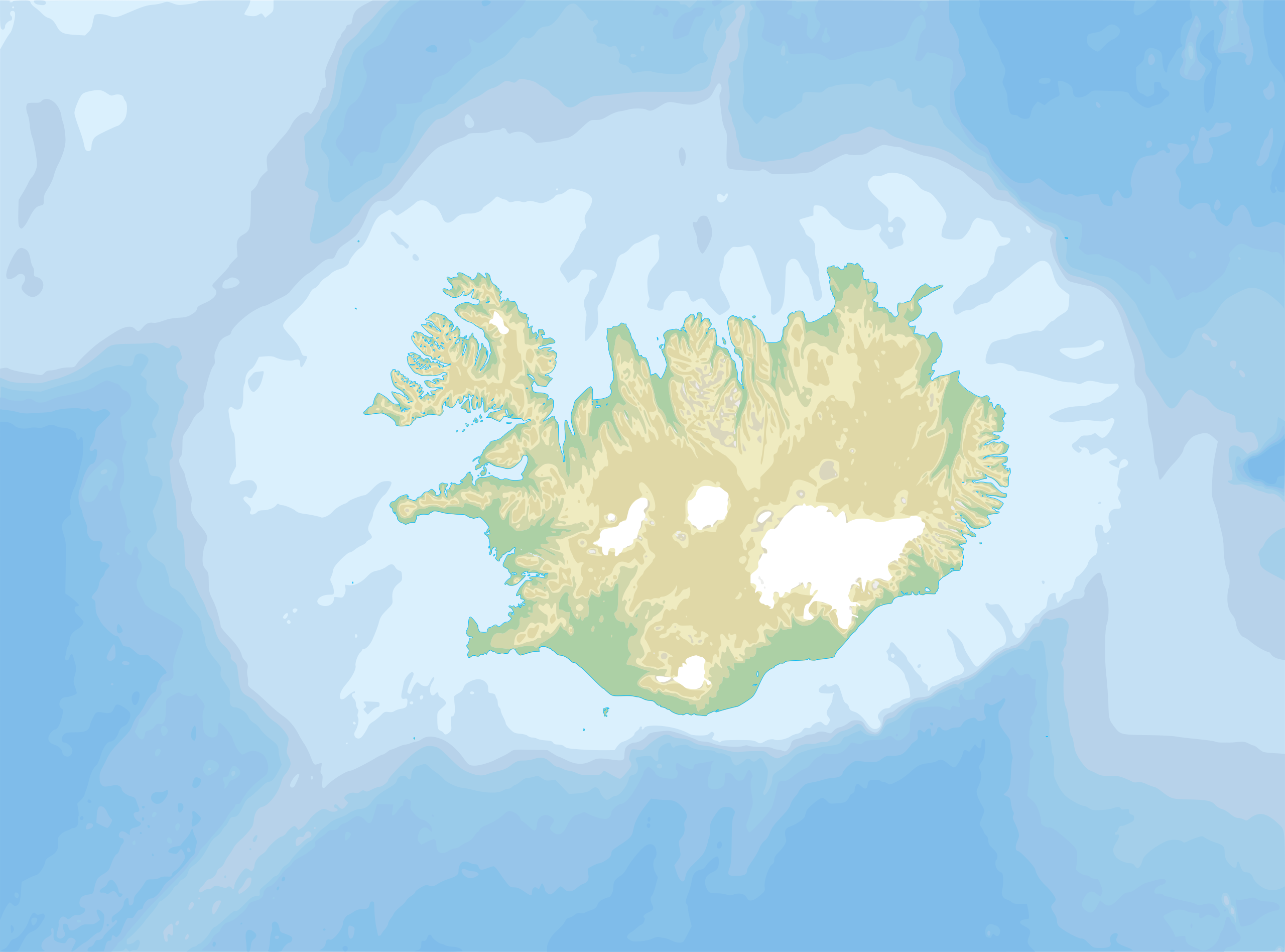
Topographic map in Icelandic of Iceland and the ocean around it. |
| ⧼wm-license-information-date⧽ | 2007 |
| ⧼wm-license-information-source⧽ | Own work ; Topographic map : National Geophysical Data Center (GLOBE) (public domain) edited with 3DEM from Visualization Software LLC and vectorized with Inkscape ; UTM projection ; WGS84 datum) ; Bathymetry : USGov public domain data provided by the Demis add-on for World Wind (see the approval e-mail and the Demis forum). ; Other references used : * Toponyms from Landabréfabók, publisher: Ríkisútgáfa Námsbóka, 1970; |
| ⧼wm-license-information-author⧽ | Akigka |
| ⧼wm-license-information-permission⧽ (⧼wm-license-information-permission-reusing-text⧽) |
GFDL |
ترخيص
|

تاريخ الملف
اضغط على زمن/تاريخ لرؤية الملف كما بدا في هذا الزمن.
| زمن/تاريخ | صورة مصغرة | الأبعاد | مستخدم | تعليق | |
|---|---|---|---|---|---|
| حالي | ★ مراجعة معتمدة 10:36، 7 أكتوبر 2023 | | 1٬276 × 945 (1٫61 ميجابايت) | Pastakhov (نقاش | مساهمات) | Upload https://upload.wikimedia.org/wikipedia/commons/3/35/Icelandic_ocean.svg |
لا يمكنك استبدال هذا الملف.
وصلات
لا يوجد صفحات تصل لهذه الصورة.