ملف:Icehouse-bottom-tennessee2.jpg
الملف الأصلي (2٬033 × 1٬025 بكسل حجم الملف: 321 كيلوبايت، نوع MIME: image/jpeg)
وصف قصير
| ⧼wm-license-information-description⧽ |
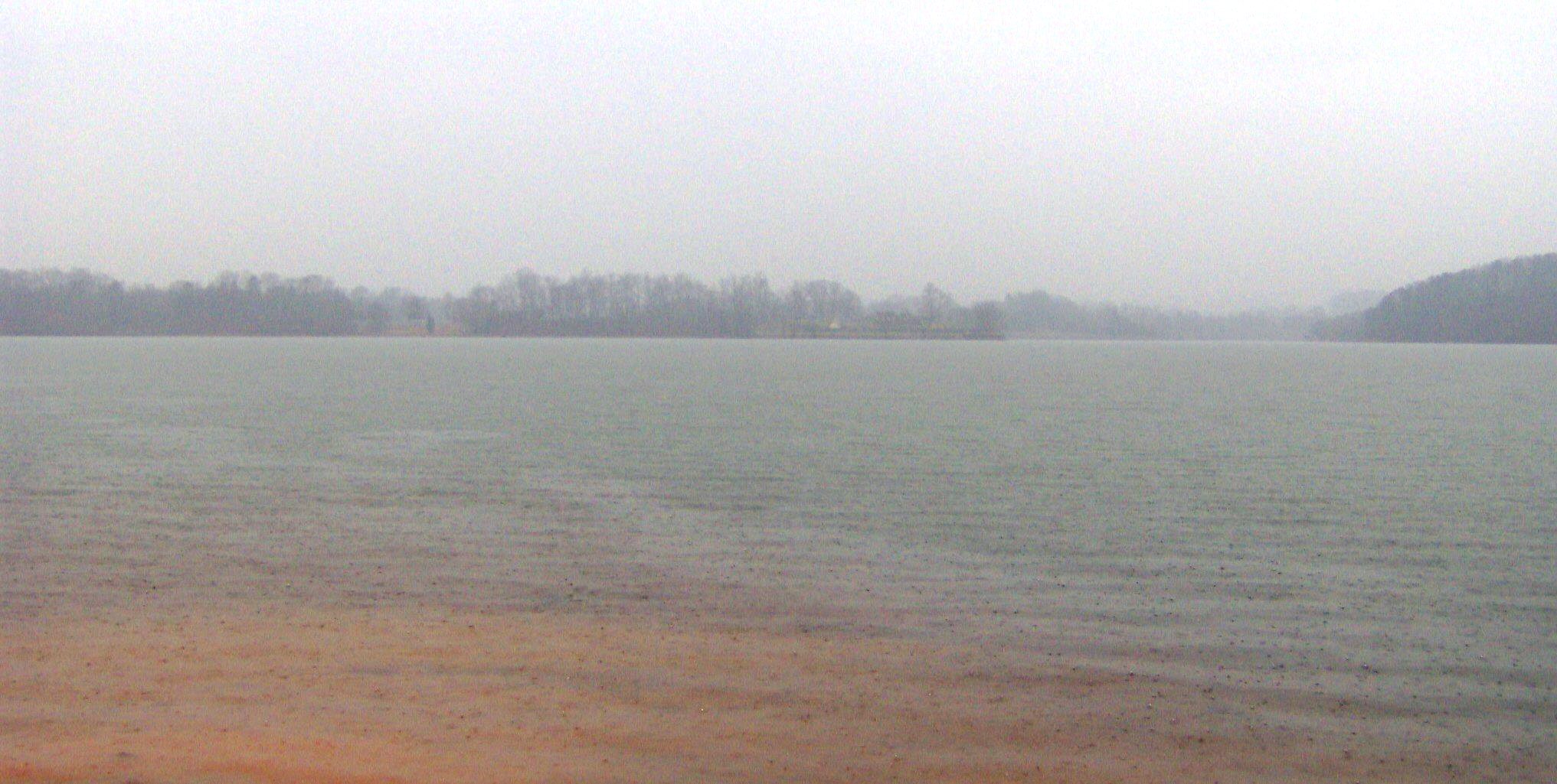
The Little Tennessee River (Tellico Lake), looking north from the McGhee-Carson Unit of the Tellico Lake Wildlife Management Area, located in the southeastern United States. Before this part of the river was inundated by the construction of Tellico Dam, several archaeological sites would have been visible, including the Icehouse Bottom site (immediately below), parts of the Thirty Acre Island and Tellico Blockhouse sites (on the right), and parts of the Tuskegee and Fort Loudoun sites (on the left). The modern replica of Fort Loudoun is barely visible through haze, toward the center of the picture. |
| ⧼wm-license-information-date⧽ | 2007 |
| ⧼wm-license-information-source⧽ | ⧼Wm-license-own-work⧽ |
| ⧼wm-license-information-author⧽ | Brian Stansberry |
ترخيص
|

تاريخ الملف
اضغط على زمن/تاريخ لرؤية الملف كما بدا في هذا الزمن.
| زمن/تاريخ | صورة مصغرة | الأبعاد | مستخدم | تعليق | |
|---|---|---|---|---|---|
| حالي | ★ مراجعة معتمدة 09:28، 18 أكتوبر 2023 | | 2٬033 × 1٬025 (321 كيلوبايت) | Pastakhov (نقاش | مساهمات) | Upload https://upload.wikimedia.org/wikipedia/commons/f/f9/Icehouse-bottom-tennessee2.jpg |
لا يمكنك استبدال هذا الملف.
وصلات
لا يوجد صفحات تصل لهذه الصورة.