ملف:IR15 – Gefecht bei Bischofsheim und Werbach.jpg
حجم هذه المعاينة: 678 × 600 بكسل. البعد الآخر: 2٬464 × 2٬179 بكسل.
الملف الأصلي (2٬464 × 2٬179 بكسل حجم الملف: 3٫5 ميجابايت، نوع MIME: image/jpeg)
وصف قصير
| ⧼wm-license-information-description⧽ |
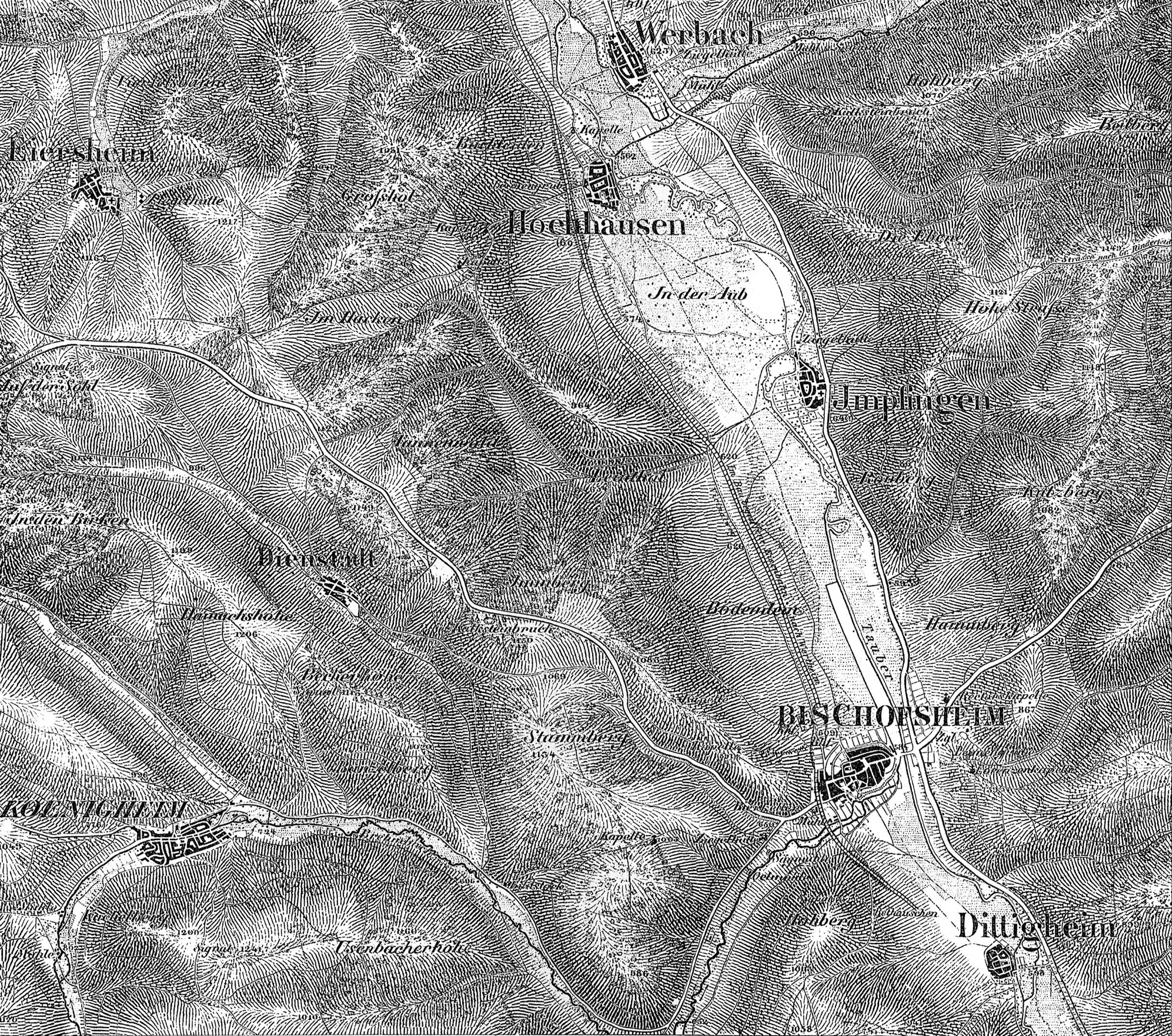
Deutsch: Plan des Gefechtsfeldes von Bischofsheim und Werbach
|
| ⧼wm-license-information-date⧽ | 1866 |
| ⧼wm-license-information-source⧽ | Alfred Cramer: "Geschichte des Infanterie-Regiments Prinz Friedrich der Niederlande (2. Westfälisches) Nr. 15"; Berlin 1910, Verlag R. Eisenschmid, Verlagsbuchhandlung für Militärwissenschaft |
| ⧼wm-license-information-author⧽ | style="background: #E4E4E4; color: black; vertical-align: middle; text-align: center; " class="unknown table-unknown"|author, not menioned anywhere |
ترخيص
تاريخ الملف
اضغط على زمن/تاريخ لرؤية الملف كما بدا في هذا الزمن.
| زمن/تاريخ | صورة مصغرة | الأبعاد | مستخدم | تعليق | |
|---|---|---|---|---|---|
| حالي | ★ مراجعة معتمدة 18:54، 16 أكتوبر 2023 | | 2٬464 × 2٬179 (3٫5 ميجابايت) | Pastakhov (نقاش | مساهمات) | Upload https://upload.wikimedia.org/wikipedia/commons/e/e1/IR15_%E2%80%93_Gefecht_bei_Bischofsheim_und_Werbach.jpg |
لا يمكنك استبدال هذا الملف.
وصلات
لا يوجد صفحات تصل لهذه الصورة.
تصنيفات:
- Battle of Tauberbischofsheim
- Tauber in Main-Tauber-Kreis in 1866
- Old maps of the history of Main-Tauber-Kreis
- Battle of Werbach
- 1866 maps of Königheim
- 1866 maps of Külsheim
- 1866 maps of Werbach
- Infanterie-Regiment „Prinz Friedrich der Niederlande“ (2. Westfälisches) Nr. 15
- 1866 maps of Tauberbischofsheim
- 1866 in Werbach
- History of Baden
- Maps of Austro-Prussian War