ملف:Hurricane Maria September 6 2005.jpg
الملف الأصلي (6٬000 × 6٬000 بكسل حجم الملف: 4٫99 ميجابايت، نوع MIME: image/jpeg)
وصف قصير
| ⧼wm-license-information-description⧽ |
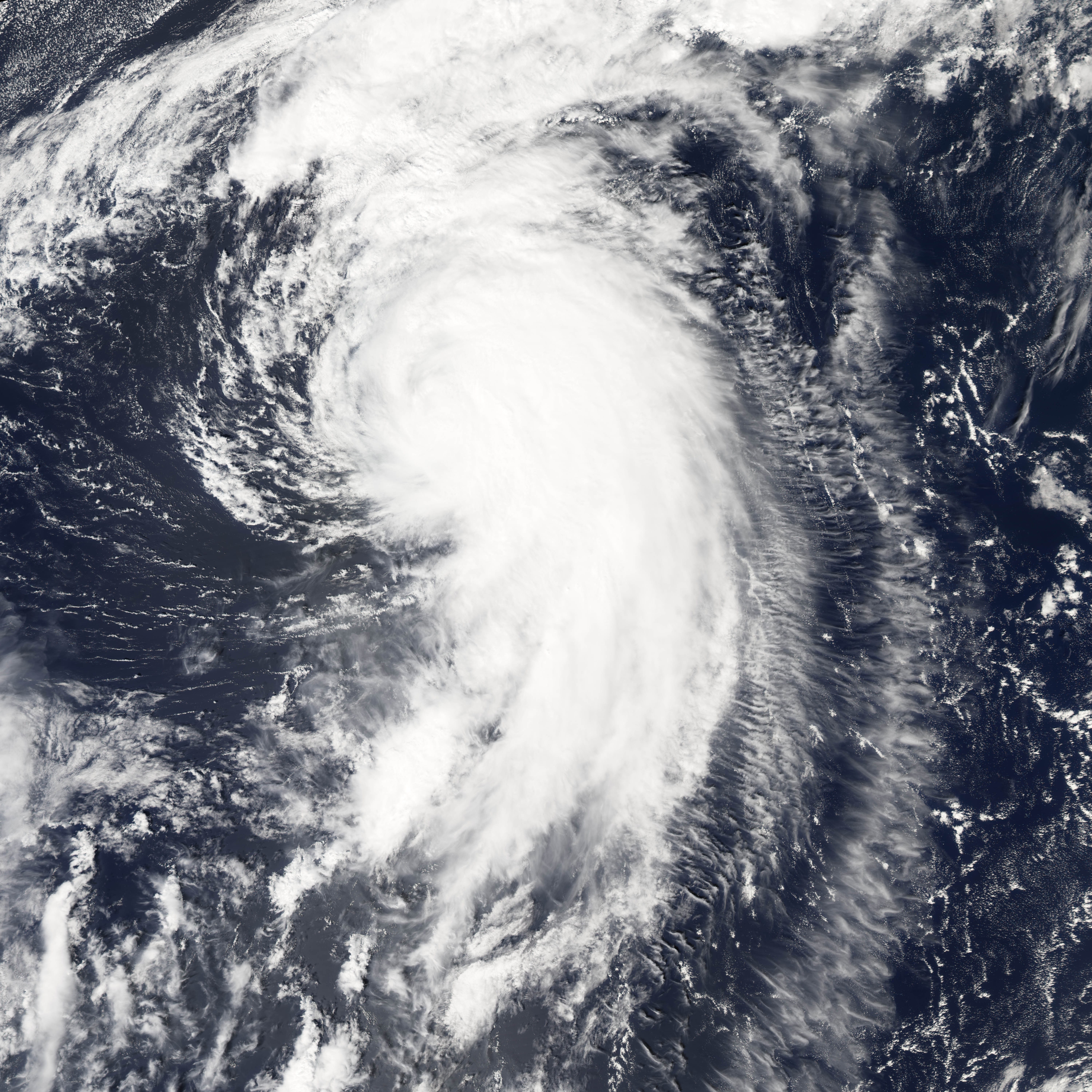
Hurricane Maria is spinning north over the Atlantic Ocean, well away from land. The storm reached its maximum intensity on September 6, 2005, several hours before the Moderate Resolution Imaging Spectroradiometer (MODIS) on NASA’s Aqua satellite captured this image at 1:45 ADT (16:45 UTC). At this time, the storm had winds of about 160 kilometers per hour (100 miles per hour) with gusts to 195 km/hr (120 mph), down from its previous intensity of 185 km/hr (115 mph) with gusts to 220 km/hr (140 mph). Maria is expected to continue to weaken as it moves north. It is not forecast to affect land. |
||
| ⧼wm-license-information-date⧽ | 2005 | ||
| ⧼wm-license-information-source⧽ | http://earthobservatory.nasa.gov/NaturalHazards/natural_hazards_v2.php3?img_id=13107 | ||
| ⧼wm-license-information-author⧽ | NASA image created by Jesse Allen, Earth Observatory, using data provided courtesy of the MODIS Rapid Response team. | ||
| ⧼wm-license-information-permission⧽ (⧼wm-license-information-permission-reusing-text⧽) |
|
تاريخ الملف
اضغط على زمن/تاريخ لرؤية الملف كما بدا في هذا الزمن.
| زمن/تاريخ | صورة مصغرة | الأبعاد | مستخدم | تعليق | |
|---|---|---|---|---|---|
| حالي | ★ مراجعة معتمدة 11:56، 4 ديسمبر 2023 | | 6٬000 × 6٬000 (4٫99 ميجابايت) | Pastakhov (نقاش | مساهمات) | Upload https://upload.wikimedia.org/wikipedia/commons/9/9a/Hurricane_Maria_September_6_2005.jpg |
لا يمكنك استبدال هذا الملف.
وصلات
لا يوجد صفحات تصل لهذه الصورة.