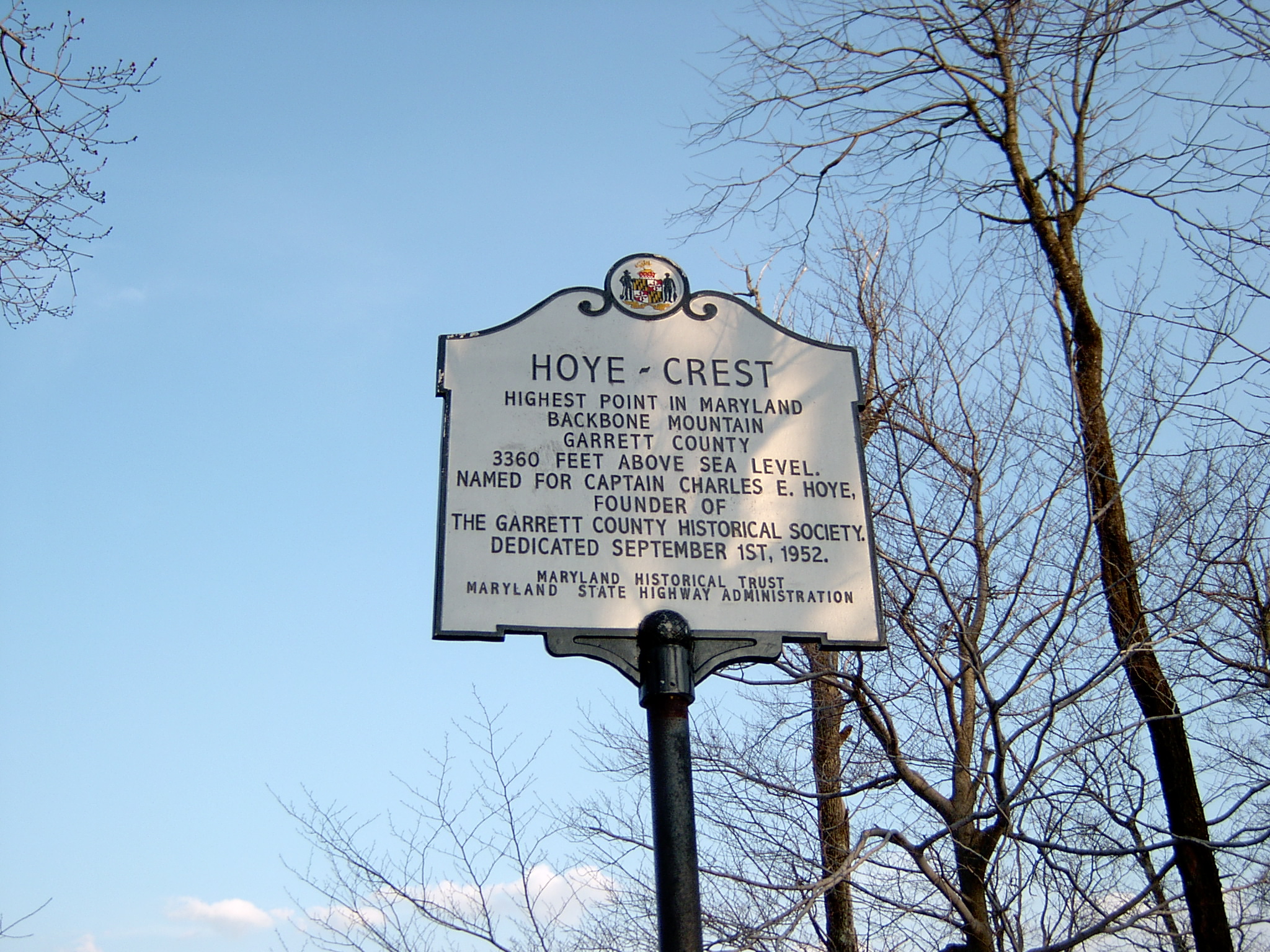
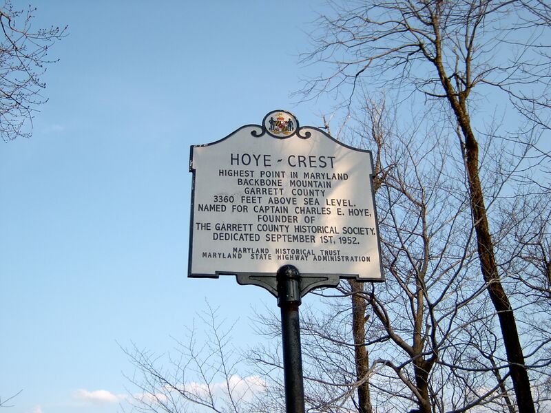
ملف:Hoye-Crest Historical Marker.jpg
حجم هذه المعاينة: 800 × 600 بكسل. البعد الآخر: 2٬048 × 1٬536 بكسل.
الملف الأصلي (2٬048 × 1٬536 بكسل حجم الملف: 1٫1 ميجابايت، نوع MIME: image/jpeg)
وصف قصير
| ⧼wm-license-information-description⧽ | |
| ⧼wm-license-information-date⧽ | 2004 |
| ⧼wm-license-information-source⧽ | Own work by author/uploader |
| ⧼wm-license-information-author⧽ | Brian M. Powell (user Bitmapped on en.wikipedia) |
39°14′14″N 79°29′07″W / 39.23722°N 79.48528°W
ترخيص
This image is licensed under the below Creative Commons license assuming that proper attribution (Brian M. Powell) is provided. If you use this image for a non-Wikimedia or non-Wikipedia project, please leave a note at Brian's Wikipedia Talk page.
|
|
هذا الملفُّ مُرخَّص بموجب رخصة المشاع الإبداعي نسبة المُصنَّف إِلى مؤلفه - المشاركة بالمثل 3.0 العامة. |
تاريخ الملف
اضغط على زمن/تاريخ لرؤية الملف كما بدا في هذا الزمن.
| زمن/تاريخ | صورة مصغرة | الأبعاد | مستخدم | تعليق | |
|---|---|---|---|---|---|
| حالي | ★ مراجعة معتمدة 22:57، 30 أكتوبر 2023 | | 2٬048 × 1٬536 (1٫1 ميجابايت) | Pastakhov (نقاش | مساهمات) | Upload https://upload.wikimedia.org/wikipedia/commons/8/8a/Hoye-Crest_Historical_Marker.jpg |
لا يمكنك استبدال هذا الملف.
وصلات
لا يوجد صفحات تصل لهذه الصورة.