ملف:Hooker Valley Pano MC edit1.jpg
حجم هذه المعاينة: 800 × 427 بكسل. البعد الآخر: 3٬745 × 2٬000 بكسل.
الملف الأصلي (3٬745 × 2٬000 بكسل حجم الملف: 5٫36 ميجابايت، نوع MIME: image/jpeg)
وصف قصير
| ⧼wm-license-information-description⧽ |
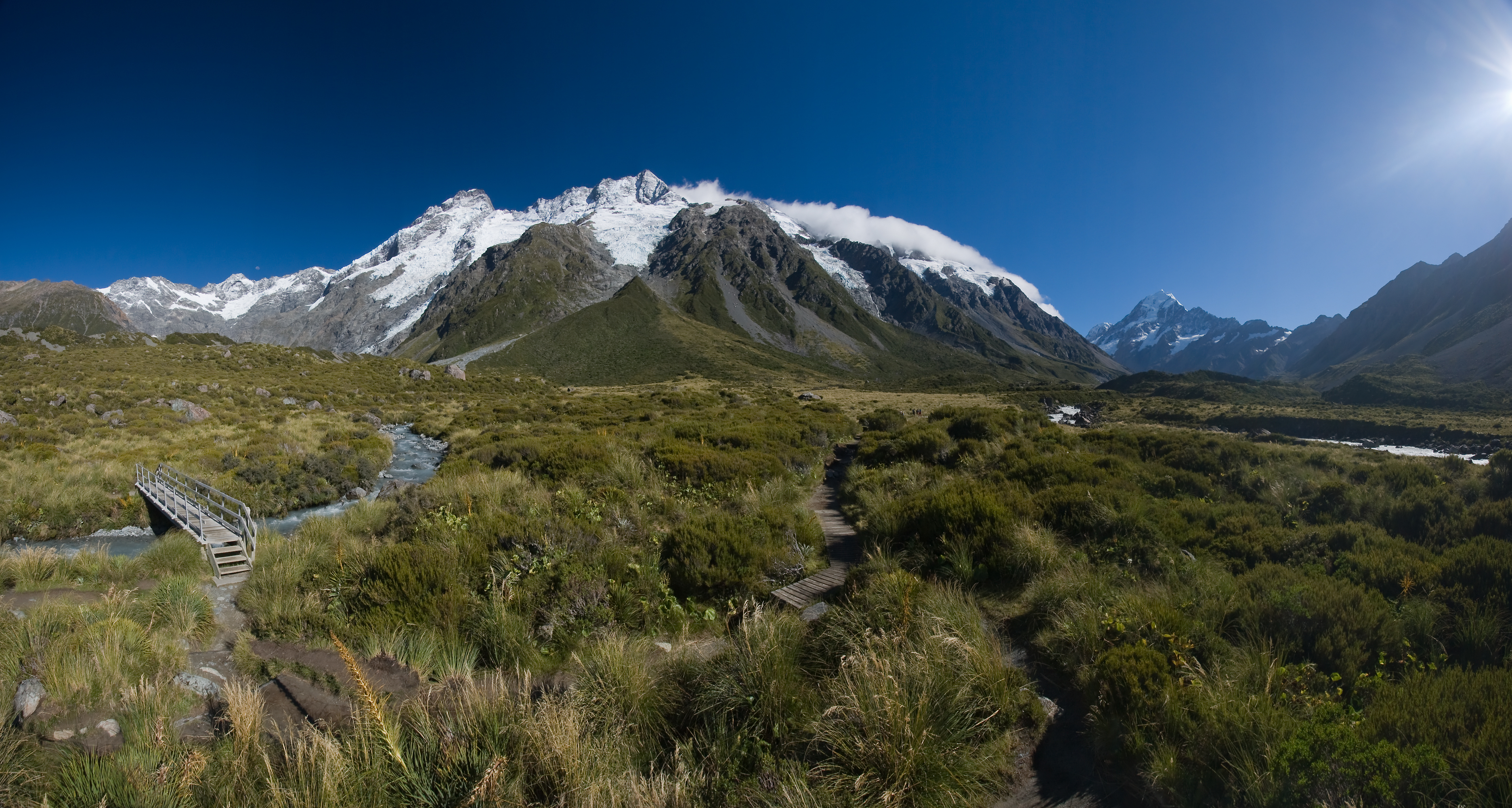
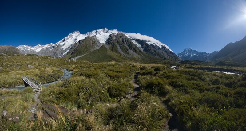
Deutsch: Die Main Divide mit Mt. Sefton und The Footstool, vom Hooker Valley aus gesehen. Rechts im Hintergrund der höchste Berg Neuseelands - Mt. Cook. Panorama zusammengesetzt aus 5 Hochformatbildern. Einige Lens Flares sowie der Schatten des Stativs wurden in der Nachbearbeitung entfernt.
English: The Main Divide with Mt. Sefton and The Footstool, view from Hooker Valley. On the right side in the background the highest peak in New Zealand - Mt. Cook. Panorama stitched from 5 portrait format images. Some lens flares ans the shadow of the tripod were removed in post-processing.
Français : Paysage des Alpes du Sud de la Nouvelle-Zélande, depuis la Hooker Valley. Sur la droite et à l'arrière plan on peut voir le Mont Cook, sommet de la Nouvelle-Zélande. Image panoramique obtenue en assemblant cinq images format portrait.
|
| ⧼wm-license-information-date⧽ | 2008 |
| ⧼wm-license-information-source⧽ | ⧼Wm-license-own-work⧽ |
| ⧼wm-license-information-author⧽ | Christian Mehlführer, User:Chmehl |
| ⧼wm-license-information-other-versions⧽ |
ملف:Hooker Valley Pano MC.jpg ملف:Hooker Valley Pano2 MC.jpg |
43°41′53.2″S 170°5′48.5″E / 43.698111°S 170.096806°E
|
ترخيص
تاريخ الملف
اضغط على زمن/تاريخ لرؤية الملف كما بدا في هذا الزمن.
| زمن/تاريخ | صورة مصغرة | الأبعاد | مستخدم | تعليق | |
|---|---|---|---|---|---|
| حالي | ★ مراجعة معتمدة 11:45، 29 نوفمبر 2023 | | 3٬745 × 2٬000 (5٫36 ميجابايت) | Pastakhov (نقاش | مساهمات) | Upload https://upload.wikimedia.org/wikipedia/commons/0/0b/Hooker_Valley_Pano_MC_edit1.jpg |
لا يمكنك استبدال هذا الملف.
وصلات
لا يوجد صفحات تصل لهذه الصورة.