ملف:High altitude view of Tennessee River at Humphreys County, Tennessee.jpg
حجم هذه المعاينة: 800 × 600 بكسل. البعدان الآخران: 2٬560 × 1٬920 بكسل | 4٬320 × 3٬240 بكسل.
الملف الأصلي (4٬320 × 3٬240 بكسل حجم الملف: 4٫47 ميجابايت، نوع MIME: image/jpeg)
وصف قصير
| ⧼wm-license-information-description⧽ |
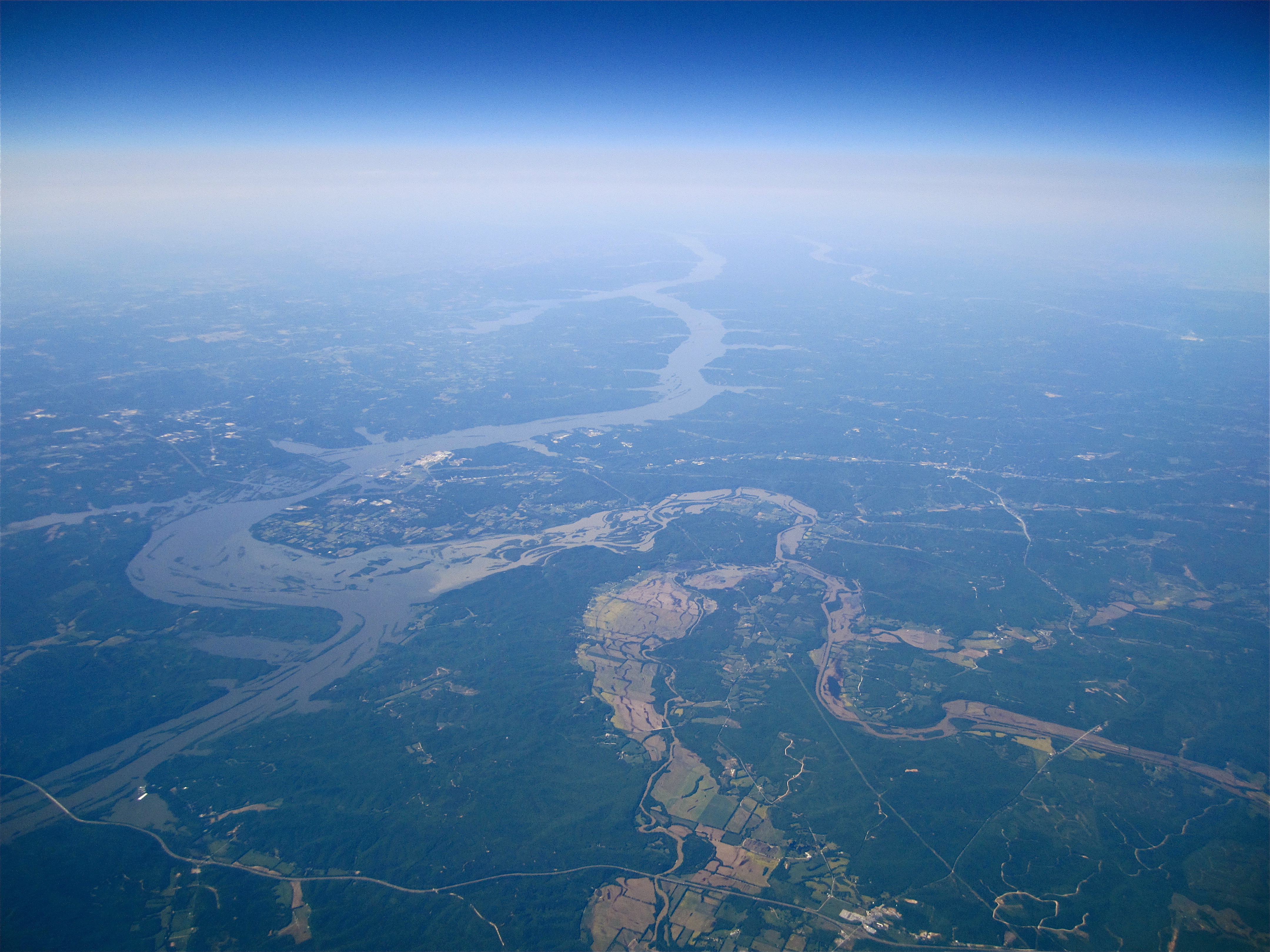
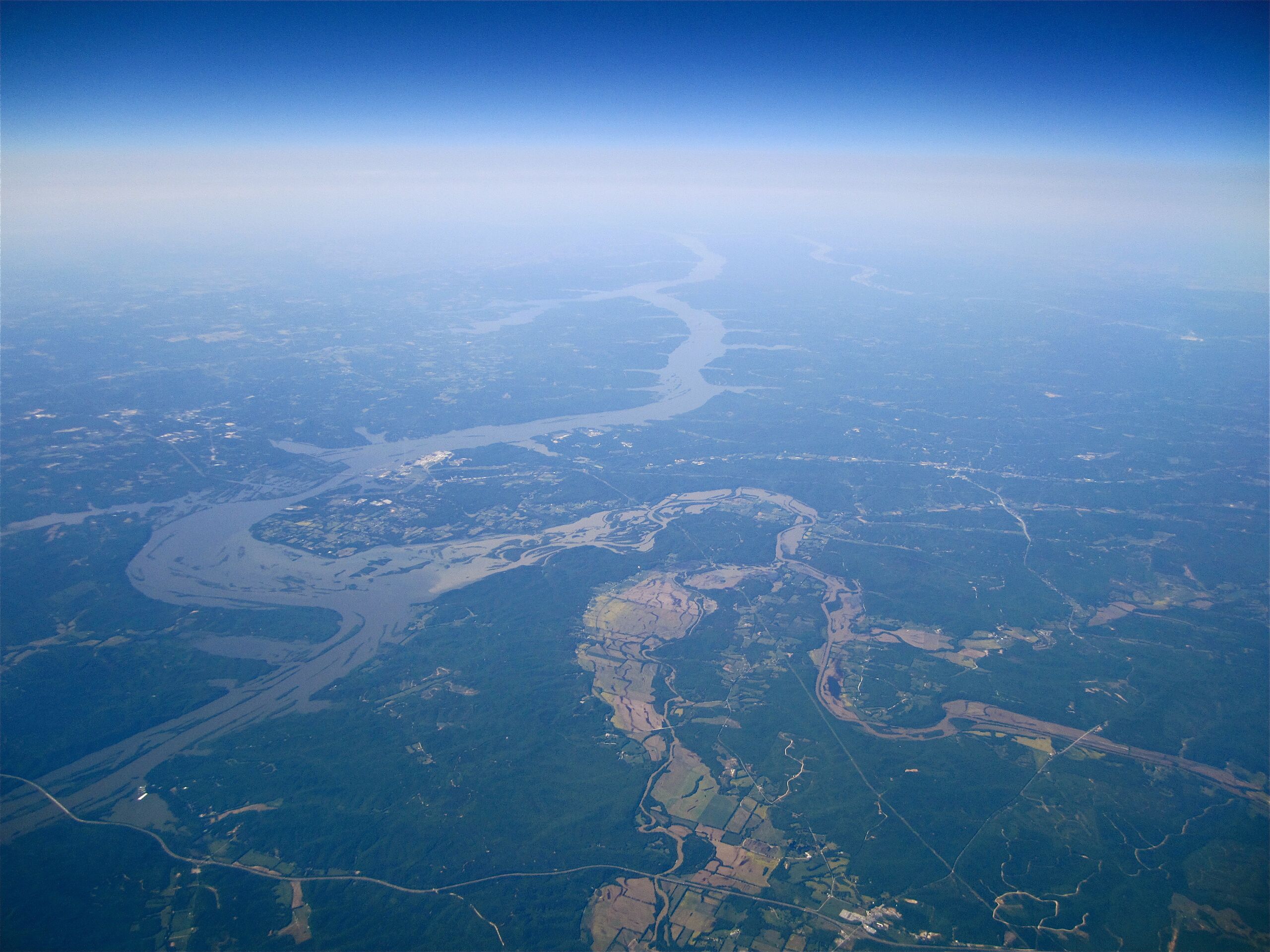
English: This high altitude aerial photograph of the Tennessee River is centered on western Humphreys County, Tennessee, and encompasses most of Humphreys, Benton and Houston Counties. This photograph was taken at an altitude of approximately 35,000 feet (11,000 m). Several landmarks are annotated in the image.
|
| ⧼wm-license-information-date⧽ | 2010, {{time}} – invalid date format 25 (help) |
| ⧼wm-license-information-source⧽ | https://www.flickr.com/photos/la-citta-vita/6044042151/ |
| ⧼wm-license-information-author⧽ | La Citta Vita |
ترخيص
قالب:FlickrVerifiedByUploadWizard
تاريخ الملف
اضغط على زمن/تاريخ لرؤية الملف كما بدا في هذا الزمن.
| زمن/تاريخ | صورة مصغرة | الأبعاد | مستخدم | تعليق | |
|---|---|---|---|---|---|
| حالي | ★ مراجعة معتمدة 19:51، 22 نوفمبر 2023 | | 4٬320 × 3٬240 (4٫47 ميجابايت) | Pastakhov (نقاش | مساهمات) | Upload https://upload.wikimedia.org/wikipedia/commons/9/90/High_altitude_view_of_Tennessee_River_at_Humphreys_County%2C_Tennessee.jpg |
لا يمكنك استبدال هذا الملف.
وصلات
لا يوجد صفحات تصل لهذه الصورة.
معلومات الصورة (ميتا)
تصنيفات:
- Humphreys County, Tennessee
- Tennessee River in Tennessee
- Aerial photographs of Tennessee
- Aerial photographs of rivers of the United States
- 2010 in Tennessee
- December 2010 United States photographs
- Photographs taken on 2010-12-17
- Taken with Canon Digital IXUS 130
- Buffalo River (Tennessee)
- Duck River
- Confluences in Tennessee
- Meanders in Tennessee
- Fluvial geomorphology of Tennessee
- Bakerville, Tennessee
- Confluences of rivers in the United States