ملف:Hemel Hempstead, High Street - geograph.org.uk - 588632.jpg
لا توجد دقة أعلى متوفرة.
Hemel_Hempstead,_High_Street_-_geograph.org.uk_-_588632.jpg (640 × 460 بكسل حجم الملف: 70 كيلوبايت، نوع MIME: image/jpeg)
وصف قصير
| ⧼wm-license-information-description⧽ |
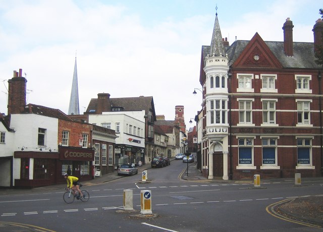
English: Hemel Hempstead: High Street This is the southern end of the High Street viewed looking across Queensway from Alexandra Road, with the landmarks, from left to right, of the steeple of St Mary's Church, the tower of the old Town Hall, and the Victorian Gothic steeple of the corner building currently used by ALH Insurance.
The 1940s Ordnance Survey map shows this road junction to be the most important in Hemel with the A4146 road heading south to the left and the A4147 road heading east leaving the junction to go up Alexandra Road towards Hemel Hempstead Midland railway station.
|
| ⧼wm-license-information-date⧽ | 2007 |
| ⧼wm-license-information-source⧽ | From geograph.org.uk |
| ⧼wm-license-information-author⧽ | Nigel Cox |
| ⧼wm-license-cc-attribution⧽ (قالب:I18n/Credit line) |
Nigel Cox / Hemel Hempstead: High Street / |
51°45′27″N 0°28′19″W / 51.7576°N 0.472°W قالب:Object location
_heading:337)
ترخيص
تاريخ الملف
اضغط على زمن/تاريخ لرؤية الملف كما بدا في هذا الزمن.
| زمن/تاريخ | صورة مصغرة | الأبعاد | مستخدم | تعليق | |
|---|---|---|---|---|---|
| حالي | ★ مراجعة معتمدة 11:08، 5 أكتوبر 2023 | | 640 × 460 (70 كيلوبايت) | Pastakhov (نقاش | مساهمات) | Upload https://upload.wikimedia.org/wikipedia/commons/2/2d/Hemel_Hempstead%2C_High_Street_-_geograph.org.uk_-_588632.jpg |
لا يمكنك استبدال هذا الملف.
وصلات
لا يوجد صفحات تصل لهذه الصورة.