ملف:Haute-Kotto sub-prefectures.png
حجم هذه المعاينة: 776 × 600 بكسل. البعد الآخر: 1٬056 × 816 بكسل.
الملف الأصلي (1٬056 × 816 بكسل حجم الملف: 25 كيلوبايت، نوع MIME: image/png)
وصف قصير
| ⧼wm-license-information-description⧽ |
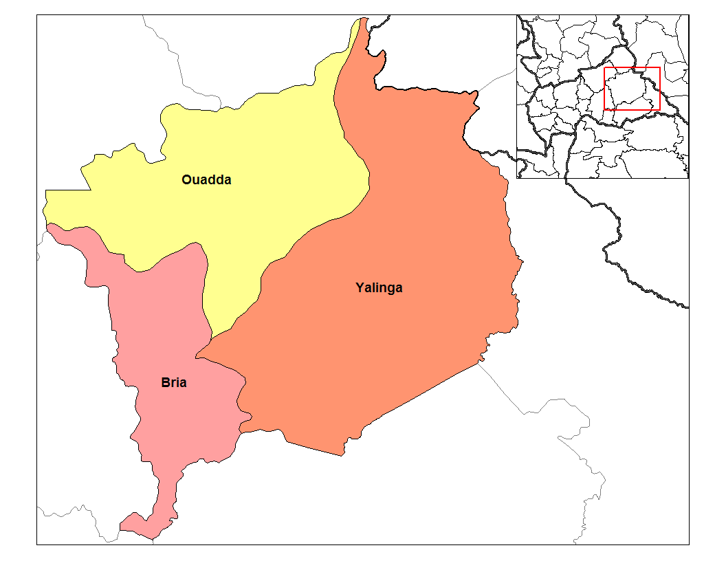
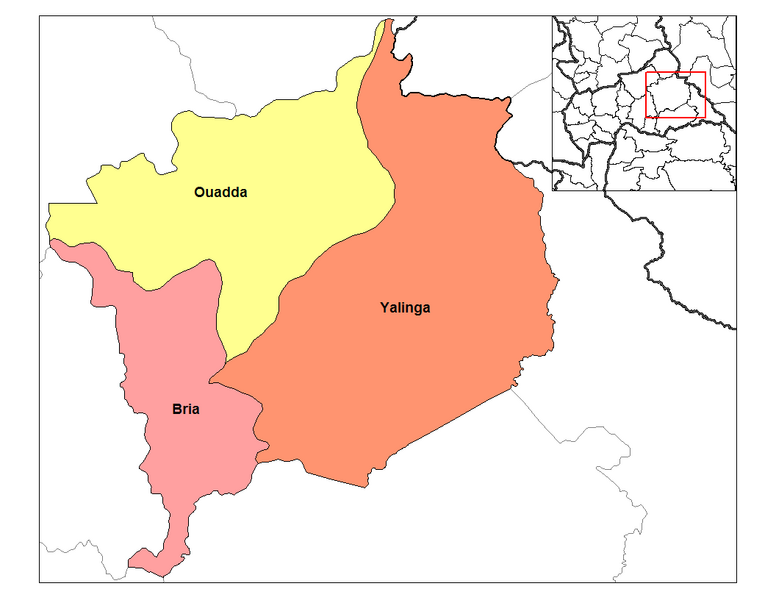
English: Map of the sub-prefectures of Haute-Kotto prefecture of the Central African Republic. Created by Rarelibra 19:46, 31 August 2006 (UTC) for public domain use, using MapInfo Professional v8.5 and various mapping resources.
|
| ⧼wm-license-information-date⧽ | قالب:Original upload date |
| ⧼wm-license-information-source⧽ | ⧼Wm-license-own-work⧽ Transferred from en.wikipedia |
| ⧼wm-license-information-author⧽ | Rarelibra at en.wikipedia |
ترخيص
| [ This image has been (or is hereby) released into the public domain by its author, Rarelibra at the wikipedia project. This applies worldwide. In case this is not legally possible: Deutsch · Ελληνικά · English · Plattdüütsch · 中文(简体) · 中文(繁體) · +/− |
قالب:Original upload log
قالب:Original description page
- 2006-08-31 19:46 Rarelibra 1056×816 (25873 bytes) Map of the sub-prefectures of Haute-Kotto prefecture of the Central African Republic. Created by ~~~~ for public domain use, using MapInfo Professional v8.5 and various mapping resources.
تاريخ الملف
اضغط على زمن/تاريخ لرؤية الملف كما بدا في هذا الزمن.
| زمن/تاريخ | صورة مصغرة | الأبعاد | مستخدم | تعليق | |
|---|---|---|---|---|---|
| حالي | ★ مراجعة معتمدة 22:58، 5 أكتوبر 2023 | | 1٬056 × 816 (25 كيلوبايت) | Pastakhov (نقاش | مساهمات) | Upload https://upload.wikimedia.org/wikipedia/commons/f/f9/Haute-Kotto_sub-prefectures.png |
لا يمكنك استبدال هذا الملف.
وصلات
لا يوجد صفحات تصل لهذه الصورة.