ملف:Hampreston, parish church of All Saints - geograph.org.uk - 506490.jpg
لا توجد دقة أعلى متوفرة.
Hampreston,_parish_church_of_All_Saints_-_geograph.org.uk_-_506490.jpg (640 × 429 بكسل حجم الملف: 78 كيلوبايت، نوع MIME: image/jpeg)
وصف قصير
| ⧼wm-license-information-description⧽ |
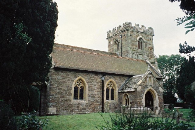
English: Hampreston: parish church of All Saints The parish has been renamed Ferndown Town in recent years, reflecting the massive modern growth of the town that used to be a backwater of the parish of Hampreston.
|
| ⧼wm-license-information-date⧽ | 1997 |
| ⧼wm-license-information-source⧽ | From geograph.org.uk |
| ⧼wm-license-information-author⧽ | Chris Downer |
| ⧼wm-license-cc-attribution⧽ (قالب:I18n/Credit line) |
Chris Downer / Hampreston: parish church of All Saints / |
50°47′21″N 1°55′20″W / 50.78915°N 1.9223°W قالب:Object location
_heading:202)
ترخيص
تاريخ الملف
اضغط على زمن/تاريخ لرؤية الملف كما بدا في هذا الزمن.
| زمن/تاريخ | صورة مصغرة | الأبعاد | مستخدم | تعليق | |
|---|---|---|---|---|---|
| حالي | ★ مراجعة معتمدة 11:31، 29 نوفمبر 2023 | | 640 × 429 (78 كيلوبايت) | Pastakhov (نقاش | مساهمات) | Upload https://upload.wikimedia.org/wikipedia/commons/6/66/Hampreston%2C_parish_church_of_All_Saints_-_geograph.org.uk_-_506490.jpg |
لا يمكنك استبدال هذا الملف.
وصلات
لا يوجد صفحات تصل لهذه الصورة.