ملف:Hambol region locator map Côte d'Ivoire.jpg
حجم هذه المعاينة: 583 × 600 بكسل. البعدان الآخران: 1٬990 × 2٬048 بكسل | 4٬137 × 4٬257 بكسل.
الملف الأصلي (4٬137 × 4٬257 بكسل حجم الملف: 1٫23 ميجابايت، نوع MIME: image/jpeg)
وصف قصير
| ⧼wm-license-information-description⧽ |
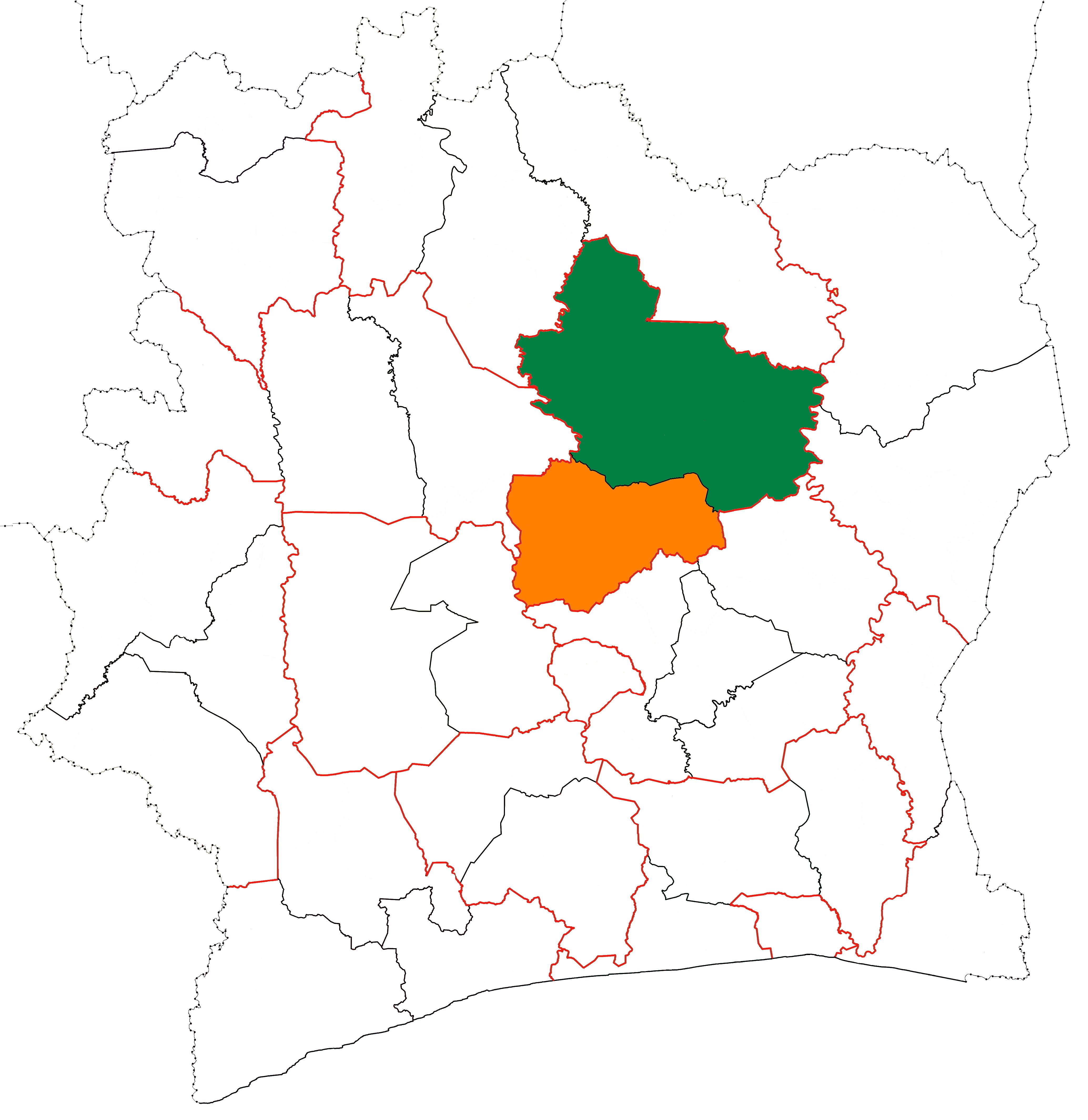
English: The location of Hambol region (green) in Côte d'Ivoire. The other shaded areas represent the other parts of Vallée du Bandama District.
|
| ⧼wm-license-information-date⧽ | 2015 |
| ⧼wm-license-information-source⧽ | ⧼Wm-license-own-work⧽ |
| ⧼wm-license-information-author⧽ | Good Olfactory |
ترخيص
|
تاريخ الملف
اضغط على زمن/تاريخ لرؤية الملف كما بدا في هذا الزمن.
| زمن/تاريخ | صورة مصغرة | الأبعاد | مستخدم | تعليق | |
|---|---|---|---|---|---|
| حالي | ★ مراجعة معتمدة 14:32، 11 أكتوبر 2023 | | 4٬137 × 4٬257 (1٫23 ميجابايت) | Pastakhov (نقاش | مساهمات) | Upload https://upload.wikimedia.org/wikipedia/commons/a/af/Hambol_region_locator_map_C%C3%B4te_d%27Ivoire.jpg |
لا يمكنك استبدال هذا الملف.
وصلات
لا يوجد صفحات تصل لهذه الصورة.