ملف:Guile Point East (geograph 4790077).jpg
الملف الأصلي (532 × 800 بكسل حجم الملف: 319 كيلوبايت، نوع MIME: image/jpeg)
وصف قصير
| ⧼wm-license-information-description⧽ |
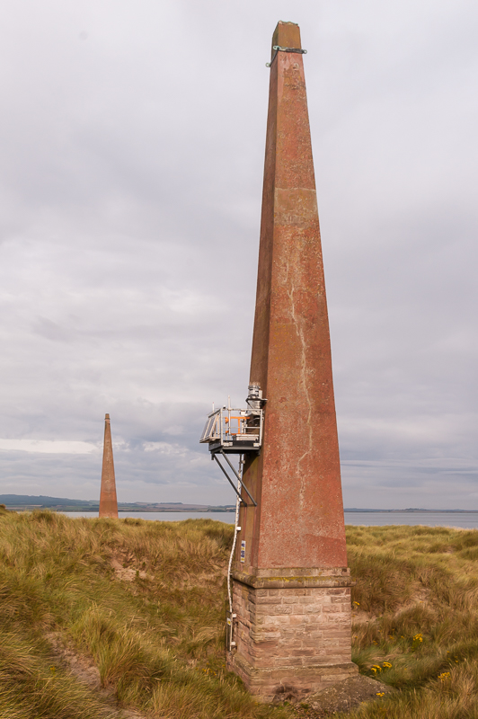
English: Guile Point East
Otherwise known as East Old Law, this is one of a pair of navigation beacons on Guile Point. Built in the first part of the 19th Century by Trinity House of Newcastle upon Tyne, their purpose was to guide sailors into Holy Island Harbour by aligning the two beacons. By the 1990s, a solar powered light had been fitted to Guile Point East, as seen in this photo and Guile Point West (or West Old Law) became redundant. Responsibility for Guile Point East was transferred to Trinity House (as distinct from Trinity House of Newcastle upon Tyne) in 1995. The two beacons are grade II listed. |
| ⧼wm-license-information-date⧽ | 2011 |
| ⧼wm-license-information-source⧽ | From geograph.org.uk |
| ⧼wm-license-information-author⧽ | Ian Capper |
| ⧼wm-license-information-permission⧽ (⧼wm-license-information-permission-reusing-text⧽) |
Creative Commons Attribution Share-alike license 2.0 |
| ⧼wm-license-cc-attribution⧽ (قالب:I18n/Credit line) |
Ian Capper / Guile Point East / |
55°39′29″N 1°47′34″W / 55.658137°N 1.792818°W قالب:Object location
.jpg¶ms=55.658137_N_1.792818_W_source:geograph-osgb36(NU1313440532)_heading:292)
ترخيص
تاريخ الملف
اضغط على زمن/تاريخ لرؤية الملف كما بدا في هذا الزمن.
| زمن/تاريخ | صورة مصغرة | الأبعاد | مستخدم | تعليق | |
|---|---|---|---|---|---|
| حالي | ★ مراجعة معتمدة 19:10، 10 نوفمبر 2023 | | 532 × 800 (319 كيلوبايت) | Pastakhov (نقاش | مساهمات) | Upload https://upload.wikimedia.org/wikipedia/commons/9/93/Guile_Point_East_%28geograph_4790077%29.jpg |
لا يمكنك استبدال هذا الملف.
وصلات
لا يوجد صفحات تصل لهذه الصورة.
.jpg&oldid=3452568)