ملف:Great Wall of China, Satellite image.jpeg
الملف الأصلي (800 × 800 بكسل حجم الملف: 224 كيلوبايت، نوع MIME: image/jpeg)
| ⧼wm-license-information-description⧽ |
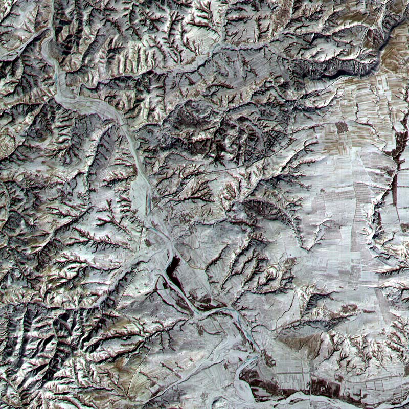
A satellite image of the Great Wall of China. This Advanced Spaceborne Thermal Emission and Reflection Radiometer (ASTER) sub-image covers a 12 × 12 km (7.5 × 7.5 miles) area in Northern Shanxi Province, China, and was acquired January 9, 2001. The low sun angle and light snow cover highlight a section of the Great Wall, visible as a black line running diagonally through the image from lower left to upper right. The Great Wall is more than 2000 years old and was built over a period of 1000 years. Stretching 7240 km (4500 miles) from Korea to the Gobi Desert, it was first built to protect China from marauders from the north. |
||
| ⧼wm-license-information-date⧽ | 2001 | ||
| ⧼wm-license-information-source⧽ | "Great Wall of China". Earth Observatory. NASA. Archived from the original on 4 August 2001. | ||
| ⧼wm-license-information-author⧽ | NASA/GSFC/MITI/ERSDAC/JAROS and U.S./Japan ASTER Science Team | ||
| ⧼wm-license-information-permission⧽ (⧼wm-license-information-permission-reusing-text⧽) |
|
تاريخ الملف
اضغط على زمن/تاريخ لرؤية الملف كما بدا في هذا الزمن.
| زمن/تاريخ | صورة مصغرة | الأبعاد | مستخدم | تعليق | |
|---|---|---|---|---|---|
| حالي | ★ مراجعة معتمدة 12:54، 13 أبريل 2024 | | 800 × 800 (224 كيلوبايت) | Pastakhov (نقاش | مساهمات) | Upload https://upload.wikimedia.org/wikipedia/commons/0/0f/Great_Wall_of_China%2C_Satellite_image.jpeg |
لا يمكنك استبدال هذا الملف.
وصلات
لا يوجد صفحات تصل لهذه الصورة.