ملف:Gonave.jpg

حجم هذه المعاينة: 600 × 600 بكسل. البعدان الآخران: 2٬048 × 2٬048 بكسل | 4٬096 × 4٬096 بكسل.
الملف الأصلي (4٬096 × 4٬096 بكسل حجم الملف: 7٫47 ميجابايت، نوع MIME: image/jpeg)
وصف قصير
| ⧼wm-license-information-description⧽ |
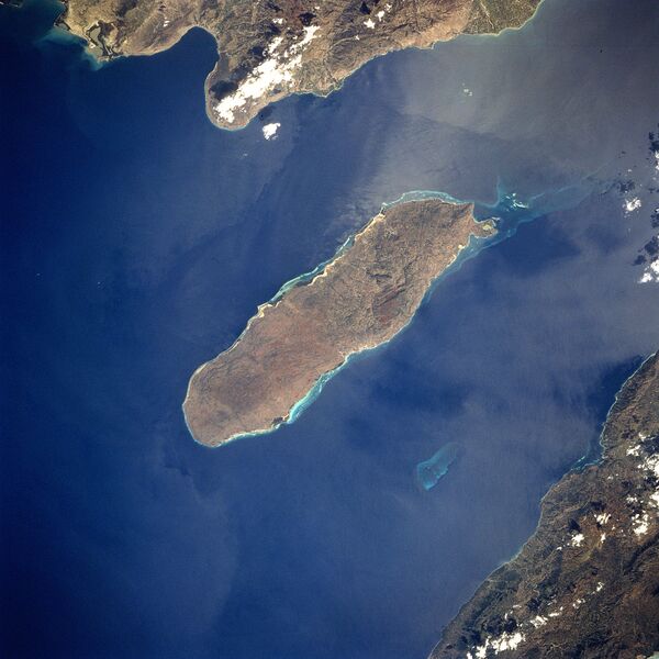
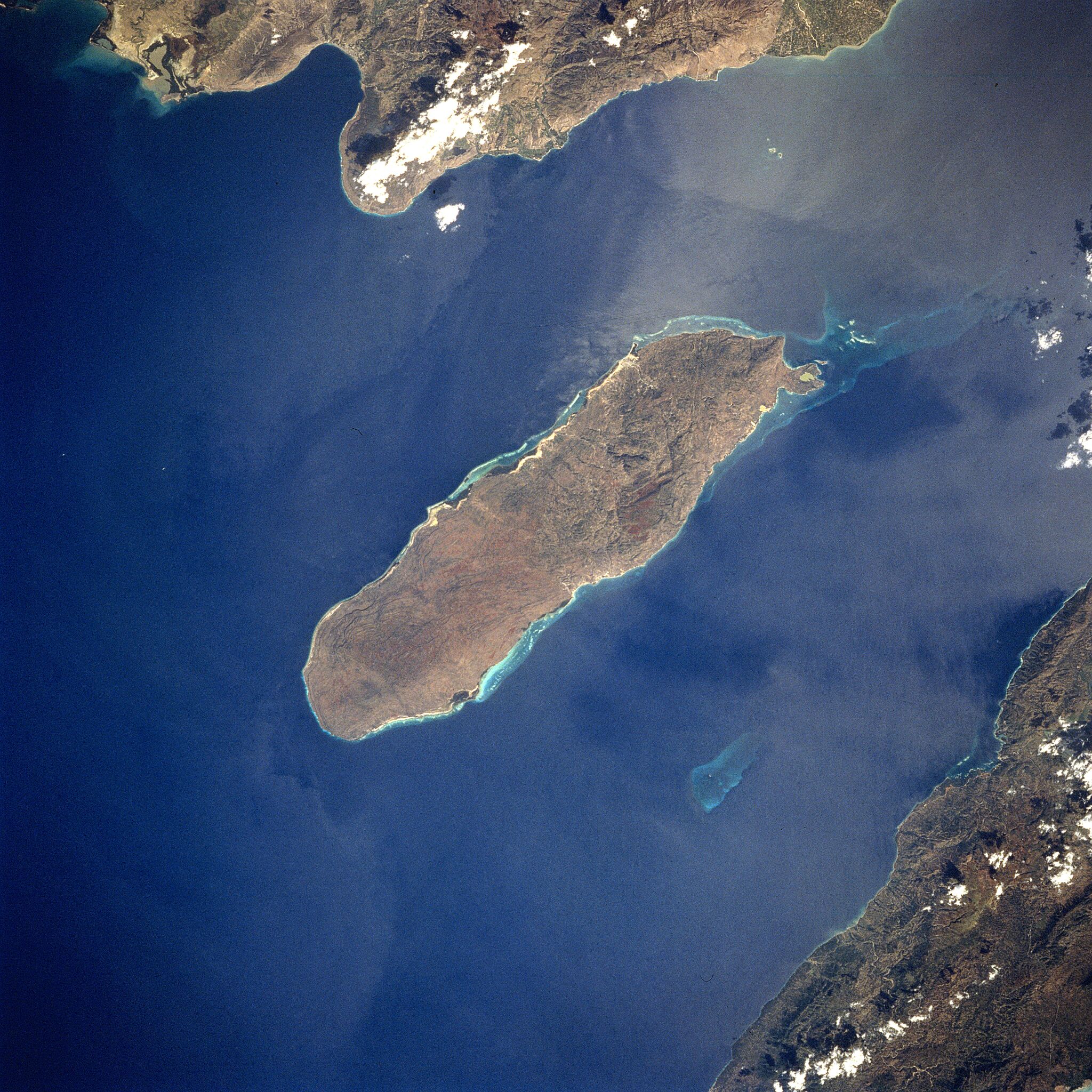
English: Gonave Island, Haiti - February 1994
Located to the west-northwest of Port Au-Prince, Haiti in the Gulf of Gonave, the reef- fringed island of Gonave can be seen in this near-nadir looking view. Made up of mostly limestone, the island of Gonave is 37 miles (60 km) long and 9 miles (15 km) wide and covers an area of 287 sq. miles (743 sq. km). The island is mostly barren and hilly with the highest point reaching 984 feet (300 meters). The rugged, barren, dry landscape prevents the cultivation of the land for agriculture and human population on the island is scarce. The island was once used as a base for pirates. |
| ⧼wm-license-information-date⧽ | 1994 |
| ⧼wm-license-information-source⧽ | Gateway to Astronaut Photography of the Earth NASA Photo ID STS060-84-56, cropped and rotated |
| ⧼wm-license-information-author⧽ | NASA |
18°50′9.996″N 73°1′43.932″W / 18.83611000°N 73.02887000°W قالب:NASA-image
ترخيص
تاريخ الملف
اضغط على زمن/تاريخ لرؤية الملف كما بدا في هذا الزمن.
| زمن/تاريخ | صورة مصغرة | الأبعاد | مستخدم | تعليق | |
|---|---|---|---|---|---|
| حالي | ★ مراجعة معتمدة 07:37، 4 نوفمبر 2023 | | 4٬096 × 4٬096 (7٫47 ميجابايت) | Pastakhov (نقاش | مساهمات) | Upload https://upload.wikimedia.org/wikipedia/commons/8/85/Gonave.jpg |
لا يمكنك استبدال هذا الملف.
وصلات
لا يوجد صفحات تصل لهذه الصورة.