ملف:Golan Heights geography.png

حجم هذه المعاينة: 522 × 600 بكسل. البعد الآخر: 758 × 871 بكسل.
الملف الأصلي (758 × 871 بكسل حجم الملف: 862 كيلوبايت، نوع MIME: image/png)
وصف قصير
| ⧼wm-license-information-description⧽ |
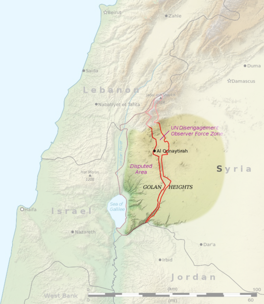
Français : Carte du plateau du Golan. English: Map of Golan Heights
|
| ⧼wm-license-information-date⧽ | 2015 |
| ⧼wm-license-information-source⧽ | |
| ⧼wm-license-information-author⧽ |
|
| ⧼wm-license-information-other-versions⧽ |
File:Golan Heights relief v1.jpg - File:Golan Heights relief v2.png |
ترخيص
|
تاريخ الملف
اضغط على زمن/تاريخ لرؤية الملف كما بدا في هذا الزمن.
| زمن/تاريخ | صورة مصغرة | الأبعاد | مستخدم | تعليق | |
|---|---|---|---|---|---|
| حالي | ★ مراجعة معتمدة 08:15، 26 يناير 2024 | | 758 × 871 (862 كيلوبايت) | Pastakhov (نقاش | مساهمات) | Upload https://upload.wikimedia.org/wikipedia/commons/5/56/Golan_Heights_geography.png |
لا يمكنك استبدال هذا الملف.
وصلات
لا يوجد صفحات تصل لهذه الصورة.