ملف:Gleisplan Bullay Moselbahn.JPG
حجم هذه المعاينة: 800 × 410 بكسل. البعد الآخر: 2٬156 × 1٬106 بكسل.
الملف الأصلي (2٬156 × 1٬106 بكسل حجم الملف: 1٫75 ميجابايت، نوع MIME: image/jpeg)
وصف قصير
| ⧼wm-license-information-description⧽ |
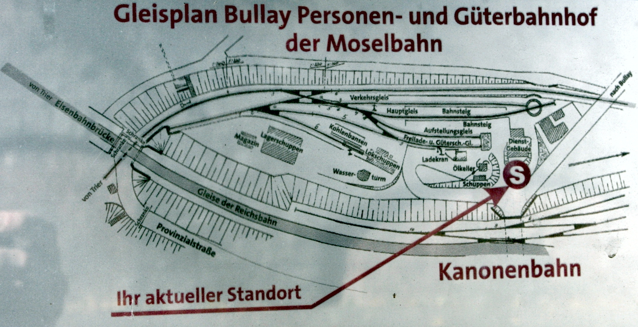
Deutsch: Gleisplan des ehemaligen Endbahnhofes Bullay Süd der Moselbahn
|
| ⧼wm-license-information-date⧽ | 2009 |
| ⧼wm-license-information-source⧽ | قالب:Self-photographed (قالب:Original text) |
| ⧼wm-license-information-author⧽ | Kallewirsch |
ترخيص
|
|
هذا الملفُّ مُرخَّص بموجب رخصة المشاع الإبداعي نسبة المُصنَّف إِلى مؤلفه - المشاركة بالمثل 3.0 العامة. |
قالب:Cc-by-sa-3.0-de قالب:Panoramafreiheit
قالب:Original upload log
- 2012-02-11 00:02 Kallewirsch 2156×1106× (1274663 bytes) {{Information |Beschreibung = Gleisplan des ehemaligen Endbahnhofes Bullay Süd der [[Moselbahn]] |Quelle = Infotafel am ehemaligen Bahnhof Bullay Süd der Moselbahn |Urheber = [[Benutzer:Kallewirsch|kallewirsch]] |Datum
تاريخ الملف
اضغط على زمن/تاريخ لرؤية الملف كما بدا في هذا الزمن.
| زمن/تاريخ | صورة مصغرة | الأبعاد | مستخدم | تعليق | |
|---|---|---|---|---|---|
| حالي | ★ مراجعة معتمدة 09:13، 4 نوفمبر 2023 | | 2٬156 × 1٬106 (1٫75 ميجابايت) | Pastakhov (نقاش | مساهمات) | Upload https://upload.wikimedia.org/wikipedia/commons/5/5e/Gleisplan_Bullay_Moselbahn.JPG |
لا يمكنك استبدال هذا الملف.
وصلات
لا يوجد صفحات تصل لهذه الصورة.