ملف:Girodonne2015 strage2.png
حجم هذه المعاينة: 800 × 524 بكسل. البعد الآخر: 984 × 645 بكسل.
الملف الأصلي (984 × 645 بكسل حجم الملف: 881 كيلوبايت، نوع MIME: image/png)
وصف قصير
| ⧼wm-license-information-description⧽ |
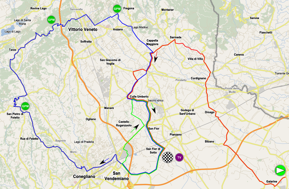
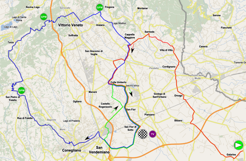
English: Map of the stage 2 of Giro Donne 2015. Background from OpenStreetMap. The itineary from the start until the first time on the finish line is in colored in red. Then 2 laps of the green circuit are done. Finally the blue circuit is done. Note that there is a doubt about the itineary between San Martino and San Fior as the map and the roadmap from the organiser are in contradiction with each other
|
| ⧼wm-license-information-date⧽ | 2015 |
| ⧼wm-license-information-source⧽ | ⧼Wm-license-own-work⧽ |
| ⧼wm-license-information-author⧽ | Psemdel |
ترخيص
|
تاريخ الملف
اضغط على زمن/تاريخ لرؤية الملف كما بدا في هذا الزمن.
| زمن/تاريخ | صورة مصغرة | الأبعاد | مستخدم | تعليق | |
|---|---|---|---|---|---|
| حالي | ★ مراجعة معتمدة 10:41، 12 نوفمبر 2023 | | 984 × 645 (881 كيلوبايت) | Pastakhov (نقاش | مساهمات) | Upload https://upload.wikimedia.org/wikipedia/commons/4/40/Girodonne2015_strage2.png |
لا يمكنك استبدال هذا الملف.
وصلات
لا يوجد صفحات تصل لهذه الصورة.