ملف:Germany, Federal Republic of location map January 1957 - October 1990.svg

حجم معاينة PNG لذلك الملف ذي الامتداد SVG: 506 × 599 بكسل. البعد الآخر: 1٬729 × 2٬048 بكسل.
الملف الأصلي (ملف SVG، أبعاده 1٬075 × 1٬273 بكسل، حجم الملف: 490 كيلوبايت)
وصف قصير
| ⧼wm-license-information-description⧽ |
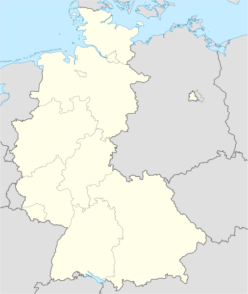
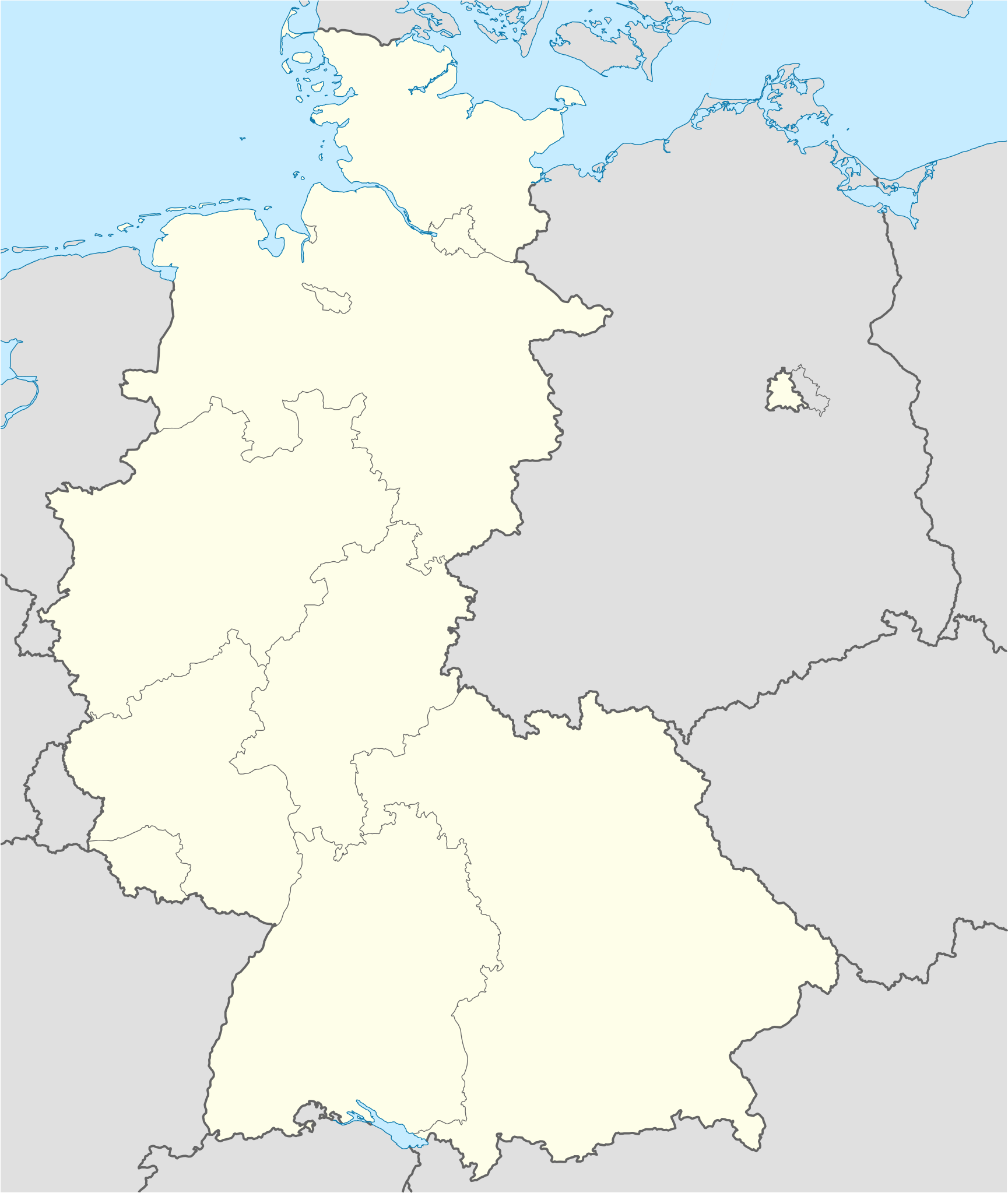
Deutsch: Positionskarte der Bundesrepublik Deutschland. Diese Karte zeigt die Bundesrepublik im Gebietsstand zwischen Januar 1957 bis Oktober 1990.
Quadratische Plattkarte, N-S-Streckung 150 %. Geographische Begrenzung der Karte:
English: Location map of Federal Republic of Germany. Map shows West-Germany as of January 1957 till October 1990.
Equirectangular projection, N/S stretching 150 %. Geographic limits of the map:
|
|||||
| ⧼wm-license-information-date⧽ | Created in 2009 | |||||
| ⧼wm-license-information-source⧽ | own work, based on File:Germany location map.svg | |||||
| ⧼wm-license-information-author⧽ | TUBS | |||||
| ⧼wm-license-information-permission⧽ (⧼wm-license-information-permission-reusing-text⧽) |
|
|||||
| ⧼wm-license-information-other-versions⧽ |
قالب:DerivativeVersions قالب:Germany location map/other versions |

تاريخ الملف
اضغط على زمن/تاريخ لرؤية الملف كما بدا في هذا الزمن.
| زمن/تاريخ | صورة مصغرة | الأبعاد | مستخدم | تعليق | |
|---|---|---|---|---|---|
| حالي | ★ مراجعة معتمدة 00:21، 5 ديسمبر 2023 | | 1٬075 × 1٬273 (490 كيلوبايت) | Pastakhov (نقاش | مساهمات) | Upload https://upload.wikimedia.org/wikipedia/commons/2/27/Germany%2C_Federal_Republic_of_location_map_January_1957_-_October_1990.svg |
لا يمكنك استبدال هذا الملف.
وصلات
الصفحات التالية تحتوي على وصلة لهذه الصورة: