ملف:Georgia's 13th congressional district (since 2023).svg

حجم معاينة PNG لذلك الملف ذي الامتداد SVG: 529 × 599 بكسل. البعد الآخر: 1٬808 × 2٬048 بكسل.
الملف الأصلي (ملف SVG، أبعاده 800 × 906 بكسل، حجم الملف: 5٫57 ميجابايت)
وصف قصير
| ⧼wm-license-information-description⧽ |
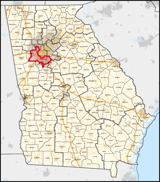
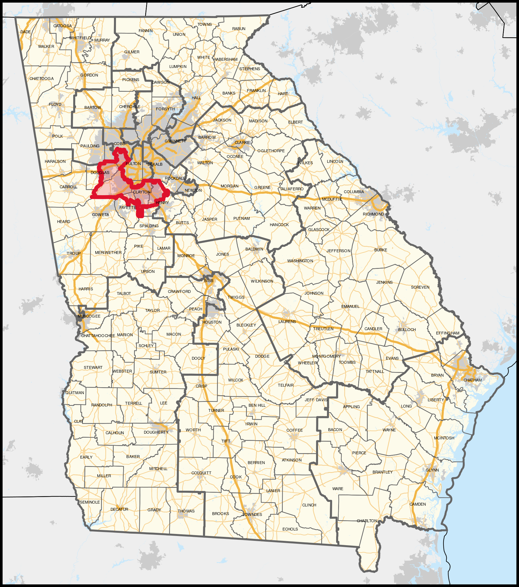
English: The congressional district, highlighted in red, overlayed with other congressional districts and county boundaries, as well as major roads, water areas, and urban clusters in Georgia and neighbouring areas. Shapefiles from the United States Census Bureau, converted with Mapshaper (Mercator projection) and Inkscape.
|
| ⧼wm-license-information-date⧽ | 2023 |
| ⧼wm-license-information-source⧽ | ⧼Wm-license-own-work⧽ |
| ⧼wm-license-information-author⧽ | Twotwofourtysix |
ترخيص
|
تاريخ الملف
اضغط على زمن/تاريخ لرؤية الملف كما بدا في هذا الزمن.
| زمن/تاريخ | صورة مصغرة | الأبعاد | مستخدم | تعليق | |
|---|---|---|---|---|---|
| حالي | ★ مراجعة معتمدة 05:39، 13 نوفمبر 2023 | | 800 × 906 (5٫57 ميجابايت) | Pastakhov (نقاش | مساهمات) | Upload https://upload.wikimedia.org/wikipedia/commons/5/5d/Georgia%27s_13th_congressional_district_%28since_2023%29.svg |
لا يمكنك استبدال هذا الملف.
وصلات
لا يوجد صفحات تصل لهذه الصورة.
.svg&oldid=3501730)