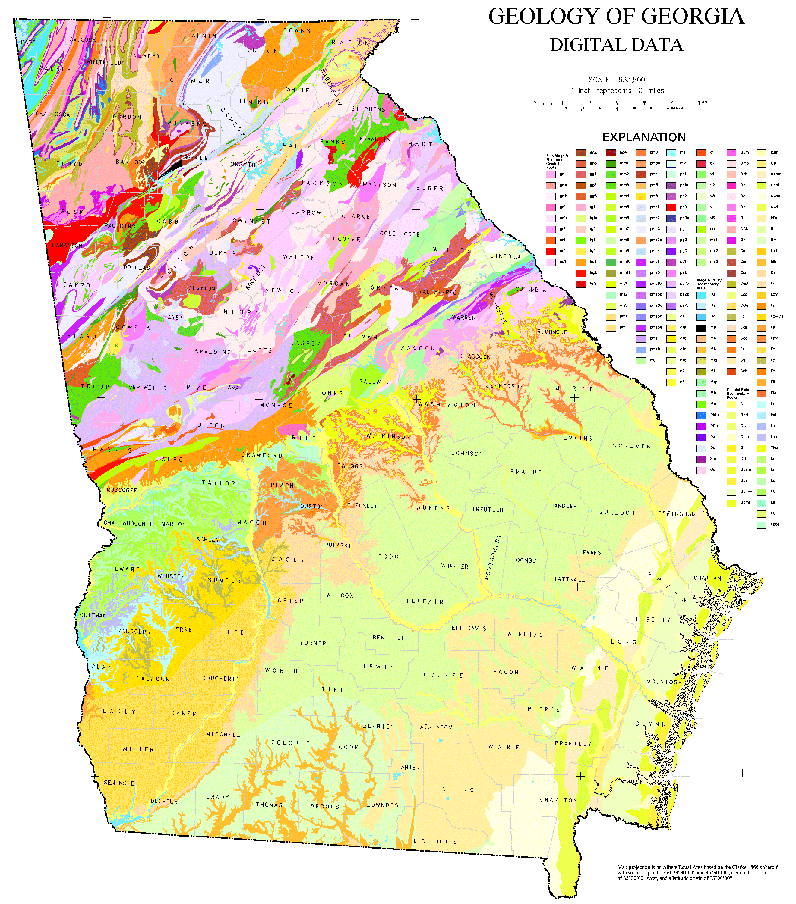
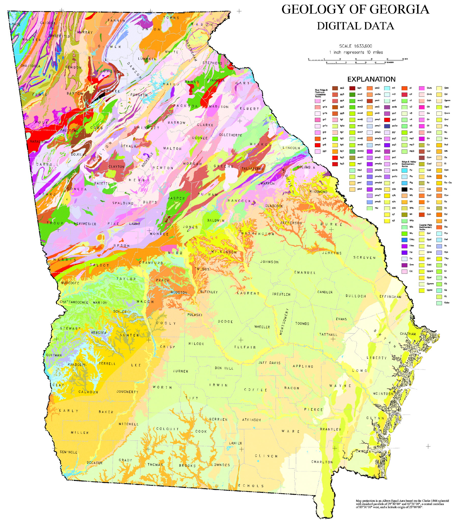
ملف:Geologic Map of Georgia.png
حجم هذه المعاينة: 528 × 600 بكسل. البعدان الآخران: 1٬802 × 2٬048 بكسل | 2٬640 × 3٬000 بكسل.
الملف الأصلي (2٬640 × 3٬000 بكسل حجم الملف: 1٫31 ميجابايت، نوع MIME: image/png)
| ⧼wm-license-information-description⧽ | |
| ⧼wm-license-information-date⧽ | |
| ⧼wm-license-information-source⧽ | |
| ⧼wm-license-information-author⧽ |
ترخيص
This image is a work of a United States Geological Survey employee, taken or made during the course of the person's official duties. As a work of the United States Government, the image is in the public domain. For more information, see the USGS copyright policy.
قالب:Original upload log
قالب:Original description page
- 2006-10-24 21:50 Tlmclain 3086×3450× (1836224 bytes) The map compilation was published by the Georgia Geologic Survey in 1976 as the Geologic Map of [[Georgia (U.S. State)|Georgia]]. Source: [http://csat.er.usgs.gov/statewide/layers/geology.html USGS] {{PD-USGov-Interior-USGS}} [[Category:Georgia (U.S. sta
تاريخ الملف
اضغط على زمن/تاريخ لرؤية الملف كما بدا في هذا الزمن.
| زمن/تاريخ | صورة مصغرة | الأبعاد | مستخدم | تعليق | |
|---|---|---|---|---|---|
| حالي | ★ مراجعة معتمدة 03:36، 11 نوفمبر 2023 | | 2٬640 × 3٬000 (1٫31 ميجابايت) | Pastakhov (نقاش | مساهمات) | Upload https://upload.wikimedia.org/wikipedia/commons/3/34/Geologic_Map_of_Georgia.png |
لا يمكنك استبدال هذا الملف.
وصلات
لا يوجد صفحات تصل لهذه الصورة.