ملف:Gem-Beekdaelen-OpenTopo.jpg
حجم هذه المعاينة: 781 × 600 بكسل. البعدان الآخران: 2٬560 × 1٬966 بكسل | 7٬037 × 5٬404 بكسل.
الملف الأصلي (7٬037 × 5٬404 بكسل حجم الملف: 7٫15 ميجابايت، نوع MIME: image/jpeg)
وصف قصير
| ⧼wm-license-information-description⧽ |
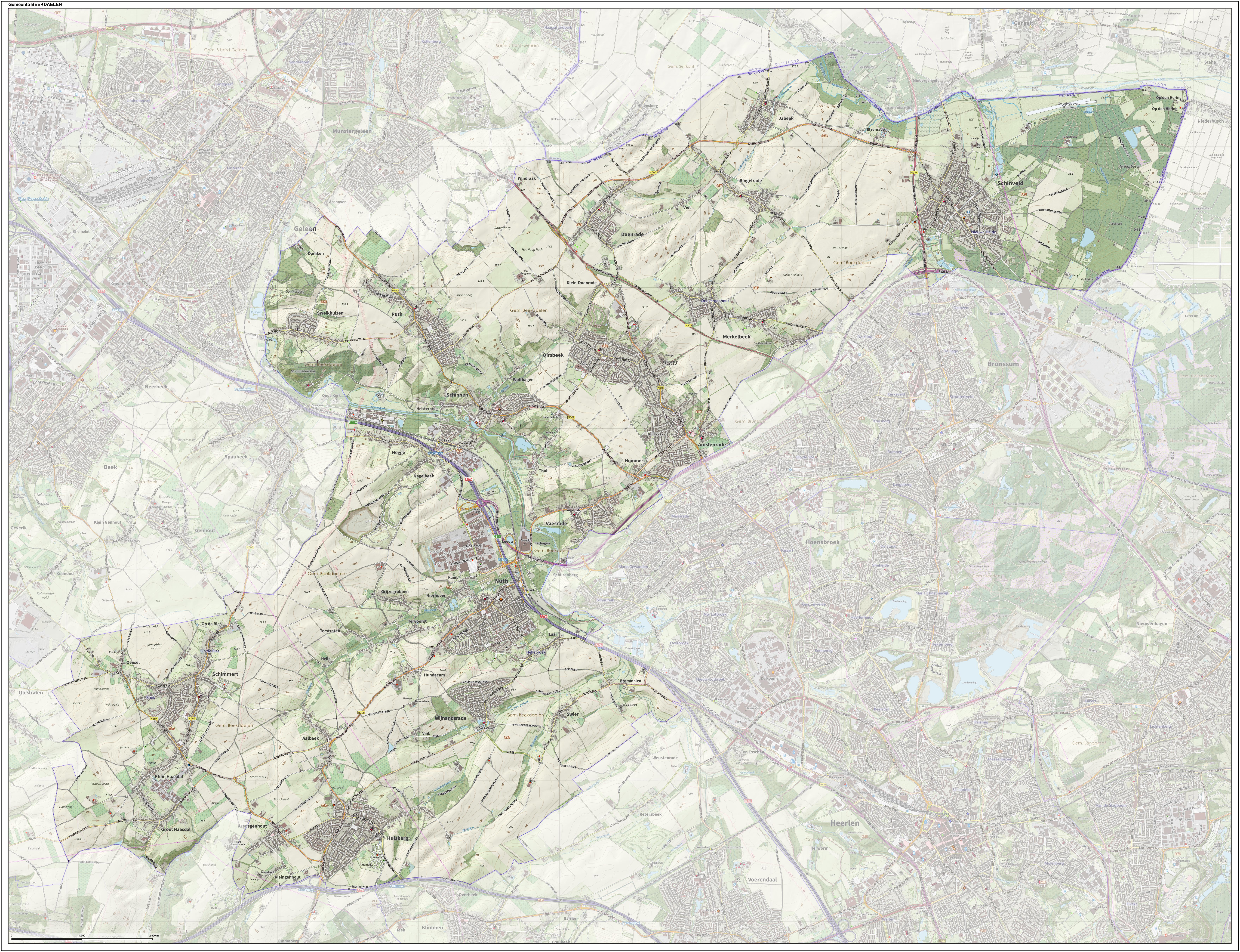
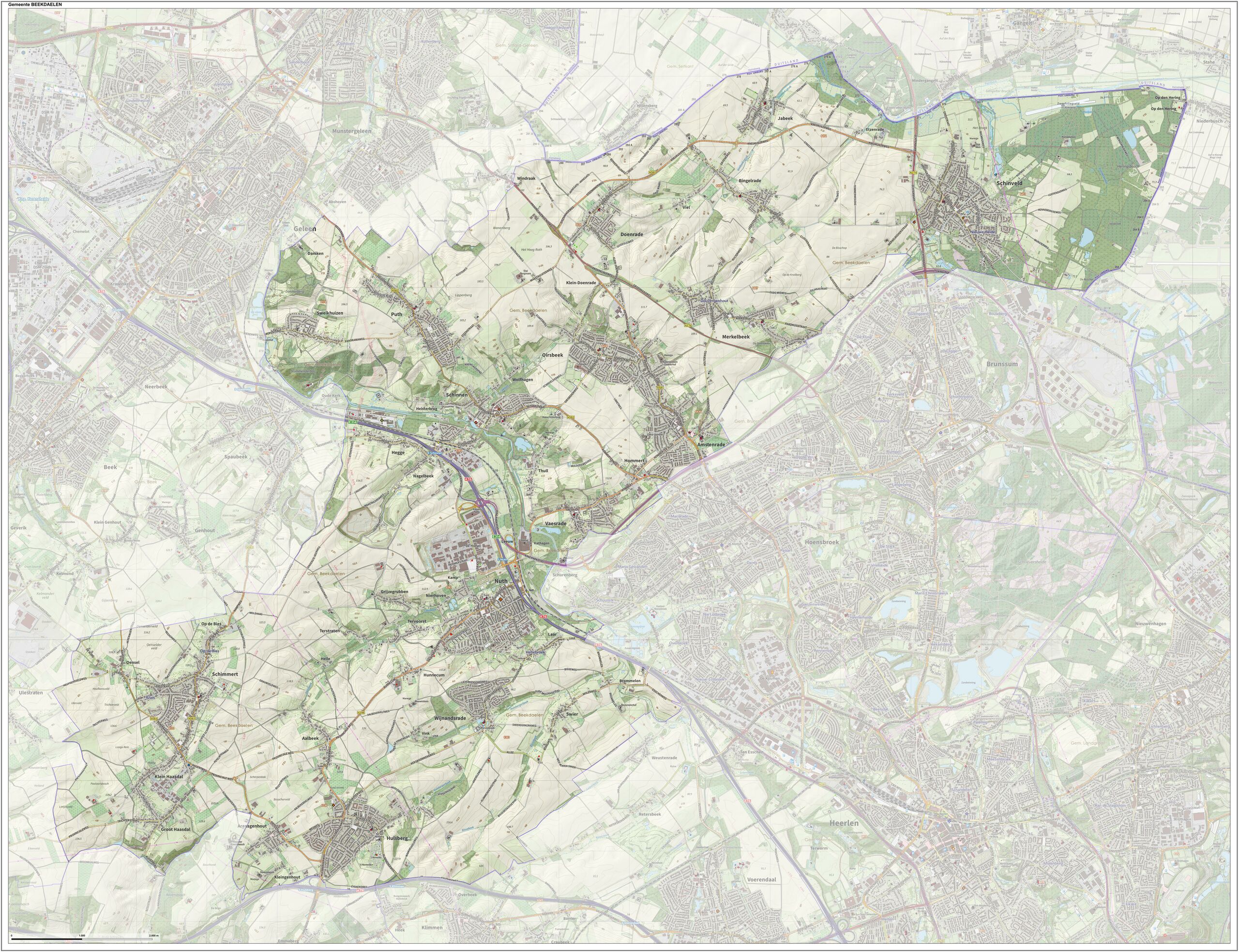
(Dutch) English: Topographic map of the upcoming municipality. Compiled by Jan-Willem van Aalst using open data from the Dutch Government collection of Geodata, plus OpenStreetMap, CC-BY OSM contributors.
|
| ⧼wm-license-information-date⧽ | 2022 |
| ⧼wm-license-information-source⧽ | ⧼Wm-license-own-work⧽ |
| ⧼wm-license-information-author⧽ | Janwillemvanaalst |
ترخيص
|
تاريخ الملف
اضغط على زمن/تاريخ لرؤية الملف كما بدا في هذا الزمن.
| زمن/تاريخ | صورة مصغرة | الأبعاد | مستخدم | تعليق | |
|---|---|---|---|---|---|
| حالي | ★ مراجعة معتمدة 07:36، 28 نوفمبر 2023 | | 7٬037 × 5٬404 (7٫15 ميجابايت) | Pastakhov (نقاش | مساهمات) | Upload https://upload.wikimedia.org/wikipedia/commons/4/47/Gem-Beekdaelen-OpenTopo.jpg |
لا يمكنك استبدال هذا الملف.
وصلات
لا يوجد صفحات تصل لهذه الصورة.