ملف:Gdansk Bay Borderlines 1939 English.svg

حجم معاينة PNG لذلك الملف ذي الامتداد SVG: 800 × 517 بكسل. البعد الآخر: 2٬560 × 1٬656 بكسل.
الملف الأصلي (ملف SVG، أبعاده 1٬339 × 866 بكسل، حجم الملف: 49 كيلوبايت)
| ⧼wm-license-information-description⧽ |
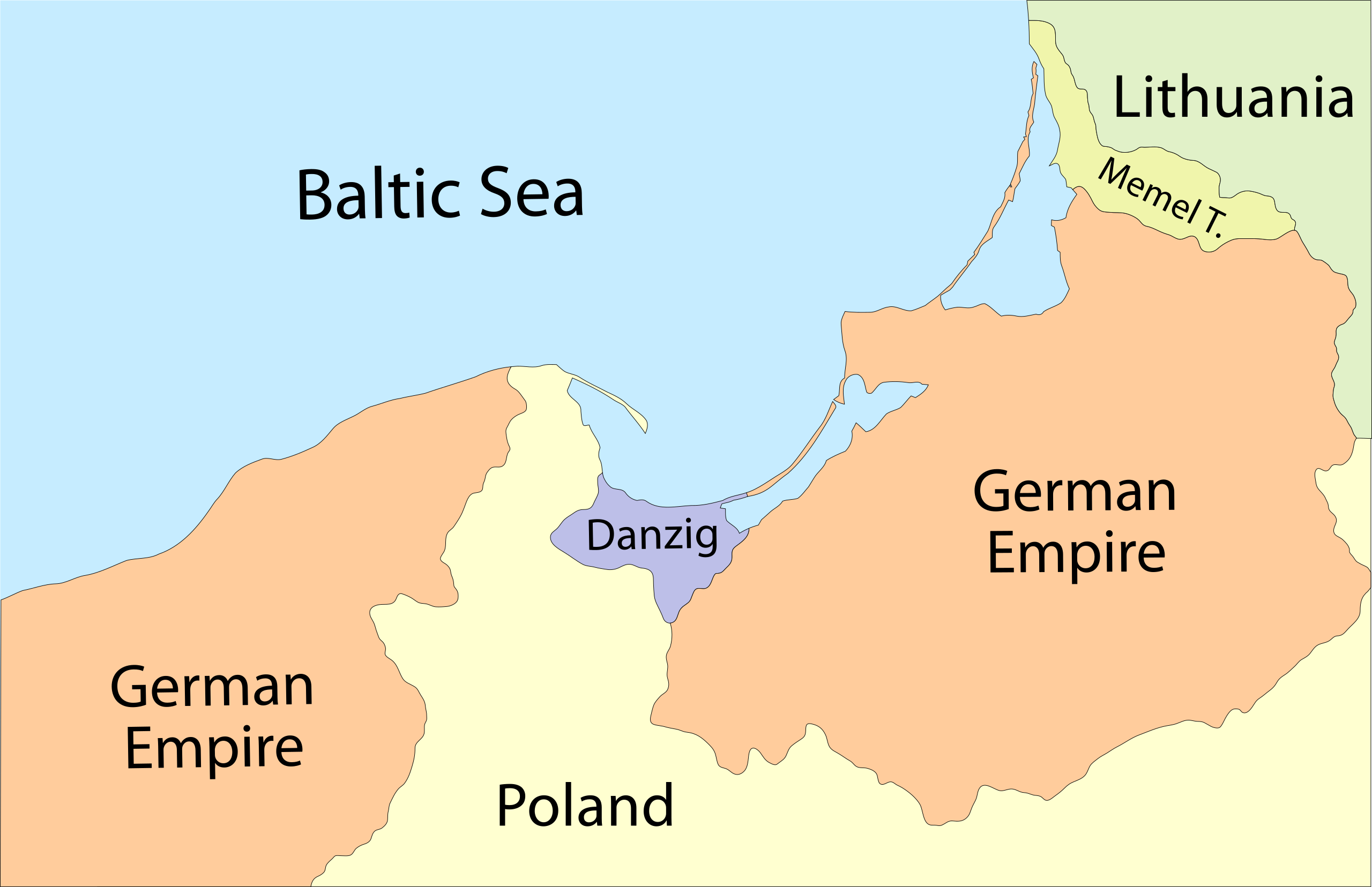
English: Map of the Gdańsk Bay in 1939. The Memel Territory was retransfered from Lithuania to Germany in March
1939. Deutsch: Karte der Danziger Bucht mit den Grenzen von 1939. Das Memelland ging im März 1939 von Litauen zurück an das Deutsche Reich
|
| ⧼wm-license-information-date⧽ | 2009-11-21 00:05 (UTC) |
| ⧼wm-license-information-source⧽ | |
| ⧼wm-license-information-author⧽ |
|
| ⧼wm-license-information-other-versions⧽ |
قالب:ValidSVG قالب:Created with Adobe Illustrator
| [This is a retouched picture, which means that it has been digitally altered from its original version. Modifications: svg. The original can be viewed here: Gdansk_Bay_Borderlines_1939_English.png. Modifications made by Justass.] Error: {{Lang}}: text has italic markup (help)
|
|

قالب:Original upload log
This image is a derivative work of the following images:
- File:Gdansk_Bay_Borderlines_1939_English.png licensed with Cc-by-sa-3.0-migrated, GFDL
- 2007-03-17T22:17:18Z Masturbius 1858x1202 (36095 Bytes) {{en|Map of the [[:en:Gdańsk Bay|Gdańsk Bay]] in 1939. The [[:en:Klaipėda Region|Memel Territory]] was retransfered from [[:en:Lithuania|Lithuania]] to [[:en:Germany|Germany]] in March 1939.}} {{de|Karte der [[:de:Danzi
- 2007-03-17T01:34:37Z Masturbius 1858x1202 (36090 Bytes) {{en|Map of the [[:en:Gdańsk Bay|Gdańsk Bay]] in 1939. The [[:en:Klaipėda Region|Memel Territory]] was retransfered from [[:en:Lithuania|Lithuania]] to [[:en:Germany|Germany]] in March 1939.}} {{de|Karte der [[:de:Danzi
تاريخ الملف
اضغط على زمن/تاريخ لرؤية الملف كما بدا في هذا الزمن.
| زمن/تاريخ | صورة مصغرة | الأبعاد | مستخدم | تعليق | |
|---|---|---|---|---|---|
| حالي | ★ مراجعة معتمدة 08:08، 3 نوفمبر 2023 | | 1٬339 × 866 (49 كيلوبايت) | Pastakhov (نقاش | مساهمات) | Upload https://upload.wikimedia.org/wikipedia/commons/3/3a/Gdansk_Bay_Borderlines_1939_English.svg |
لا يمكنك استبدال هذا الملف.
وصلات
لا يوجد صفحات تصل لهذه الصورة.