ملف:Galveston Bay Landsat.jpg
لا توجد دقة أعلى متوفرة.
Galveston_Bay_Landsat.jpg (368 × 464 بكسل حجم الملف: 33 كيلوبايت، نوع MIME: image/jpeg)
وصف قصير
| ⧼wm-license-information-description⧽ |
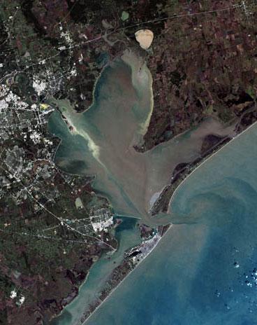
English: Trinity Bay, (above), and Galveston Bay, in southeast Texas.
|
| ⧼wm-license-information-date⧽ | 2000 |
| ⧼wm-license-information-source⧽ | Houston, Texas at the Internet Archive |
| ⧼wm-license-information-author⧽ | United States Geological Survey |
| ⧼wm-license-information-other-versions⧽ |
ترخيص
This image is a work of a United States Geological Survey employee, taken or made during the course of the person's official duties. As a work of the United States Government, the image is in the public domain. For more information, see the USGS copyright policy.
قالب:Original upload log
قالب:Transferred from قالب:Original description page
Upload date | User | Bytes | Dimensions | Comment
- 2009-10-15 04:15 (UTC) | Mcorazao | 23150 (bytes) | 247×322 | Author: United States Geological Service http://landsat.usgs.gov/gallery/detail/370/ This image is a clipped version of a satellite shot of the Houston area (clipping by M. Corazao)
تاريخ الملف
اضغط على زمن/تاريخ لرؤية الملف كما بدا في هذا الزمن.
| زمن/تاريخ | صورة مصغرة | الأبعاد | مستخدم | تعليق | |
|---|---|---|---|---|---|
| حالي | ★ مراجعة معتمدة 04:35، 7 نوفمبر 2023 | | 368 × 464 (33 كيلوبايت) | Pastakhov (نقاش | مساهمات) | Upload https://upload.wikimedia.org/wikipedia/commons/f/f9/Galveston_Bay_Landsat.jpg |
لا يمكنك استبدال هذا الملف.
وصلات
لا يوجد صفحات تصل لهذه الصورة.