ملف:Galapagos-satellite-2002.jpg
حجم هذه المعاينة: 800 × 600 بكسل. البعد الآخر: 1٬600 × 1٬200 بكسل.
الملف الأصلي (1٬600 × 1٬200 بكسل حجم الملف: 387 كيلوبايت، نوع MIME: image/jpeg)
وصف قصير
| ⧼wm-license-information-description⧽ |
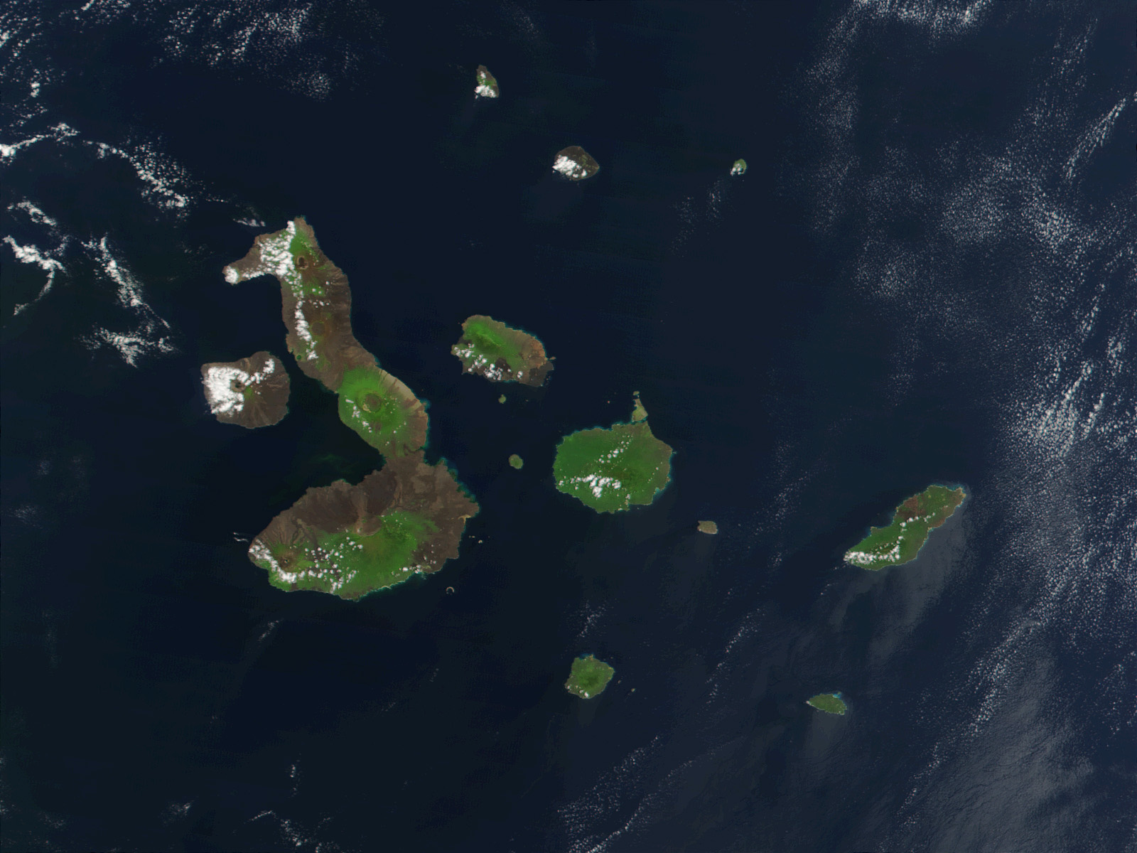
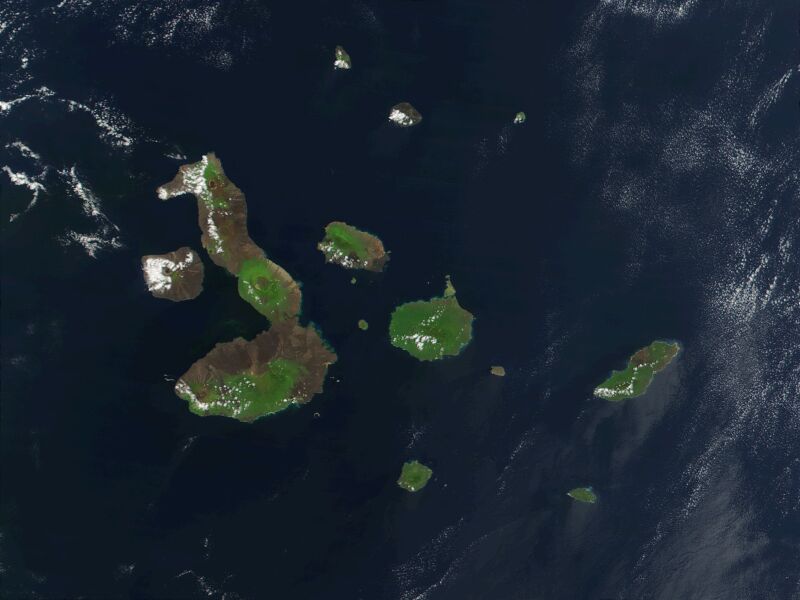
English: This true-color image of the Galapagos Islands was acquired on March 12, 2002, by the Moderate-resolution Imaging Spectroradiometer (MODIS), flying aboard NASA's Terra satellite. The Galapagos Islands, which are part of Ecuador, sit in the Pacific Ocean about 1000 km (620 miles) west of South America. As the three craters on the largest island (Isabela Island) suggest, the archipelago was created by volcanic eruptions, which took place millions of years ago.
|
| ⧼wm-license-information-date⧽ | 2002 |
| ⧼wm-license-information-source⧽ | Earth Observatory 8270 and NASA GSFC |
| ⧼wm-license-information-author⧽ | Jacques Descloitres, MODIS Rapid Response Project at NASA/GSFC |
ترخيص
تاريخ الملف
اضغط على زمن/تاريخ لرؤية الملف كما بدا في هذا الزمن.
| زمن/تاريخ | صورة مصغرة | الأبعاد | مستخدم | تعليق | |
|---|---|---|---|---|---|
| حالي | ★ مراجعة معتمدة 04:42، 16 أكتوبر 2023 | | 1٬600 × 1٬200 (387 كيلوبايت) | Pastakhov (نقاش | مساهمات) | Upload https://upload.wikimedia.org/wikipedia/commons/b/b1/Galapagos-satellite-2002.jpg |
لا يمكنك استبدال هذا الملف.
وصلات
لا يوجد صفحات تصل لهذه الصورة.