ملف:Gainesville Metropolitan Area.png

حجم هذه المعاينة: 601 × 599 بكسل. البعدان الآخران: 2٬054 × 2٬048 بكسل | 2٬560 × 2٬552 بكسل.
الملف الأصلي (2٬560 × 2٬552 بكسل حجم الملف: 684 كيلوبايت، نوع MIME: image/png)

|
[All images in this gallery should be recreated using vector graphics as an SVG file. This has several advantages; see Commons:Media for cleanup for more information. If an SVG form of this image is already available, please upload it. After uploading an SVG, replace this template with {{vector version available|new image name.svg}}.] Error: {{Lang}}: text has italic markup (help) |
|
العربية | български | català | čeština | dansk | Deutsch | English | Esperanto | español | français | galego | 한국어 | italiano | magyar | lietuvių | 日本語 | Plattdüütsch | Nederlands | norsk | polski | português | română | русский | suomi | svenska | Türkçe | українська | 中文(繁體) | 中文(简体) | +/− | |
| ⧼wm-license-information-description⧽ |
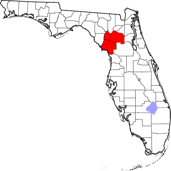
Locator map of the Gainesville Metropolitan Statistical Area in the northern part of the U.S. state of Florida. |
||
| ⧼wm-license-information-date⧽ | 2008 | ||
| ⧼wm-license-information-source⧽ | Modified from this United States Census Bureau file, based on this Census definitions list. | ||
| ⧼wm-license-information-author⧽ | User:Nyttend | ||
| ⧼wm-license-information-permission⧽ (⧼wm-license-information-permission-reusing-text⧽) |
US Government work is public domain, and my work is |
تاريخ الملف
اضغط على زمن/تاريخ لرؤية الملف كما بدا في هذا الزمن.
| زمن/تاريخ | صورة مصغرة | الأبعاد | مستخدم | تعليق | |
|---|---|---|---|---|---|
| حالي | ★ مراجعة معتمدة 12:20، 4 ديسمبر 2023 | | 2٬560 × 2٬552 (684 كيلوبايت) | Pastakhov (نقاش | مساهمات) | Upload https://upload.wikimedia.org/wikipedia/commons/2/26/Gainesville_Metropolitan_Area.png |
لا يمكنك استبدال هذا الملف.
وصلات
لا يوجد صفحات تصل لهذه الصورة.