ملف:G7211 Nanyou Expressway English map.png
حجم هذه المعاينة: 800 × 454 بكسل. البعد الآخر: 2٬078 × 1٬179 بكسل.
الملف الأصلي (2٬078 × 1٬179 بكسل حجم الملف: 376 كيلوبايت، نوع MIME: image/png)
وصف قصير
| ⧼wm-license-information-description⧽ |
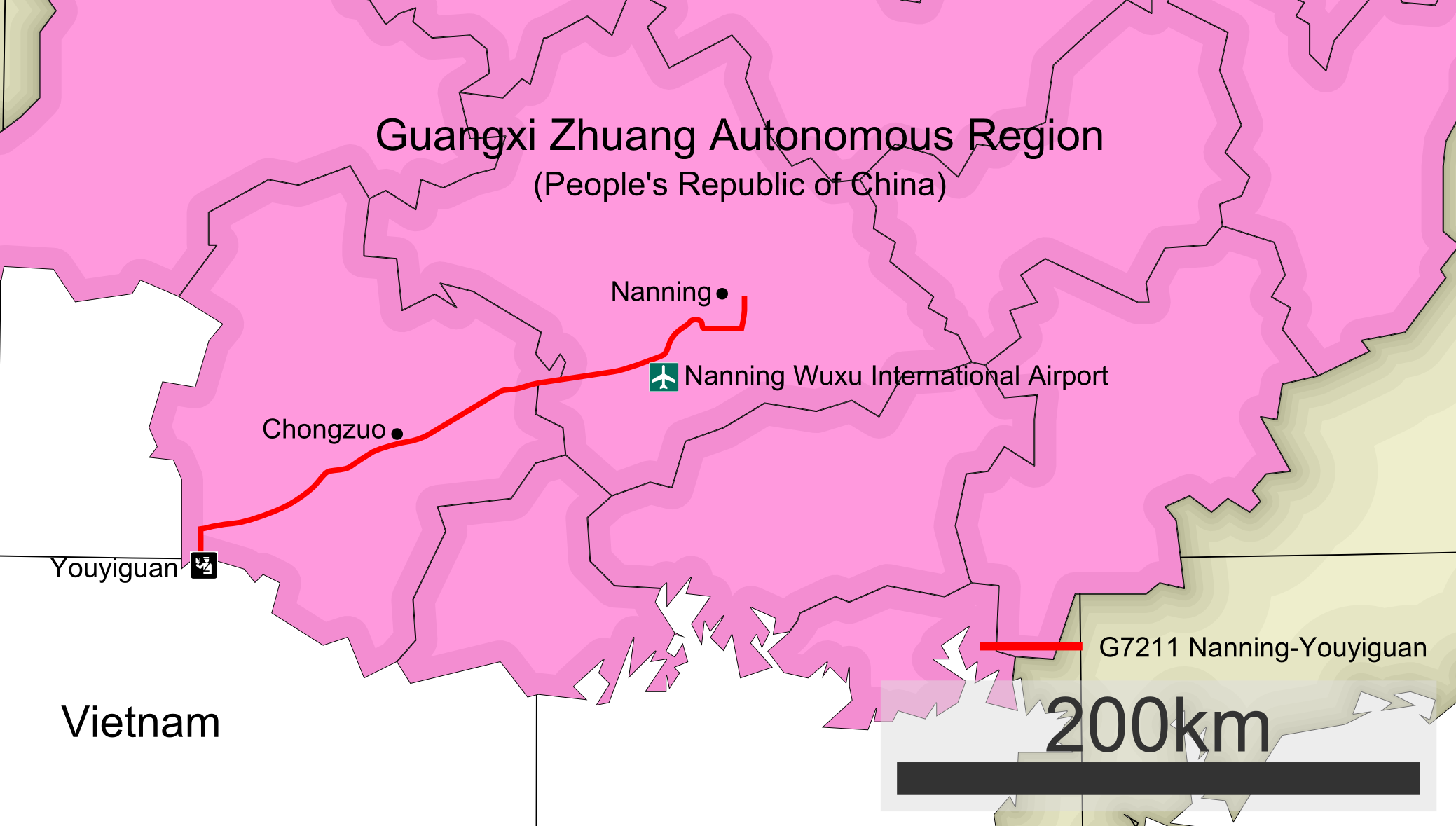
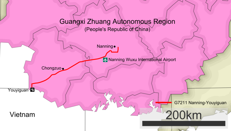
English: Detailed map showing the route of G7211 Nanning–Youyiguan Expressway in Guangxi Zhuang Autonomous Region, in English.
|
| ⧼wm-license-information-date⧽ | 2013, {{time}} – invalid date format 54 (help) |
| ⧼wm-license-information-source⧽ | ⧼Wm-license-own-work⧽ |
| ⧼wm-license-information-author⧽ | Modifications by Heights Derivative work by Lincun at the Japanese Wikipedia. |
| ⧼wm-license-information-other-versions⧽ |
|
Following works used in image:
- Map of Province in China 450000 广西壮族自治区.svg
Outline map of Guangxi by Lincun

Airport sign.
- Aiga immigration inv.svg
Customs checkpoint sign.

ترخيص
|
تاريخ الملف
اضغط على زمن/تاريخ لرؤية الملف كما بدا في هذا الزمن.
| زمن/تاريخ | صورة مصغرة | الأبعاد | مستخدم | تعليق | |
|---|---|---|---|---|---|
| حالي | ★ مراجعة معتمدة 15:28، 14 نوفمبر 2023 | | 2٬078 × 1٬179 (376 كيلوبايت) | Pastakhov (نقاش | مساهمات) | Upload https://upload.wikimedia.org/wikipedia/commons/1/13/G7211_Nanyou_Expressway_English_map.png |
لا يمكنك استبدال هذا الملف.
وصلات
لا يوجد صفحات تصل لهذه الصورة.