ملف:Fritchley Windmill - geograph.org.uk - 1255772.jpg
لا توجد دقة أعلى متوفرة.
Fritchley_Windmill_-_geograph.org.uk_-_1255772.jpg (640 × 451 بكسل حجم الملف: 126 كيلوبايت، نوع MIME: image/jpeg)
وصف قصير
| ⧼wm-license-information-description⧽ |
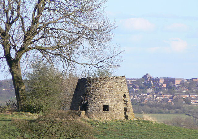
English: Fritchley Windmill The ruined roundhouse of a post mill standing on a knoll above the Amber Valley, where it would catch the wind well from all directions. In the background is the town centre of Ripley.
|
| ⧼wm-license-information-date⧽ | 2009 |
| ⧼wm-license-information-source⧽ | From geograph.org.uk |
| ⧼wm-license-information-author⧽ | Alan Murray-Rust |
| ⧼wm-license-cc-attribution⧽ (قالب:I18n/Credit line) |
Alan Murray-Rust / Fritchley Windmill / |
قالب:Listed building England قالب:On Wikidata 53°04′36″N 1°27′32″W / 53.07655°N 1.4588°W قالب:Object location
_heading:135)
ترخيص
تاريخ الملف
اضغط على زمن/تاريخ لرؤية الملف كما بدا في هذا الزمن.
| زمن/تاريخ | صورة مصغرة | الأبعاد | مستخدم | تعليق | |
|---|---|---|---|---|---|
| حالي | ★ مراجعة معتمدة 01:01، 5 ديسمبر 2023 | | 640 × 451 (126 كيلوبايت) | Pastakhov (نقاش | مساهمات) | Upload https://upload.wikimedia.org/wikipedia/commons/c/cd/Fritchley_Windmill_-_geograph.org.uk_-_1255772.jpg |
لا يمكنك استبدال هذا الملف.
وصلات
لا يوجد صفحات تصل لهذه الصورة.