ملف:Frimley Green - geograph.org.uk - 574060.jpg
لا توجد دقة أعلى متوفرة.
Frimley_Green_-_geograph.org.uk_-_574060.jpg (640 × 480 بكسل حجم الملف: 99 كيلوبايت، نوع MIME: image/jpeg)
وصف قصير
| ⧼wm-license-information-description⧽ |
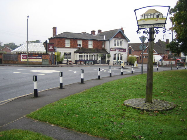
English: Frimley Green Frimley Green's village sign features the Bedford Farm Barn, a Grade II listed building in The Hatches that dates from around 1500. Beyond the B3411 Sturt Road is the Rose and Thistle public house.
|
| ⧼wm-license-information-date⧽ | 2007 |
| ⧼wm-license-information-source⧽ | From geograph.org.uk |
| ⧼wm-license-information-author⧽ | Nigel Cox |
| ⧼wm-license-cc-attribution⧽ (قالب:I18n/Credit line) |
Nigel Cox / Frimley Green / |
51°18′07″N 0°43′37″W / 51.3020°N 0.727°W قالب:Object location
_heading:157)
ترخيص
تاريخ الملف
اضغط على زمن/تاريخ لرؤية الملف كما بدا في هذا الزمن.
| زمن/تاريخ | صورة مصغرة | الأبعاد | مستخدم | تعليق | |
|---|---|---|---|---|---|
| حالي | ★ مراجعة معتمدة 13:07، 9 أكتوبر 2023 | | 640 × 480 (99 كيلوبايت) | Pastakhov (نقاش | مساهمات) | Upload https://upload.wikimedia.org/wikipedia/commons/e/e6/Frimley_Green_-_geograph.org.uk_-_574060.jpg |
لا يمكنك استبدال هذا الملف.
وصلات
لا يوجد صفحات تصل لهذه الصورة.