ملف:France Density of Monuments historiques by department.svg

حجم معاينة PNG لذلك الملف ذي الامتداد SVG: 632 × 600 بكسل. البعد الآخر: 2٬158 × 2٬048 بكسل.
الملف الأصلي (ملف SVG، أبعاده 2٬000 × 1٬898 بكسل، حجم الملف: 1٫45 ميجابايت)
| ⧼wm-license-information-description⧽ |
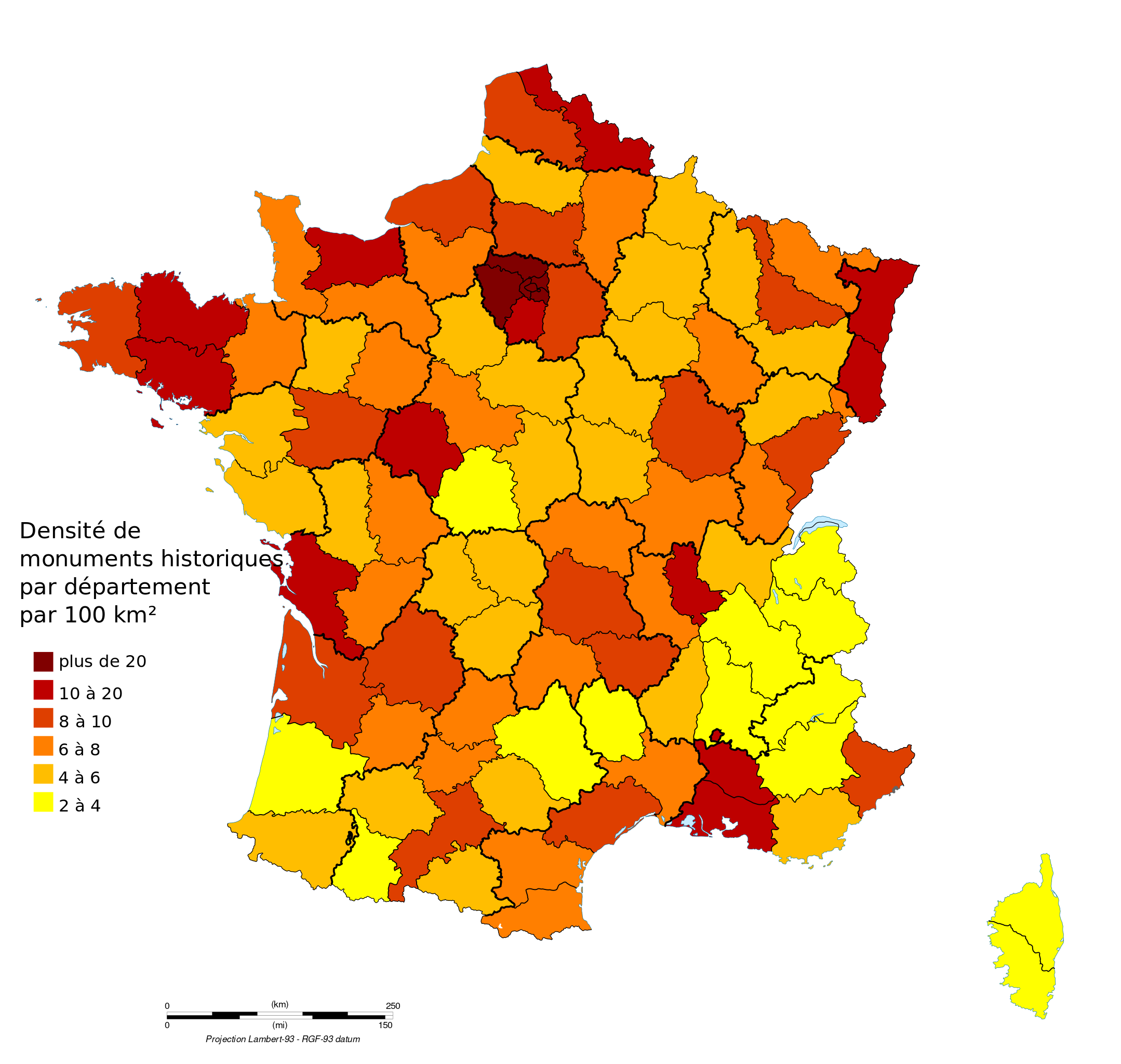
Français : Densité de monuments historiques par département en unité par centaine de kilomètres carrés
|
| ⧼wm-license-information-date⧽ | 2010-07-12 12:45 (UTC) |
| ⧼wm-license-information-source⧽ | |
| ⧼wm-license-information-author⧽ |
|
|

قالب:Original upload log
This image is a derivative work of the following images:
- File:France_map_Lambert-93_with_regions_and_departments_polygons-blank.svg licensed with Cc-by-sa-3.0,2.5,2.0,1.0, GFDL
- 2009-02-03T18:58:47Z Sting 2000x1898 (1873536 Bytes) == Summary == {{Location|46|15|00|N|02|06|00|E|scale:5000000}} {{Information |Description={{en|Blank map of [[:en:France|France]] in the official Lambert-93 projection, with regions and departments as independent polygons. '
تاريخ الملف
اضغط على زمن/تاريخ لرؤية الملف كما بدا في هذا الزمن.
| زمن/تاريخ | صورة مصغرة | الأبعاد | مستخدم | تعليق | |
|---|---|---|---|---|---|
| حالي | ★ مراجعة معتمدة 06:01، 28 أكتوبر 2023 | | 2٬000 × 1٬898 (1٫45 ميجابايت) | Pastakhov (نقاش | مساهمات) | Upload https://upload.wikimedia.org/wikipedia/commons/5/52/France_Density_of_Monuments_historiques_by_department.svg |
لا يمكنك استبدال هذا الملف.
وصلات
لا يوجد صفحات تصل لهذه الصورة.