ملف:Four Corners, Southwestern U.S.jpg
حجم هذه المعاينة: 600 × 600 بكسل. البعد الآخر: 2٬200 × 2٬200 بكسل.
الملف الأصلي (2٬200 × 2٬200 بكسل حجم الملف: 2٫73 ميجابايت، نوع MIME: image/jpeg)
وصف قصير
| ⧼wm-license-information-description⧽ |
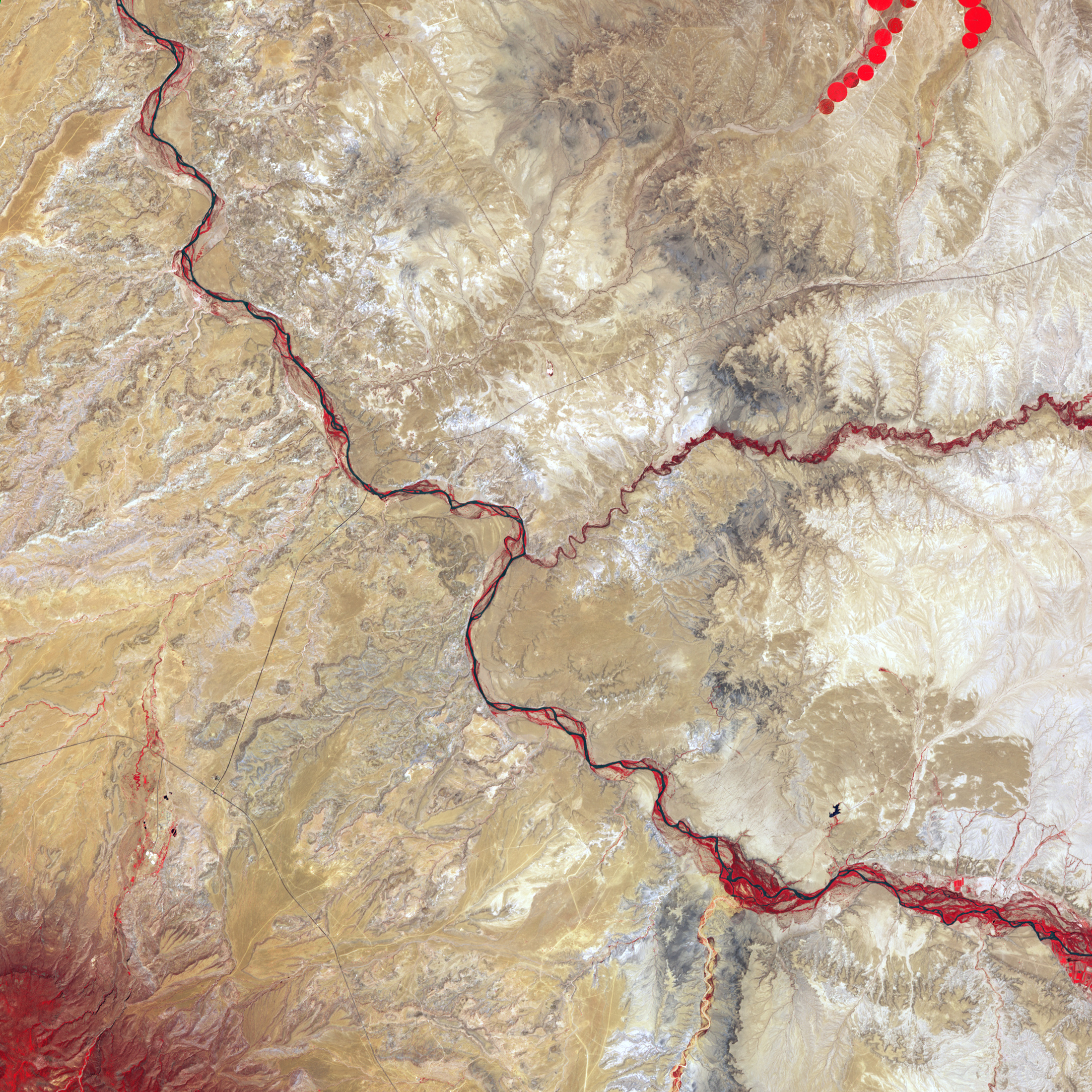
English: Satellite image of the Four Corners. Vegetation is red, and sparsely vegetated or bare areas range from off-white to gray to tan. Water appears navy blue to nearly black. Vegetation (bright red) lines the braided river channels, but the rarity of red in this image attests to the general paucity of vegetation in the region, where shrubs dot plateaus and dry valleys.
|
| ⧼wm-license-information-date⧽ | 2001 |
| ⧼wm-license-information-source⧽ | NASA Earth Observatory |
| ⧼wm-license-information-author⧽ | Jesse Allen |
| ⧼wm-license-information-other-versions⧽ |
Captioned photomap: File:Fourcorners Aster 2001.jpg |
Image captured by the Advanced Spaceborne Thermal Emission and Reflection Radiometer (ASTER) on NASA’s Terra satellite. Data provided courtesy of NASA/GSFC/METI/ERSDAC/JAROS, and U.S./Japan ASTER Science Team.
ترخيص
تاريخ الملف
اضغط على زمن/تاريخ لرؤية الملف كما بدا في هذا الزمن.
| زمن/تاريخ | صورة مصغرة | الأبعاد | مستخدم | تعليق | |
|---|---|---|---|---|---|
| حالي | ★ مراجعة معتمدة 15:52، 10 أكتوبر 2023 | | 2٬200 × 2٬200 (2٫73 ميجابايت) | Pastakhov (نقاش | مساهمات) | Upload https://upload.wikimedia.org/wikipedia/commons/3/3f/Four_Corners%2C_Southwestern_U.S.jpg |
لا يمكنك استبدال هذا الملف.
وصلات
لا يوجد صفحات تصل لهذه الصورة.
معلومات الصورة (ميتا)
تصنيفات:
- صور ناسا
- Four Corners (United States)
- Photos of the United States by ASTER
- Carrizo Mountains
- San Juan River (Colorado River tributary)
- Mancos River
- Colorado Plateau Navajo section
- Landforms on the Navajo Nation
- Colorado Plateau region of Colorado
- Colorado Plateau region of New Mexico
- Colorado Plateau region of Arizona
- Colorado Plateau region of Utah
- Fluvial geomorphology of Colorado