ملف:Fairfax County Virginia Incorporated and Unincorporated Areas Fort Hunt highlighted.svg

حجم معاينة PNG لذلك الملف ذي الامتداد SVG: 500 × 550 بكسل. البعد الآخر: 1٬862 × 2٬048 بكسل.
الملف الأصلي (ملف SVG، أبعاده 500 × 550 بكسل، حجم الملف: 228 كيلوبايت)
وصف قصير
قالب:Igen
| ⧼wm-license-information-description⧽ |
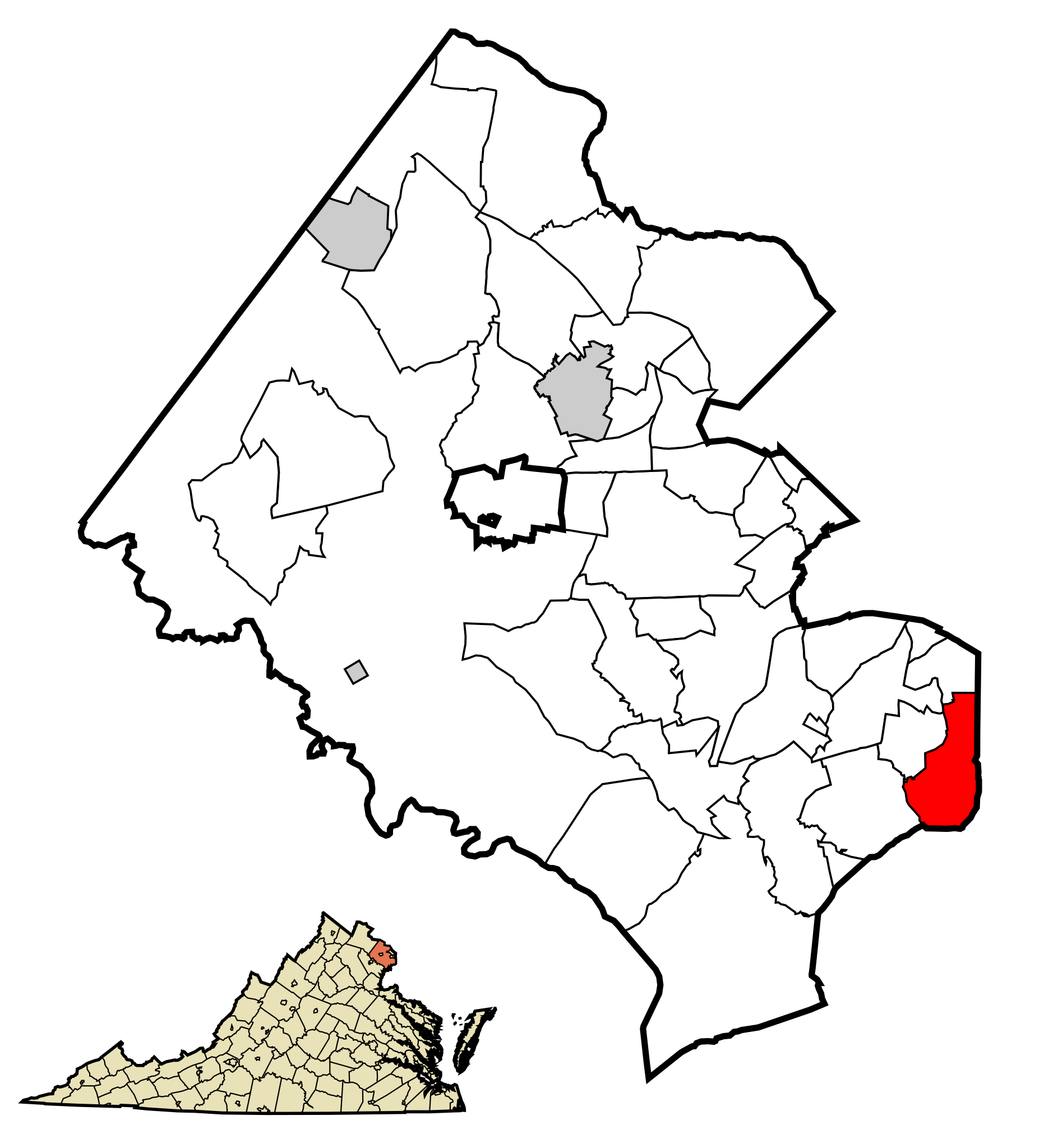
English: This map shows the incorporated areas and unincorporated areas in Fairfax County, Virginia. Fort Hunt is highlighted in red. Other incorporated cities are shown in gray and CDPs in white. Map data is based on the following files as noted:
|
| ⧼wm-license-information-date⧽ | 2009 |
| ⧼wm-license-information-source⧽ | My own work, based on public domain information |
| ⧼wm-license-information-author⧽ | Ixnayonthetimmay |
ترخيص
تاريخ الملف
اضغط على زمن/تاريخ لرؤية الملف كما بدا في هذا الزمن.
| زمن/تاريخ | صورة مصغرة | الأبعاد | مستخدم | تعليق | |
|---|---|---|---|---|---|
| حالي | ★ مراجعة معتمدة 13:33، 17 نوفمبر 2023 | | 500 × 550 (228 كيلوبايت) | Pastakhov (نقاش | مساهمات) | Upload https://upload.wikimedia.org/wikipedia/commons/f/fb/Fairfax_County_Virginia_Incorporated_and_Unincorporated_Areas_Fort_Hunt_highlighted.svg |
لا يمكنك استبدال هذا الملف.
وصلات
لا يوجد صفحات تصل لهذه الصورة.