ملف:Extreme heatwave ESA19643799.jpeg
حجم هذه المعاينة: 694 × 600 بكسل. البعد الآخر: 2٬312 × 1٬998 بكسل.
الملف الأصلي (2٬312 × 1٬998 بكسل حجم الملف: 3٫91 ميجابايت، نوع MIME: image/jpeg)
وصف قصير
| ⧼wm-license-information-description⧽ |
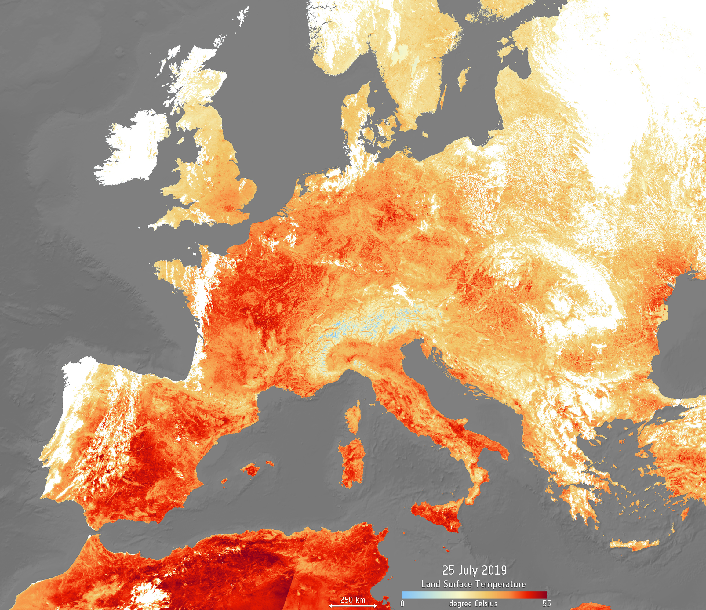
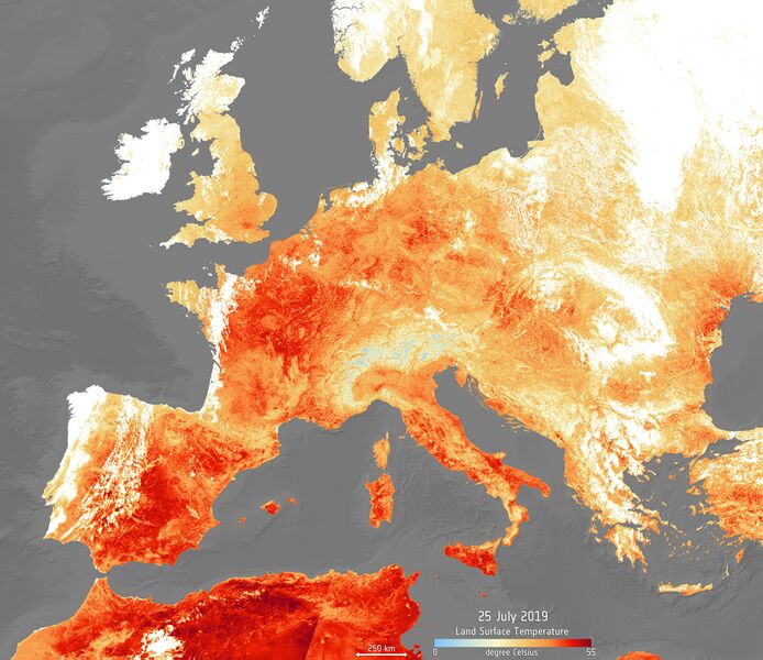
English: An extreme heatwave has hit Europe once again this week, following June's hot spell. High temperatures are expected to peak today, reaching as high as 39—40°C, with Netherlands, Belgium and Germany recording their highest ever temperatures. Paris reached a sweltering 41°C, breaking its previous record in 1947.
The map has been generated using the Copernicus Sentinel-3’s Sea and Land Surface Temperature Radiometer. Whereas weather forecasts use predicted air temperatures, the satellite measures the real amount of energy radiating from Earth – therefore this map better represents the real temperature of the land surface. Clouds are visible in white in the image, while the light blue represent snow-covered areas. In many countries, red heat warnings have been issued, including Italy, Spain and France and civilians are advised to avoid travelling and stay hydrated. See an animation showing the land surface temperature from 25 July, compared to data recorded during the previous heatwave on 26 June 2019, here. |
| ⧼wm-license-information-date⧽ | قالب:Upload date |
| ⧼wm-license-information-source⧽ | Extreme heatwave |
| ⧼wm-license-information-author⧽ | European Space Agency |
| Activity | Observing the Earth |
| Mission | Sentinel-3 |
| System | Copernicus |
ترخيص
تاريخ الملف
اضغط على زمن/تاريخ لرؤية الملف كما بدا في هذا الزمن.
| زمن/تاريخ | صورة مصغرة | الأبعاد | مستخدم | تعليق | |
|---|---|---|---|---|---|
| حالي | ★ مراجعة معتمدة 16:32، 30 نوفمبر 2023 | | 2٬312 × 1٬998 (3٫91 ميجابايت) | Pastakhov (نقاش | مساهمات) | Upload https://upload.wikimedia.org/wikipedia/commons/5/56/Extreme_heatwave_ESA19643799.jpeg |
لا يمكنك استبدال هذا الملف.
وصلات
لا يوجد صفحات تصل لهذه الصورة.