ملف:Europe-Isle of Man.svg

حجم معاينة PNG لذلك الملف ذي الامتداد SVG: 713 × 600 بكسل. البعد الآخر: 2٬435 × 2٬048 بكسل.
الملف الأصلي (ملف SVG، أبعاده 2٬045 × 1٬720 بكسل، حجم الملف: 2٫24 ميجابايت)
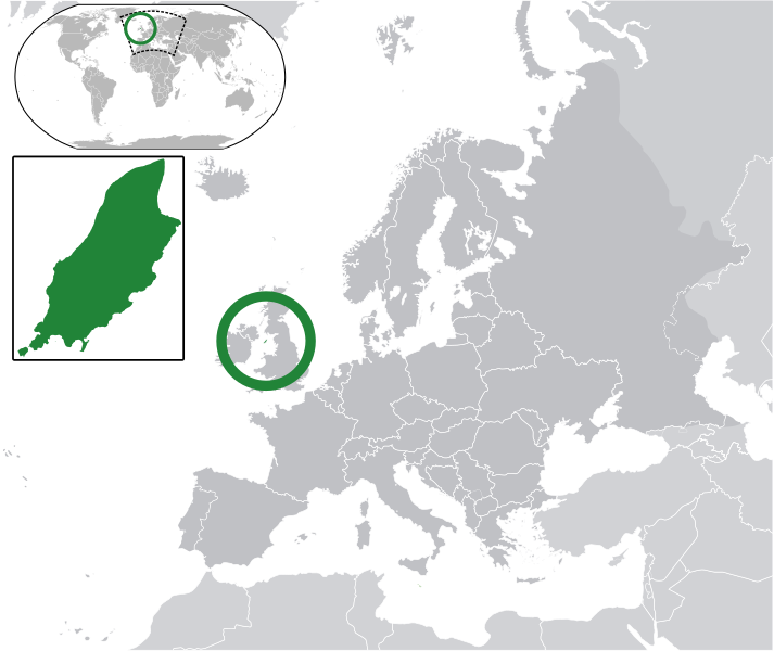
وصف قصير
قالب:Igen
| ⧼wm-license-information-description⧽ |
English: قالب:Europe-SVG-en The Full Map of the Isle of Man
Map in English of the Isle of Man, with bounds of sheadings, towns, villages, districts and parishes. |
||
| ⧼wm-license-information-date⧽ | 2011 | ||
| ⧼wm-license-information-source⧽ | قالب:Based | ||
| ⧼wm-license-information-author⧽ | Chipmunkdavis | ||
| ⧼wm-license-information-permission⧽ (⧼wm-license-information-permission-reusing-text⧽) |
|
قالب:Original upload log
This image is a derivative work of the following images:
- licensed with Cc-by-sa-3.0
- 2011-02-21T07:49:57Z Chipmunkdavis 2045x1720 (2394864 Bytes)
- قالب:F licensed with Cc-by-sa-3.0,2.5,2.0,1.0, GFDL
- 2008-01-17T12:48:28Z Sémhur 1200x1100 (227618 Bytes) Update
- 2007-05-29T20:36:04Z Sémhur 0x0 (364350 Bytes) {{Information |Description=Map in English of the [[:en:Isle of Man|Isle of Man]], with bounds of sheadings, towns, villages, districts and parishes. |Source=Own work. Based on maps [[:Image:Isle of Man map-fr.svg]], [[:Image:
تاريخ الملف
اضغط على زمن/تاريخ لرؤية الملف كما بدا في هذا الزمن.
| زمن/تاريخ | صورة مصغرة | الأبعاد | مستخدم | تعليق | |
|---|---|---|---|---|---|
| حالي | ★ مراجعة معتمدة 18:03، 12 ديسمبر 2023 | | 2٬045 × 1٬720 (2٫24 ميجابايت) | Pastakhov (نقاش | مساهمات) | Upload https://upload.wikimedia.org/wikipedia/commons/f/fd/Europe-Isle_of_Man.svg |
لا يمكنك استبدال هذا الملف.
وصلات
لا يوجد صفحات تصل لهذه الصورة.