ملف:Ephesos regional map.png
حجم هذه المعاينة: 800 × 568 بكسل. البعد الآخر: 1٬168 × 830 بكسل.
الملف الأصلي (1٬168 × 830 بكسل حجم الملف: 1٫32 ميجابايت، نوع MIME: image/png)
وصف قصير
| ⧼wm-license-information-description⧽ |
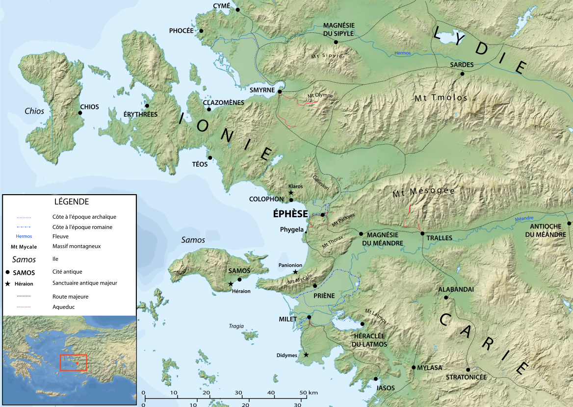
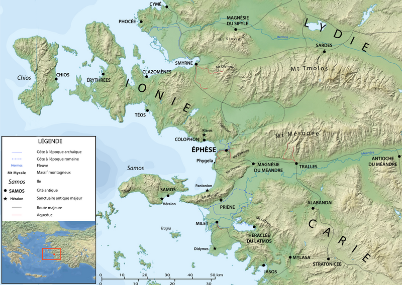
Map of Ephesos region in Antiquity, made after Eric Gaba's map of the Aegean area (Image:Aegean_Sea_map_bathymetry-fr.svg) |
|||
| ⧼wm-license-information-date⧽ | 2008 | |||
| ⧼wm-license-information-source⧽ | ⧼Wm-license-own-work⧽ | |||
| ⧼wm-license-information-author⧽ | Marsyas after User:Sting | |||
| ⧼wm-license-information-permission⧽ (⧼wm-license-information-permission-reusing-text⧽) |
|

ترخيص
|
تاريخ الملف
اضغط على زمن/تاريخ لرؤية الملف كما بدا في هذا الزمن.
| زمن/تاريخ | صورة مصغرة | الأبعاد | مستخدم | تعليق | |
|---|---|---|---|---|---|
| حالي | ★ مراجعة معتمدة 11:40، 14 أكتوبر 2023 | | 1٬168 × 830 (1٫32 ميجابايت) | Pastakhov (نقاش | مساهمات) | Upload https://upload.wikimedia.org/wikipedia/commons/3/3a/Ephesos_regional_map.png |
لا يمكنك استبدال هذا الملف.
وصلات
لا يوجد صفحات تصل لهذه الصورة.