ملف:Enderby Land, Antarctica.jpg
الملف الأصلي (1٬750 × 1٬300 بكسل حجم الملف: 465 كيلوبايت، نوع MIME: image/jpeg)
وصف قصير
| ⧼wm-license-information-description⧽ |
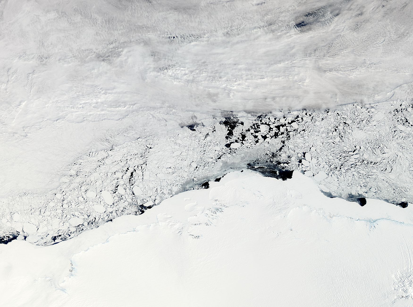
NASA image acquired November 3, 2011 The Moderate Resolution Imaging Spectroradiometer (MODIS) instrument on NASA's Aqua satellite captured this image of Enderby Land, Antarctica on November 3, 2011 at 11:20 UTC (7:20 a.m. EDT). The ice and snow appear bright white at the bottom of the image. Clouds grace the top of the image, and sea ice floats in William Scoresby Bay. Enderby Land is an Antarctic land mass that extends from Shinnan Glacier to William Scoresby Bay. Discovered in 1831, it was named after the Enderby Brothers of London. Operation Ice Bridge is exploring Antarctic ice, and more information can be found at www.nasa.gov/icebridge. Image Credit: NASA Goddard MODIS Rapid Response Team NASA Goddard Space Flight Center enables NASA’s mission through four scientific endeavors: Earth Science, Heliophysics, Solar System Exploration, and Astrophysics. Goddard plays a leading role in NASA’s accomplishments by contributing compelling scientific knowledge to advance the Agency’s mission. |
| ⧼wm-license-information-date⧽ | 2011, {{time}} – invalid date format 23 (help) |
| ⧼wm-license-information-source⧽ | NASA Satellite Sees Enderby Land, Antarctica
|
| ⧼wm-license-information-author⧽ | NASA Goddard Space Flight Center from Greenbelt, MD, USA |
ترخيص
تاريخ الملف
اضغط على زمن/تاريخ لرؤية الملف كما بدا في هذا الزمن.
| زمن/تاريخ | صورة مصغرة | الأبعاد | مستخدم | تعليق | |
|---|---|---|---|---|---|
| حالي | ★ مراجعة معتمدة 16:48، 10 نوفمبر 2023 | | 1٬750 × 1٬300 (465 كيلوبايت) | Pastakhov (نقاش | مساهمات) | Upload https://upload.wikimedia.org/wikipedia/commons/e/e8/Enderby_Land%2C_Antarctica.jpg |
لا يمكنك استبدال هذا الملف.
وصلات
لا يوجد صفحات تصل لهذه الصورة.