ملف:Eglwys Llanddwywe - geograph.org.uk - 220430.jpg
لا توجد دقة أعلى متوفرة.
Eglwys_Llanddwywe_-_geograph.org.uk_-_220430.jpg (640 × 480 بكسل حجم الملف: 48 كيلوبايت، نوع MIME: image/jpeg)
وصف قصير
| ⧼wm-license-information-description⧽ |
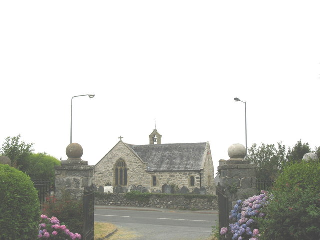
English: Eglwys Llanddwywe. The present church of St Dwywe, built on an ancient religious site, dates from the late 16th century. Located on the seaward side of the A494, it stands opposite the gates of Ffordd Gors (Gors Road), the mile-long, wide and straight drive leading uphill to Cors-y-Gedol mansion. In addition to a nave and chancel (the window behind the altar is on the left in the photograph) it contains the Croes-y-gedol chapel (the extension on the right). This is crammed with memorials to the Vaughan and Mostyn families.
|
| ⧼wm-license-information-date⧽ | 2006 |
| ⧼wm-license-information-source⧽ | From geograph.org.uk |
| ⧼wm-license-information-author⧽ | Eric Jones |
| ⧼wm-license-cc-attribution⧽ (قالب:I18n/Credit line) |
Eric Jones / Eglwys Llanddwywe / |
52°46′52″N 4°05′38″W / 52.7811°N 4.094°W قالب:Object location
_heading:247)
ترخيص
تاريخ الملف
اضغط على زمن/تاريخ لرؤية الملف كما بدا في هذا الزمن.
| زمن/تاريخ | صورة مصغرة | الأبعاد | مستخدم | تعليق | |
|---|---|---|---|---|---|
| حالي | ★ مراجعة معتمدة 01:01، 10 نوفمبر 2023 | | 640 × 480 (48 كيلوبايت) | Pastakhov (نقاش | مساهمات) | Upload https://upload.wikimedia.org/wikipedia/commons/7/77/Eglwys_Llanddwywe_-_geograph.org.uk_-_220430.jpg |
لا يمكنك استبدال هذا الملف.
وصلات
لا يوجد صفحات تصل لهذه الصورة.