ملف:EFS highres STS066 STS066-101-39.JPG
حجم هذه المعاينة: 600 × 600 بكسل. البعدان الآخران: 2٬048 × 2٬048 بكسل | 4٬030 × 4٬030 بكسل.
الملف الأصلي (4٬030 × 4٬030 بكسل حجم الملف: 14٫71 ميجابايت، نوع MIME: image/jpeg)
وصف قصير
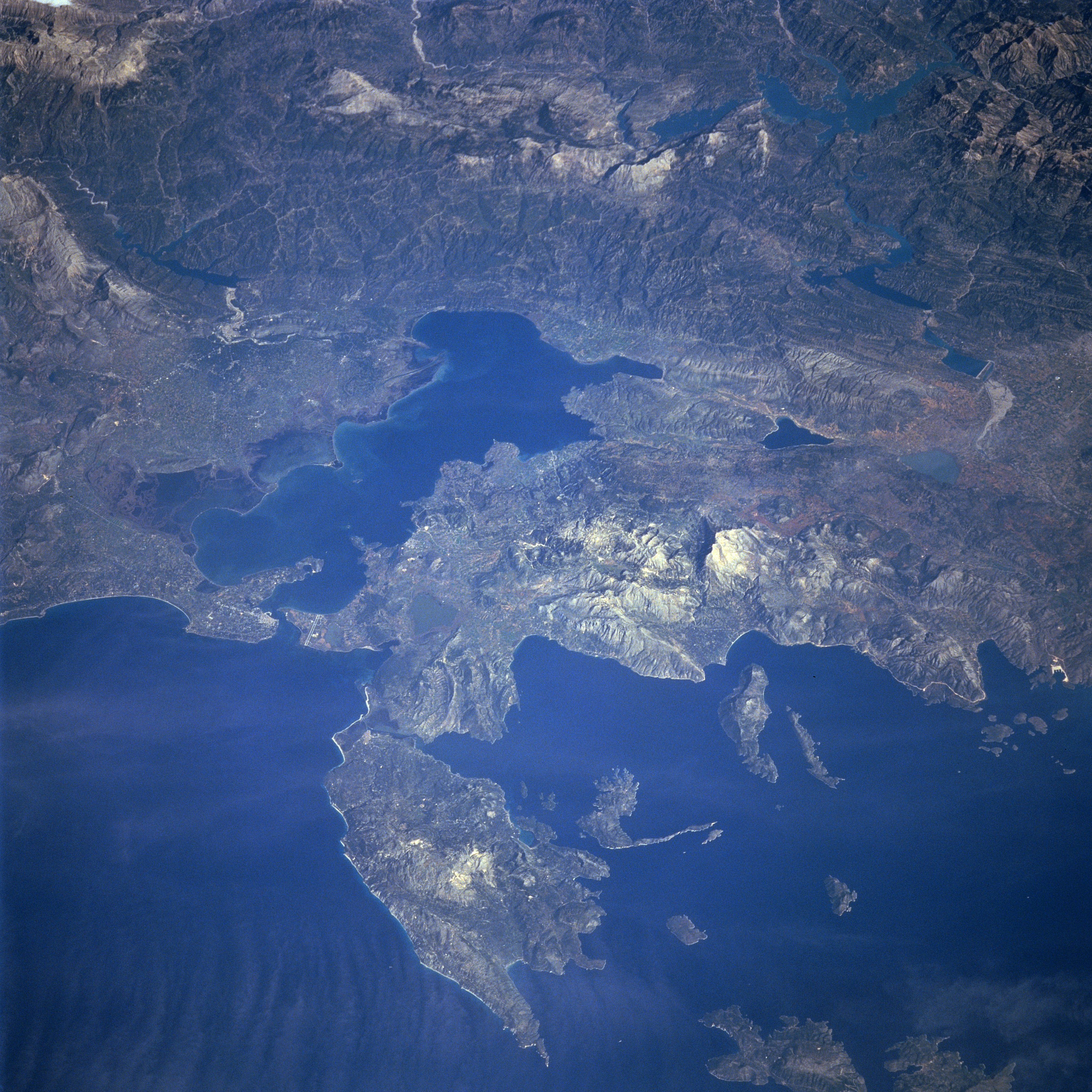
Photograph of the Ambracian Gulf, taken by space-shuttle mission STS-66 in November 1994.
Original caption, from [1]:
- STS066-101-039 Levkas Island, Ambracian Bay, Greece November, 1994
- The Ambracian Bay, an inlet of the Ionian Sea (bottom left) can be seen in this northeast-looking view. The bay, sometimes referred to as a gulf, is 25 miles 40 km) long and from 4 to 10 miles (6 to 16 km) wide. On the shores of Ambracian Bay are the ruins of several cities important to ancient Greece. Levkas (Leucas) Island is visible in the lower left quadrant of the image. Levkas Island is a mountainous island that covers an area of 115 square miles (300 square km). Olive oil, wine, and tobacco are produced on the island. Covering almost a third of the top portion of the image is the western half of the Pindus Mountains. The Pindus, trending northwest to southeast are a continuation of the Dinaric Alps, but are made up of reduced limestone content compared to the range further to the north. Extending for 100 miles (160 km), the sparsely populated, rugged range is rich in timber. Lake Takhniti, a recreational lake, is discernible in the upper right portion of the image. Ithaki Island is visible near the bottom right of the image.
ترخيص
تاريخ الملف
اضغط على زمن/تاريخ لرؤية الملف كما بدا في هذا الزمن.
| زمن/تاريخ | صورة مصغرة | الأبعاد | مستخدم | تعليق | |
|---|---|---|---|---|---|
| حالي | ★ مراجعة معتمدة 13:09، 9 نوفمبر 2023 | | 4٬030 × 4٬030 (14٫71 ميجابايت) | Pastakhov (نقاش | مساهمات) | Upload https://upload.wikimedia.org/wikipedia/commons/4/4b/EFS_highres_STS066_STS066-101-39.JPG |
لا يمكنك استبدال هذا الملف.
وصلات
لا يوجد صفحات تصل لهذه الصورة.