ملف:Drogheda 1649.jpg
حجم هذه المعاينة: 392 × 600 بكسل. البعد الآخر: 1٬454 × 2٬224 بكسل.
الملف الأصلي (1٬454 × 2٬224 بكسل حجم الملف: 858 كيلوبايت، نوع MIME: image/jpeg)
وصف قصير
| ⧼wm-license-information-description⧽ |
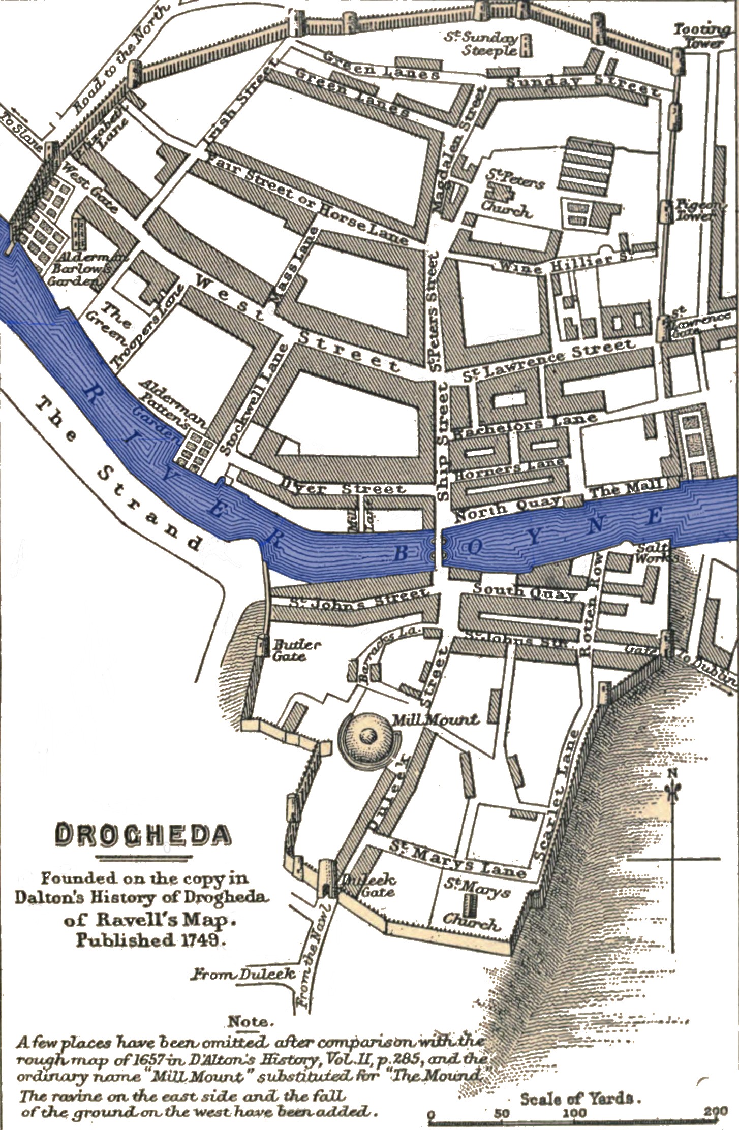
English: Drogheda -- S. R. Gardiner notes: Founded on the copy of Ravell's map published 1749 in D'Alton's History of Drogheda, Vol. II, p. 363, Note A few places have been omitted after comparison with the rough map of 1657 in the same volume p. 285, and the ordinary name "Mill Mount" substituted for "The Mound". The Ravine on the east side and the fall ground on the west have been added.
|
| ⧼wm-license-information-date⧽ | 2012, {{time}} – invalid date format 59 (help) |
| ⧼wm-license-information-source⧽ | History of the Commonwealth and Protectorate, 1649-1656 (1903) volume 1 page 113 |
| ⧼wm-license-information-author⧽ | Gardiner, Samuel Rawson and F.S. Weller (illustrator) |
ترخيص
تاريخ الملف
اضغط على زمن/تاريخ لرؤية الملف كما بدا في هذا الزمن.
| زمن/تاريخ | صورة مصغرة | الأبعاد | مستخدم | تعليق | |
|---|---|---|---|---|---|
| حالي | ★ مراجعة معتمدة 12:39، 28 نوفمبر 2023 | | 1٬454 × 2٬224 (858 كيلوبايت) | Pastakhov (نقاش | مساهمات) | Upload https://upload.wikimedia.org/wikipedia/commons/d/dc/Drogheda_1649.jpg |
لا يمكنك استبدال هذا الملف.
وصلات
لا يوجد صفحات تصل لهذه الصورة.