ملف:Diffa arrondissements.png
الملف الأصلي (1٬056 × 816 بكسل حجم الملف: 29 كيلوبايت، نوع MIME: image/png)
| ⧼wm-license-information-description⧽ |
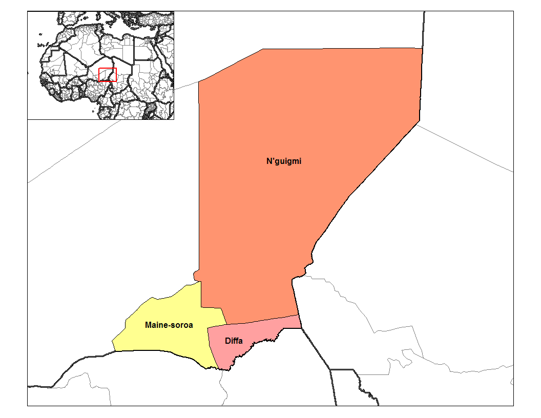
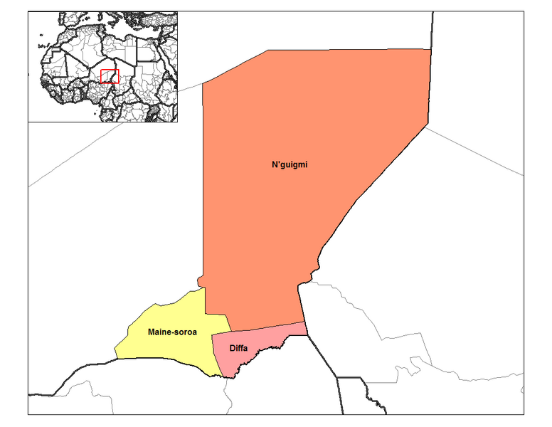
وصف قصيرMap of the arrondissements of Diffa department in Niger. Created by Rarelibra 14:33, 13 September 2006 (UTC) for public domain use, using MapInfo Professional v8.5 and various mapping resources. |
||
| ⧼wm-license-information-date⧽ | |||
| ⧼wm-license-information-source⧽ | ⧼Wm-license-own-work⧽ | ||
| ⧼wm-license-information-author⧽ | User Rarelibra on en.wikipedia | ||
| ⧼wm-license-information-permission⧽ (⧼wm-license-information-permission-reusing-text⧽) |
|
||
| ⧼wm-license-information-other-versions⧽ |
Originally from en.wikipedia; description page is (was) here * 14:33, 13 September 2006 [[:en:User:Rarelibra|Rarelibra]] 1056×816 (30,184 bytes) <span class="comment">(Map of the arrondissements of Diffa department in Niger. Created by Rarelibra for public domain use, using MapInfo Professional v8.5 and various mapping resources.)</span> |
(Uploaded using CommonsHelper or PushForCommons)
تاريخ الملف
اضغط على زمن/تاريخ لرؤية الملف كما بدا في هذا الزمن.
| زمن/تاريخ | صورة مصغرة | الأبعاد | مستخدم | تعليق | |
|---|---|---|---|---|---|
| حالي | ★ مراجعة معتمدة 17:03، 3 نوفمبر 2023 | | 1٬056 × 816 (29 كيلوبايت) | Pastakhov (نقاش | مساهمات) | Upload https://upload.wikimedia.org/wikipedia/commons/6/62/Diffa_arrondissements.png |
لا يمكنك استبدال هذا الملف.
وصلات
لا يوجد صفحات تصل لهذه الصورة.