ملف:Davis County Utah incorporated and unincorporated areas Fruit Heights highlighted.svg

حجم معاينة PNG لذلك الملف ذي الامتداد SVG: 800 × 345 بكسل. البعد الآخر: 2٬560 × 1٬103 بكسل.
الملف الأصلي (ملف SVG، أبعاده 1٬300 × 560 بكسل، حجم الملف: 4٫17 ميجابايت)
وصف قصير
| ⧼wm-license-information-description⧽ |
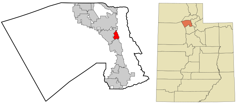
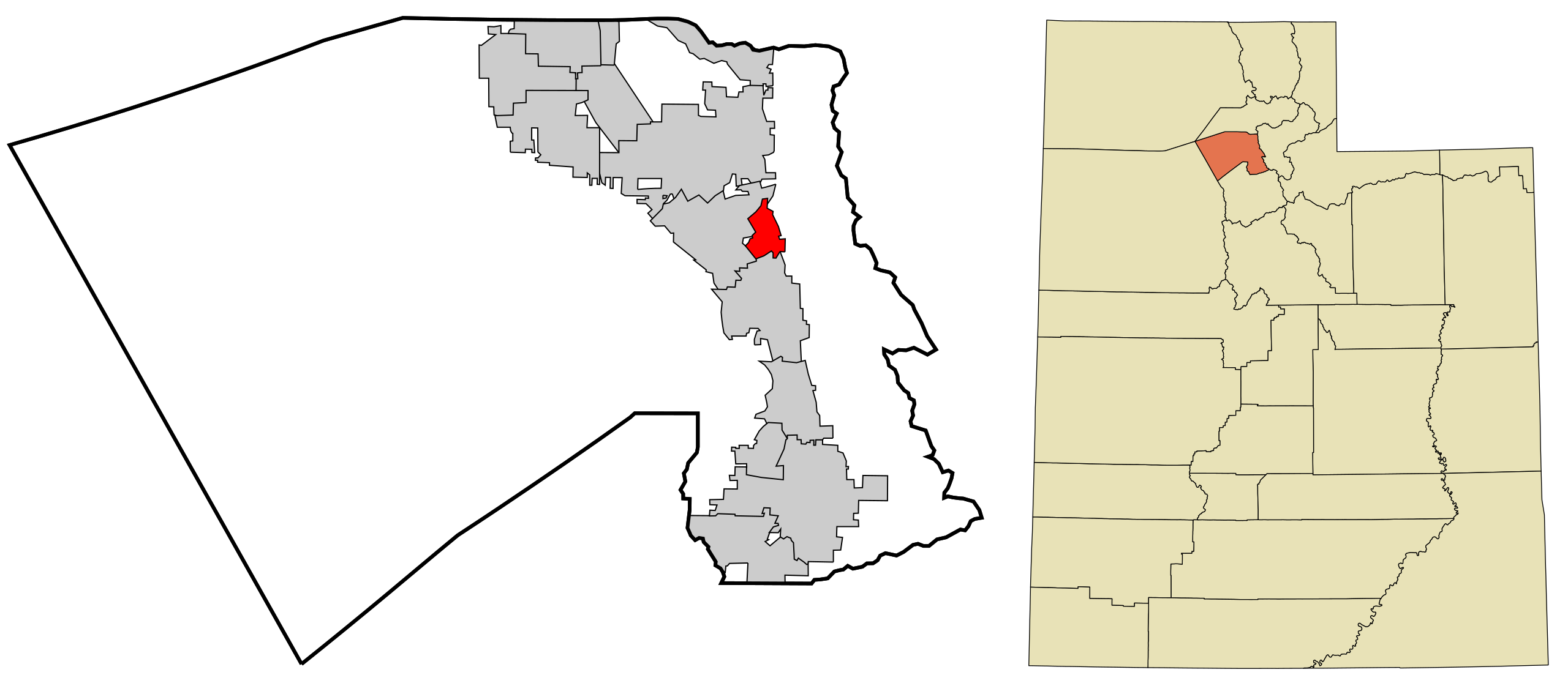
English: Map showing the location of this city with Davis County, Utah. Data from [1]
|
| ⧼wm-license-information-date⧽ | 2014, {{time}} – invalid date format 17 (help) |
| ⧼wm-license-information-source⧽ | ⧼Wm-license-own-work⧽ |
| ⧼wm-license-information-author⧽ | Rcsprinter123 |
ترخيص
تاريخ الملف
اضغط على زمن/تاريخ لرؤية الملف كما بدا في هذا الزمن.
| زمن/تاريخ | صورة مصغرة | الأبعاد | مستخدم | تعليق | |
|---|---|---|---|---|---|
| حالي | ★ مراجعة معتمدة 20:04، 18 أكتوبر 2023 | | 1٬300 × 560 (4٫17 ميجابايت) | Pastakhov (نقاش | مساهمات) | Upload https://upload.wikimedia.org/wikipedia/commons/d/d0/Davis_County_Utah_incorporated_and_unincorporated_areas_Fruit_Heights_highlighted.svg |
لا يمكنك استبدال هذا الملف.
وصلات
لا يوجد صفحات تصل لهذه الصورة.