ملف:Cwmllynfell station site geograph-3361034-by-Ben-Brooksbank.jpg

حجم هذه المعاينة: 800 × 446 بكسل. البعد الآخر: 2٬345 × 1٬308 بكسل.
الملف الأصلي (2٬345 × 1٬308 بكسل حجم الملف: 2٫29 ميجابايت، نوع MIME: image/jpeg)
وصف قصير
| ⧼wm-license-information-description⧽ |
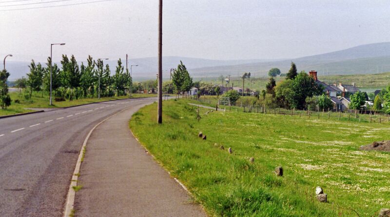
English: Site of Cwmllynfell station.
View northward in the Cwmannan Valley on A4068, with the Carmarthenshire Black Mountains (Carn Ushaf, 1,580 ft.) on the horizon. The station had been over to the left, with the line - crossing on the level - being the ex-Midland Swansea (St Thomas) - Ystelyfera - Brynamman (East) line, which was closed to passengers on 25/9/50, to goods on 28/9/64. |
| ⧼wm-license-information-date⧽ | 1990 |
| ⧼wm-license-information-source⧽ | From geograph.org.uk |
| ⧼wm-license-information-author⧽ | Ben Brooksbank |
| ⧼wm-license-information-permission⧽ (⧼wm-license-information-permission-reusing-text⧽) |
Creative Commons Attribution Share-alike license 2.0 |
ترخيص
تاريخ الملف
اضغط على زمن/تاريخ لرؤية الملف كما بدا في هذا الزمن.
| زمن/تاريخ | صورة مصغرة | الأبعاد | مستخدم | تعليق | |
|---|---|---|---|---|---|
| حالي | ★ مراجعة معتمدة 06:45، 11 نوفمبر 2023 | | 2٬345 × 1٬308 (2٫29 ميجابايت) | Pastakhov (نقاش | مساهمات) | Upload https://upload.wikimedia.org/wikipedia/commons/b/be/Cwmllynfell_station_site_geograph-3361034-by-Ben-Brooksbank.jpg |
لا يمكنك استبدال هذا الملف.
وصلات
لا يوجد صفحات تصل لهذه الصورة.