ملف:Ctrw map.JPG

حجم هذه المعاينة: 608 × 600 بكسل. البعد الآخر: 648 × 639 بكسل.
الملف الأصلي (648 × 639 بكسل حجم الملف: 29 كيلوبايت، نوع MIME: image/jpeg)
وصف قصير
| ⧼wm-license-information-description⧽ |
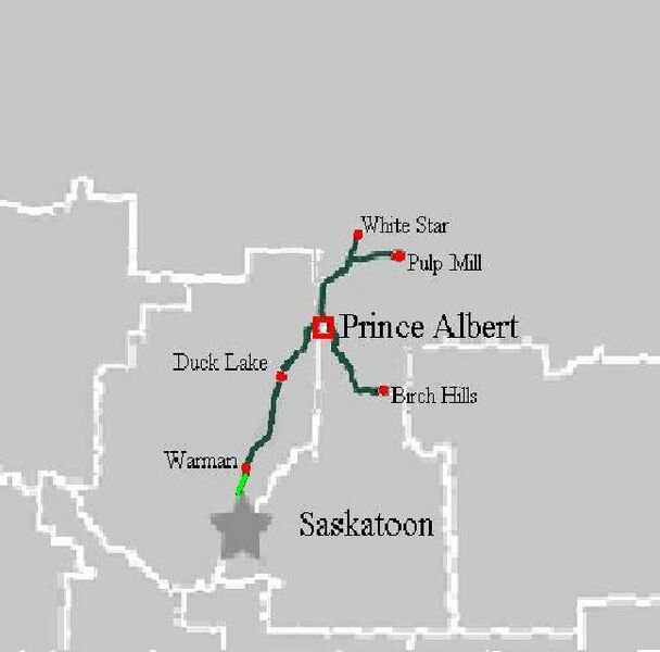
English: CTRW system map of current operations.
|
|||
| ⧼wm-license-information-date⧽ | 2009 | |||
| ⧼wm-license-information-source⧽ | Mark Zulkoskey. I (Kermit Crack) created this work entirely by myself with the help of Wiki Commons Sask map. | |||
| ⧼wm-license-information-author⧽ | Mark Zulkoskey | |||
| ⧼wm-license-information-permission⧽ (⧼wm-license-information-permission-reusing-text⧽) |
|
|||
| ⧼wm-license-information-other-versions⧽ |
Wiki Commons sask map |
قالب:Original upload log
| زمن/تاريخ | الأبعاد | مستخدم | تعليق |
|---|---|---|---|
| 2009-11-09 11:05 | 648×639× (29468 bytes) | KermitCrack | Zoomed into northern sask region. |
| 2009-11-09 10:55 | 648×793× (33164 bytes) | KermitCrack | {{Information |Description = CTRW system map of current operations |Source = I (Kermit Crack) created this work entirely by myself with the help of Wiki Commons Sask map |Date = Nov 9/09 |Author = Kermit Crack |other_ver |
تاريخ الملف
اضغط على زمن/تاريخ لرؤية الملف كما بدا في هذا الزمن.
| زمن/تاريخ | صورة مصغرة | الأبعاد | مستخدم | تعليق | |
|---|---|---|---|---|---|
| حالي | ★ مراجعة معتمدة 11:37، 23 نوفمبر 2023 | | 648 × 639 (29 كيلوبايت) | Pastakhov (نقاش | مساهمات) | Upload https://upload.wikimedia.org/wikipedia/commons/1/10/Ctrw_map.JPG |
لا يمكنك استبدال هذا الملف.
وصلات
لا يوجد صفحات تصل لهذه الصورة.