ملف:Comoros Mayotte.PNG

حجم هذه المعاينة: 784 × 600 بكسل. البعد الآخر: 847 × 648 بكسل.
الملف الأصلي (847 × 648 بكسل حجم الملف: 70 كيلوبايت، نوع MIME: image/png)
| ⧼wm-license-information-description⧽ |
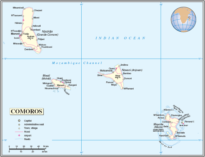
English: Map of the Comoros and Mayotte
About the maps: The United Nations cartographics section claims:
|
| ⧼wm-license-information-date⧽ | 2005-06-22 00:57 UTC |
| ⧼wm-license-information-source⧽ | [1] |
| ⧼wm-license-information-author⧽ | Thuresson |
تاريخ الملف
اضغط على زمن/تاريخ لرؤية الملف كما بدا في هذا الزمن.
| زمن/تاريخ | صورة مصغرة | الأبعاد | مستخدم | تعليق | |
|---|---|---|---|---|---|
| حالي | ★ مراجعة معتمدة 09:53، 10 أكتوبر 2023 | | 847 × 648 (70 كيلوبايت) | Pastakhov (نقاش | مساهمات) | Upload https://upload.wikimedia.org/wikipedia/commons/8/8b/Comoros_Mayotte.PNG |
لا يمكنك استبدال هذا الملف.
وصلات
لا يوجد صفحات تصل لهذه الصورة.