ملف:Commencement Bay from the Air.jpg
حجم هذه المعاينة: 800 × 600 بكسل. البعد الآخر: 2٬560 × 1٬920 بكسل.
الملف الأصلي (4٬032 × 3٬024 بكسل حجم الملف: 2٫02 ميجابايت، نوع MIME: image/jpeg)
وصف قصير
| ⧼wm-license-information-description⧽ |
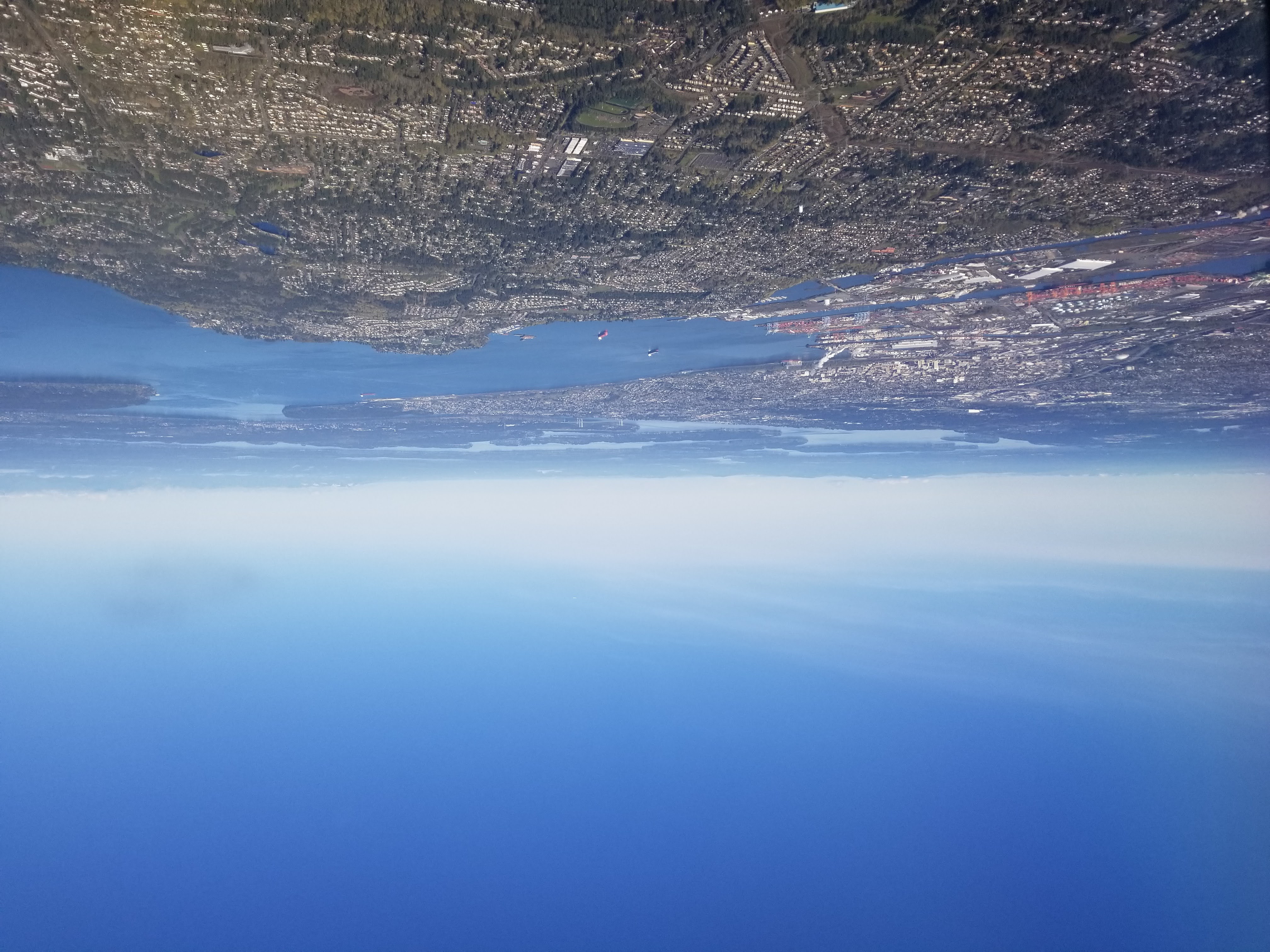
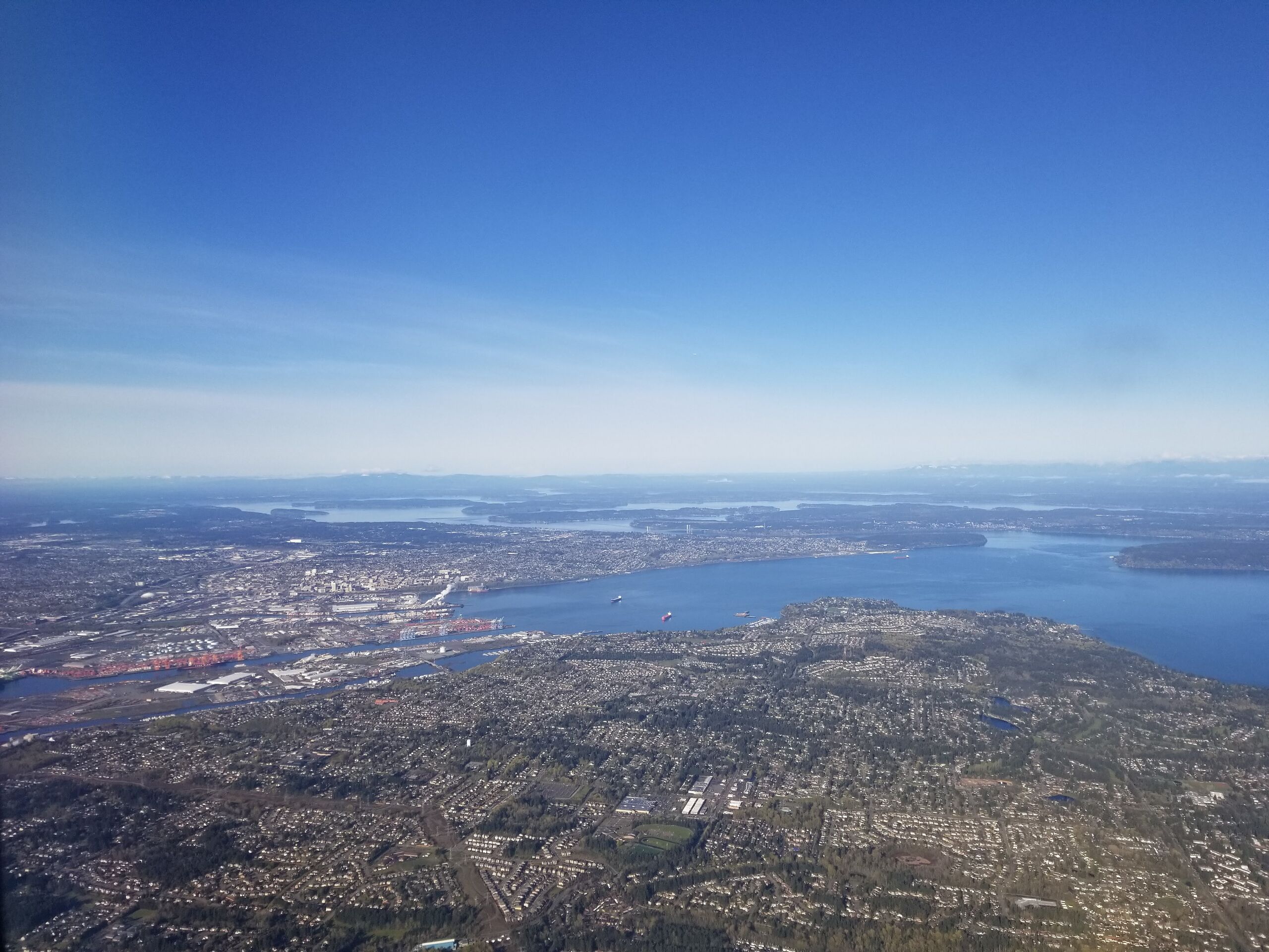
English: Taken of Commencement Bay (part of Puget Sound) while on an airplane. Include surrounding areas such as downtown Tacoma, Point Defiance, Gig Harbor, Fox Island, the Key Peninsula, Ketron Island, Anderson Island, McNeil Island, Thurston County, and the Olympic Mountains. Tacoma Narrows Bridge is visible.
|
| ⧼wm-license-information-date⧽ | 2022, {{time}} – invalid date format 44 (help) |
| ⧼wm-license-information-source⧽ | ⧼Wm-license-own-work⧽ |
| ⧼wm-license-information-author⧽ | Eusebius1517 |
47°15′10″N 122°26′39″W / 47.252875°N 122.444289°W
ترخيص
|
تاريخ الملف
اضغط على زمن/تاريخ لرؤية الملف كما بدا في هذا الزمن.
| زمن/تاريخ | صورة مصغرة | الأبعاد | مستخدم | تعليق | |
|---|---|---|---|---|---|
| حالي | ★ مراجعة معتمدة 15:38، 29 أكتوبر 2023 | | 4٬032 × 3٬024 (2٫02 ميجابايت) | Pastakhov (نقاش | مساهمات) | Upload https://upload.wikimedia.org/wikipedia/commons/9/98/Commencement_Bay_from_the_Air.jpg |
لا يمكنك استبدال هذا الملف.
وصلات
لا يوجد صفحات تصل لهذه الصورة.