ملف:Club Row, Shoreditch, East London - geograph.org.uk - 687827.jpg
لا توجد دقة أعلى متوفرة.
Club_Row,_Shoreditch,_East_London_-_geograph.org.uk_-_687827.jpg (640 × 427 بكسل حجم الملف: 96 كيلوبايت، نوع MIME: image/jpeg)
وصف قصير
| ⧼wm-license-information-description⧽ |
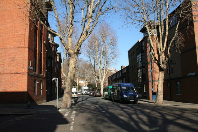
English: Club Row, Shoreditch, East London Looking northwards towards Arnold Circus from the junction of Club Row with Old Nichol Street. In Victorian times, this area was one of London's most notorious slums, inhabited, according to Alan Jackson, almost entirely by criminals. It was all cleared away before 1900 and the area was rebuilt.
|
| ⧼wm-license-information-date⧽ | 2008 |
| ⧼wm-license-information-source⧽ | From geograph.org.uk |
| ⧼wm-license-information-author⧽ | Dr Neil Clifton |
| ⧼wm-license-cc-attribution⧽ (قالب:I18n/Credit line) |
Dr Neil Clifton / Club Row, Shoreditch, East London / |
51°31′29″N 0°04′26″W / 51.52474°N 0.0739°W قالب:Object location
_heading:337)
ترخيص
تاريخ الملف
اضغط على زمن/تاريخ لرؤية الملف كما بدا في هذا الزمن.
| زمن/تاريخ | صورة مصغرة | الأبعاد | مستخدم | تعليق | |
|---|---|---|---|---|---|
| حالي | ★ مراجعة معتمدة 01:56، 16 أكتوبر 2023 | | 640 × 427 (96 كيلوبايت) | Pastakhov (نقاش | مساهمات) | Upload https://upload.wikimedia.org/wikipedia/commons/d/dc/Club_Row%2C_Shoreditch%2C_East_London_-_geograph.org.uk_-_687827.jpg |
لا يمكنك استبدال هذا الملف.
وصلات
لا يوجد صفحات تصل لهذه الصورة.