ملف:Chambonchard - confluence cher-tartasse-juil2012.JPG
لا توجد دقة أعلى متوفرة.
Chambonchard_-_confluence_cher-tartasse-juil2012.JPG (764 × 507 بكسل حجم الملف: 86 كيلوبايت، نوع MIME: image/jpeg)
وصف قصير
| ⧼wm-license-information-description⧽ |
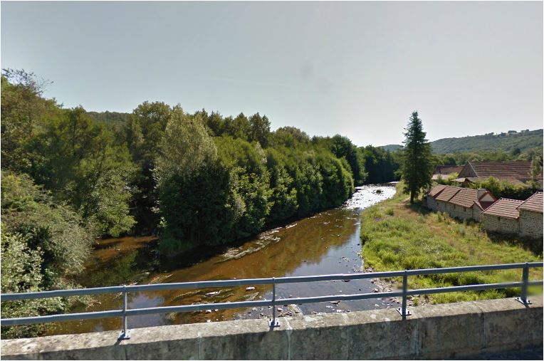
English: The river Cher at Chambonchard on the D 915 road, where it sets the border between the Creuse (commune of Chambonchard) and the Allier (commune of La Petite-Marche) departements. It is also the confluence point with its tributary the Tartasse river coming in on the left of the photo (on the right bank of the Cher). The Tartasse river flows in the Allier departement. The photo looks upstream. Français : Le Cher à Chambochard sur la D 915, où il marque la limite entre les départements de la Creuse (commune de Chambonchard) et de l'Allier (commune of La Petite-Marche). C'est aussi le point de confluence avec son affluent la Tartasse, vue ici arrivant sur la gauche (en rive droite du Cher). La Tartasse coule dans le département de l'Allier. Vue vers l'amont.
|
| ⧼wm-license-information-date⧽ | 2012 |
| ⧼wm-license-information-source⧽ | ⧼Wm-license-own-work⧽ |
| ⧼wm-license-information-author⧽ | Basicdesign |
ترخيص
|
تاريخ الملف
اضغط على زمن/تاريخ لرؤية الملف كما بدا في هذا الزمن.
| زمن/تاريخ | صورة مصغرة | الأبعاد | مستخدم | تعليق | |
|---|---|---|---|---|---|
| حالي | ★ مراجعة معتمدة 18:16، 22 نوفمبر 2023 | | 764 × 507 (86 كيلوبايت) | Pastakhov (نقاش | مساهمات) | Upload https://upload.wikimedia.org/wikipedia/commons/9/93/Chambonchard_-_confluence_cher-tartasse-juil2012.JPG |
لا يمكنك استبدال هذا الملف.
وصلات
لا يوجد صفحات تصل لهذه الصورة.