ملف:Cattaraugus Creek mouth Lake Erie.jpg
حجم هذه المعاينة: 800 × 561 بكسل. البعد الآخر: 1٬500 × 1٬051 بكسل.
الملف الأصلي (1٬500 × 1٬051 بكسل حجم الملف: 674 كيلوبايت، نوع MIME: image/jpeg)
| ⧼wm-license-information-description⧽ |
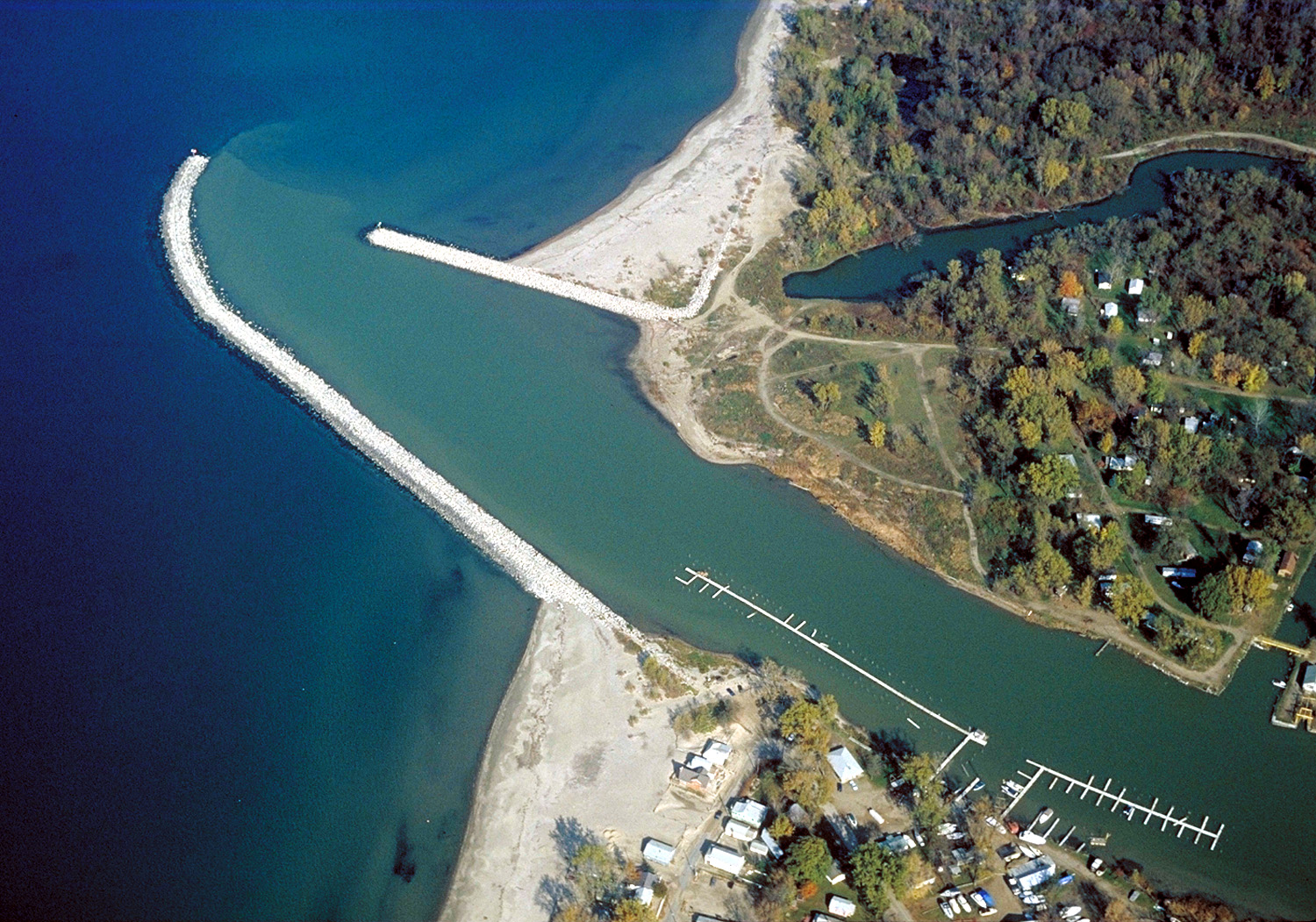
English: The mouth of Cattaraugus Creek on Lake Erie near Sunset Bay, New York, USA. The Cattaraugus Indian Reservation occupies the land on the north side (upper in this photograph) of the creek. View is to the north. The U.S. Army Corps of Engineers constructed the breakwaters and dredges the channel as necessary.
|
| ⧼wm-license-information-date⧽ | 1992 |
| ⧼wm-license-information-source⧽ | U.S. Army Corps of Engineers Digital Visual Library Image page Image description page Digital Visual Library home page |
| ⧼wm-license-information-author⧽ | Ken Winters, U.S. Army Corps of Engineers |
| ⧼wm-license-information-permission⧽ (⧼wm-license-information-permission-reusing-text⧽) |
|
| قالب:Location/i18n | Sunset Bay, New York, USA |
تاريخ الملف
اضغط على زمن/تاريخ لرؤية الملف كما بدا في هذا الزمن.
| زمن/تاريخ | صورة مصغرة | الأبعاد | مستخدم | تعليق | |
|---|---|---|---|---|---|
| حالي | ★ مراجعة معتمدة 06:52، 9 نوفمبر 2023 | | 1٬500 × 1٬051 (674 كيلوبايت) | Pastakhov (نقاش | مساهمات) | Upload https://upload.wikimedia.org/wikipedia/commons/a/af/Cattaraugus_Creek_mouth_Lake_Erie.jpg |
لا يمكنك استبدال هذا الملف.
وصلات
لا يوجد صفحات تصل لهذه الصورة.